

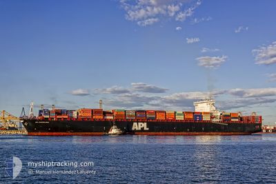
APL BARCELONA
Container Ship

Current Trip
| Time Travelled | 1 day |
|---|---|
| Remaining Time | 7 h, 50 mins |
| Distance Travelled | 276.27 nm |
| Remaining Distance | 76.70 nm |
| AVG Speed | 9.7 Knots |
| MAX Speed | 15.1 Knots |
| AVG Wind | 15.6 knots |
| MAX Wind | 23.8 knots |
| MIN Temp | 12°C / 53.6°F |
| MAX Temp | 13.9°C / 57.02°F |
| Draught | 12.6 m |
| Position Received | Now |
Current Position
| Longitude | 8.16017° |
|---|---|
| Latitude | 53.99194° |
| Status | Under way using engine |
| Speed | 10.8 Knots |
| Course | 87.1° |
| Area | North Sea |
| Station | T-AIS |
| Position Received | Now |
Information
The current position of APL BARCELONA is in North Sea with coordinates 53.99194° / 8.16017° as reported on 2025-06-07 20:15 by AIS to our vessel tracker app. The vessel's current speed is 10.8 Knots and is heading at the port of HAMBURG. The estimated time of arrival as calculated by MyShipTracking vessel tracking app is 2025-06-08 06:06 LT
The vessel APL BARCELONA (IMO: 9462043, MMSI: 566483000) is a Container Ship that was built in 2012 ( 13 years old ). It's sailing under the flag of [SG] Singapore.
In this page you can find informations about the vessels current position, last detected port calls, and current voyage information. If the vessels is not in coverage by AIS you will find the latest position.
The current position of APL BARCELONA is detected by our AIS receivers and we are not responsible for the reliability of the data. The last position was recorded while the vessel was in Coverage by the Ais receivers of our vessel tracking app.
The current draught of APL BARCELONA as reported by AIS is 12.6 meters
Weather
| Temperature | 13°C / 55.4°F |
|---|---|
| Wind Speed | 12 knots |
| Direction | 265° W |
| Pressure | 1005.7 hPa |
| Humidity | 82.5 % |
| Cloud Coverage | 51 % |


Featured Company
Last Port Calls
| Port | Arrival | Departure | Time In Port |
|---|---|---|---|
| 2025-06-05 06:50 | 2025-06-06 08:19 | 1 d | |
| 2025-06-03 12:14 | 2025-06-04 09:43 | 21 h | |
| 2025-05-29 11:03 | 2025-05-30 08:43 | 21 h | |
| 2025-05-02 03:03 | 2025-05-03 09:33 | 1 d | |
| 2025-04-29 12:44 | 2025-05-01 01:20 | 1 d | |
| 2025-04-26 09:32 | 2025-04-27 21:00 | 1 d | |
| 2025-04-22 00:20 | 2025-04-23 09:33 | 1 d |
Most Visited Ports (Last year)
| Port | Arrivals | |
|---|---|---|
| 5 | ||
| 4 | ||
| 4 | ||
| 4 | ||
| 4 | ||
| 4 |
Last Trips
| Origin | Departure | Destination | Arrival | Distance | |
|---|---|---|---|---|---|
| 2025-06-04 09:43 | 2025-06-05 06:50 | 268.30 nm | |||
| 2025-05-30 08:43 | 2025-06-03 12:14 | 1204.84 nm | |||
| 2025-05-03 09:33 | 2025-05-29 11:03 | 9814.84 nm | |||
| 2025-05-01 01:20 | 2025-05-02 03:03 | 429.20 nm | |||
| 2025-04-27 21:00 | 2025-04-29 12:44 | 578.90 nm | |||
| 2025-04-23 09:33 | 2025-04-26 09:32 | 775.30 nm | |||
| 2025-03-24 00:47 | 2025-04-22 00:20 | 10061.24 nm |
Events
| Time | Event | Details | Position / Dest | Info |
|---|---|---|---|---|
| 2025-06-07 19:10 | ETA Changed | 2025/06/07 20:15 2025/06/07 04:00 |
54.05254 / 7.88230
NLRTM>DEHAM
|
Speed: 10 kn Course: 128.5° |
| 2025-06-07 18:42 | Status Changed | Under way using engine Default |
54.09437 / 7.77470
NLRTM>DEHAM
|
Speed: 9.7 kn Course: 119° |
| 2025-06-07 18:33 | Status Changed | Default Under way using engine |
54.10745 / 7.73544
NLRTM>DEHAM
|
Speed: 9.1 kn Course: 142.9° |
| 2025-06-07 18:16 | Status Changed | Under way using engine Default |
54.13565 / 7.68394
NLRTM>DEHAM
|
Speed: 9.2 kn Course: 143° |
| 2025-06-07 18:08 | IN Coverage |
54.13565 / 7.68394
North Sea
|
Speed: 9.2 kn Course: 142.7° |
|
| 2025-06-07 16:39 | START Moving | 19.91 nm, North West of HELGOLAND |
54.34895 / 7.41693
NLRTM>DEHAM
|
Speed: 8.1 kn Course: 170° |
| 2025-06-07 11:32 | Status Changed | Default Under way using engine |
54.35846 / 7.36192
NLRTM>DEHAM
|
Speed: 0.9 kn Course: 316° |
| 2025-06-07 11:28 | Status Changed | Under way using engine Default |
54.35768 / 7.36095
NLRTM>DEHAM
|
Speed: 1 kn Course: 312° |
| 2025-06-07 11:28 | OUT of Coverage |
54.35768 / 7.36095
North Sea
|
Speed: 0.9 kn Course: 33.4° |
|
| 2025-06-07 11:16 | IN Coverage |
54.35768 / 7.36095
North Sea
|
Speed: 0.9 kn Course: 33.4° |