
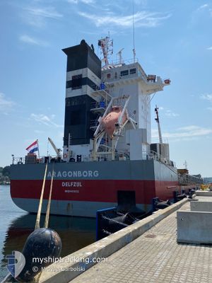
ARAGONBORG
General Cargo
Current Trip
| Time Travelled | 3 days |
|---|---|
| Remaining Time | --- |
| Distance Travelled | 422.12 nm |
| Remaining Distance | 9.86 nm |
| AVG Speed | 10.9 Knots |
| MAX Speed | 14.5 Knots |
| AVG Wind | 7.2 knots |
| MAX Wind | 10.3 knots |
| MIN Temp | 17.7°C / 63.86°F |
| MAX Temp | 24°C / 75.2°F |
| Draught | 5.7 m |
| Position Received | 3 m ago |
Current Position
| Longitude | -93.28693° |
|---|---|
| Latitude | 30.10865° |
| Status | Under way using engine |
| Speed | 0.9 Knots |
| Course | 163° |
| Area | Gulf of Mexico |
| Station | T-AIS |
| Position Received | 3 m ago |
Info
Information
The current position of ARAGONBORG is in Gulf of Mexico with coordinates 30.10865° / -93.28693° as reported on 2025-02-07 00:05 by AIS to our vessel tracker app. The vessel's current speed is 0.9 Knots and is heading at the port of LAKE CHARLES. The estimated time of arrival as calculated by MyShipTracking vessel tracking app is 2025-02-04 20:00 LT
The vessel ARAGONBORG (IMO: 9466312, MMSI: 245953000) is a General Cargo that was built in 2010 ( 15 years old ). It's sailing under the flag of [NL] Netherlands.
In this page you can find informations about the vessels current position, last detected port calls, and current voyage information. If the vessels is not in coverage by AIS you will find the latest position.
The current position of ARAGONBORG is detected by our AIS receivers and we are not responsible for the reliability of the data. The last position was recorded while the vessel was in Coverage by the Ais receivers of our vessel tracking app.
The current draught of ARAGONBORG as reported by AIS is 5.7 meters
Weather
| Temperature | 20.3°C / 68.54°F |
|---|---|
| Wind Speed | 6 knots |
| Direction | 189° S |
| Pressure | 1017.1 hPa |
| Humidity | 89.6 % |
| Cloud Coverage | --- |
Featured Company
Last Port Calls
| Port | Arrival | Departure | Time In Port |
|---|---|---|---|
| 2025-01-31 11:33 | 2025-02-03 12:11 | 3 d | |
| 2025-01-12 16:56 | 2025-01-15 12:23 | 2 d | |
| 2025-01-11 14:39 | 2025-01-12 16:47 | 1 d | |
| 2025-01-10 06:59 | 2025-01-11 13:31 | 1 d |
Last Trips
| Origin | Departure | Destination | Arrival | Distance | |
|---|---|---|---|---|---|
| 2025-01-15 12:23 | 2025-01-31 11:33 | 3330.12 nm | |||
| 2025-01-12 16:47 | 2025-01-12 16:56 | 0.21 nm | |||
| 2025-01-11 13:31 | 2025-01-11 14:39 | 8.26 nm | |||
| 2024-11-13 20:38 | 2025-01-10 06:59 | 6738.85 nm |
Events
| Time | Event | Details | Position / Dest | Info |
|---|---|---|---|---|
| 2025-02-06 23:35 | Status Changed | Under way using engine Default |
30.09191 / -93.32403
USLCH
|
Speed: 9.3 kn Course: 6° |
| 2025-02-06 23:31 | Status Changed | Default Under way using engine |
30.08413 / -93.32558
USLCH
|
Speed: 8.8 kn Course: 355.3° |
| 2025-02-06 23:21 | Status Changed | Under way using engine Default |
30.05928 / -93.32773
USLCH
|
Speed: 6.9 kn Course: 5° |
| 2025-02-06 22:59 | Status Changed | Default Under way using engine |
30.01210 / -93.33215
USLCH
|
Speed: 7 kn Course: 4.1° |
| 2025-02-06 20:49 | START Moving | 10.83 nm, South of CAMERON |
29.61815 / -93.27907
USLCH
|
Speed: 5.8 kn Course: 314° |
| 2025-02-06 20:48 | Draught Changed | 5.7 5.9 |
29.61707 / -93.27780
USLCH
|
Speed: 5.2 kn Course: 312.7° |
| 2025-02-06 20:42 | Status Changed | Under way using engine At anchor |
29.61543 / -93.27325
USLCH
|
Speed: 0.5 kn Course: 264° |
| 2025-02-06 20:30 | Status Changed | At anchor Default |
29.61526 / -93.27388
USLCH
|
Speed: Course: 277° |
| 2025-02-06 20:13 | Status Changed | Default At anchor |
29.61558 / -93.27415
USLCH
|
Speed: Course: 268° |
| 2025-02-06 20:03 | Status Changed | At anchor Default |
29.61567 / -93.27408
USLCH
|
Speed: 0.1 kn Course: 262° |