
ARAGONBORG
General Cargo
Current Trip
| Time Travelled | 8 days |
|---|---|
| Remaining Time | --- |
| Distance Travelled | 447.47 nm |
| Remaining Distance | --- |
| AVG Speed | 10.2 Noeuds |
| MAX Speed | 14.5 Noeuds |
| AVG Wind | 7.5 knots |
| MAX Wind | 12.5 knots |
| MIN Temp | 15.8°C / 60.44°F |
| MAX Temp | 24°C / 75.2°F |
| Tirant d eau | 9.3 m |
| Position reçue | Maintenant |
Current Position
| Longitude | -93.33074° |
|---|---|
| Latitude | 29.68182° |
| Etat | Under way using engine |
| Vitesse | 10.3 Noeuds |
| Parcours | 172.1° |
| Zone | Gulf of Mexico |
| Station | T-AIS |
| Position reçue | Maintenant |
Info
Information
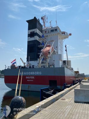
The current position of ARAGONBORG is in Gulf of Mexico with coordinates 29.68182° / -93.33074° as reported on 2025-02-12 00:01 by AIS to our vessel tracker app. The vessel's current speed is 10.3 Noeuds and is heading at the port of TROIS-RIVIERES. The estimated time of arrival as calculated by MyShipTracking vessel tracking app is 2025-02-23 10:30 LT
The vessel ARAGONBORG (IMO: 9466312, MMSI: 245953000) is a General Cargo that was built in 2010 ( 15 Age ). It's sailing under the flag of [NL] Netherlands.
In this page you can find informations about the vessels current position, last detected port calls, and current voyage information. If the vessels is not in coverage by AIS you will find the latest position.
The current position of ARAGONBORG is detected by our AIS receivers and we are not responsible for the reliability of the data. The last position was recorded while the vessel was in Coverage by the Ais receivers of our vessel tracking app.
The current draught of ARAGONBORG as reported by AIS is 9.3 meters
Weather
| Temperature | 16.8°C / 62.24°F |
|---|---|
| Wind Speed | 9 knots |
| Direction | 34° NE |
| Pressure | 1011.4 hPa |
| Humidity | 90 % |
| Cloud Coverage | 100 % |
Featured Company
Last Port Calls
| Port | Arrival | Departure | Time In Port |
|---|---|---|---|
| 2025-01-31 11:33 | 2025-02-03 12:11 | 3 d | |
| 2025-01-12 16:56 | 2025-01-15 12:23 | 2 d | |
| 2025-01-11 14:39 | 2025-01-12 16:47 | 1 d | |
| 2025-01-10 06:59 | 2025-01-11 13:31 | 1 d |
Last Trips
| Origin | Departure | Destination | Arrival | Distance | |
|---|---|---|---|---|---|
| 2025-01-15 12:23 | 2025-01-31 11:33 | 3330.12 nm | |||
| 2025-01-12 16:47 | 2025-01-12 16:56 | 0.21 nm | |||
| 2025-01-11 13:31 | 2025-01-11 14:39 | 8.26 nm | |||
| 2024-11-13 20:38 | 2025-01-10 06:59 | 6738.85 nm |
Events
| Heure | Evenement | Détails | Position/ Destination | Info |
|---|---|---|---|---|
| 2025-02-11 20:58 | Démarrage | 7.8 nm, South West of LAKE CHARLES |
30.10893 / -93.29803
CATRR
|
Vitesse: 3.2 kn Parcours: 256° |
| 2025-02-11 20:45 | Etat Changé | Under way using engine Moored |
30.10990 / -93.29572
CATRR
|
Vitesse: Parcours: 261° |
| 2025-02-11 20:39 | Etat Changé | Moored Default |
30.10990 / -93.29572
CATRR
|
Vitesse: Parcours: 260° |
| 2025-02-11 20:27 | Etat Changé | Default Moored |
30.10990 / -93.29572
CATRR
|
Vitesse: Parcours: 260° |
| 2025-02-11 20:21 | Etat Changé | Moored Default |
30.10990 / -93.29572
CATRR
|
Vitesse: Parcours: 260° |
| 2025-02-11 20:15 | Etat Changé | Default Moored |
30.10990 / -93.29572
CATRR
|
Vitesse: Parcours: 260° |
| 2025-02-11 20:03 | Etat Changé | Moored Default |
30.10989 / -93.29571
CATRR
|
Vitesse: Parcours: 260° |
| 2025-02-11 19:57 | Etat Changé | Default Moored |
30.10989 / -93.29571
CATRR
|
Vitesse: Parcours: 260° |
| 2025-02-11 19:27 | Etat Changé | Moored Default |
30.10988 / -93.29570
CATRR
|
Vitesse: Parcours: 260° |
| 2025-02-11 19:18 | Etat Changé | Default Moored |
30.10990 / -93.29571
CATRR
|
Vitesse: Parcours: 260° |