
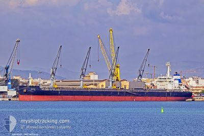
ARCADIA
Cargo
Current Trip
| Time Travelled | 8 days |
|---|---|
| Remaining Time | --- |
| Distance Travelled | 2094.45 nm |
| Remaining Distance | --- |
| AVG Speed | 10.1 Knots |
| MAX Speed | 12.9 Knots |
| AVG Wind | 9.8 knots |
| MAX Wind | 39.8 knots |
| MIN Temp | 6.7°C / 44.06°F |
| MAX Temp | 16.5°C / 61.7°F |
| Draught | 8.2 m |
| Position Received | 3 m ago |
Current Position
| Longitude | -5.41578° |
|---|---|
| Latitude | 36.08704° |
| Status | At anchor |
| Speed | |
| Course | 9° |
| Area | Strait of Gibraltar |
| Station | T-AIS |
| Position Received | 3 m ago |
Info
Information
The current position of ARCADIA is in Strait of Gibraltar with coordinates 36.08704° / -5.41578° as reported on 2025-02-14 09:30 by AIS to our vessel tracker app. The vessel's current speed is 0 Knots
The vessel ARCADIA (IMO: 9695640, MMSI: 256820000) is a Cargo It's sailing under the flag of [MT] Malta.
In this page you can find informations about the vessels current position, last detected port calls, and current voyage information. If the vessels is not in coverage by AIS you will find the latest position.
The current position of ARCADIA is detected by our AIS receivers and we are not responsible for the reliability of the data. The last position was recorded while the vessel was in Coverage by the Ais receivers of our vessel tracking app.
The current draught of ARCADIA as reported by AIS is 8.2 meters
Weather
| Temperature | 14.3°C / 57.74°F |
|---|---|
| Wind Speed | 9 knots |
| Direction | 68° ENE |
| Pressure | 1019.8 hPa |
| Humidity | 72.2 % |
| Cloud Coverage | --- |
Featured Company
Last Port Calls
| Port | Arrival | Departure | Time In Port |
|---|---|---|---|
| 2025-01-27 09:49 | 2025-02-05 16:49 | 9 d | |
| 2025-01-18 01:13 | 2025-01-22 12:24 | 4 d | |
| 2025-01-06 13:20 | 2025-01-09 15:48 | 3 d | |
| 2024-12-26 11:02 | 2024-12-30 13:05 | 4 d | |
| 2024-12-03 13:10 | 2024-12-08 13:33 | 5 d |
Most Visited Ports (Last year)
| Port | Arrivals | |
|---|---|---|
| 2 | ||
| 1 | ||
| 1 | ||
| 1 | ||
| 1 | ||
| 1 |
Last Trips
| Origin | Departure | Destination | Arrival | Distance | |
|---|---|---|---|---|---|
| 2025-01-22 14:24 | 2025-01-27 12:49 | 1098.59 nm | |||
| 2025-01-09 18:48 | 2025-01-18 03:13 | 524.14 nm | |||
| 2024-12-30 14:05 | 2025-01-06 16:20 | 1762.63 nm | |||
| 2024-12-08 07:33 | 2024-12-26 12:02 | 4781.74 nm | |||
| 2024-11-30 03:49 | 2024-12-03 07:10 | 490.48 nm |
Events
| Time | Event | Details | Position / Dest | Info |
|---|---|---|---|---|
| 2025-02-14 08:35 | Draught Changed | 8.2 8.1 |
36.08671 / -5.41520
BALTIMORE
|
Speed: Course: 350° |
| 2025-02-14 07:47 | Draught Changed | 8.1 7.7 |
36.08692 / -5.41489
BALTIMORE
|
Speed: 0.1 kn Course: 340° |
| 2025-02-14 07:47 | Destination Changed | BALTIMORE ES AGL |
36.08692 / -5.41489
BALTIMORE
|
Speed: 0.1 kn Course: 340° |
| 2025-02-14 07:47 | ETA Changed | 2025/02/26 08:00 2025/02/13 05:00 |
36.08692 / -5.41489
BALTIMORE
|
Speed: 0.1 kn Course: 340° |
| 2025-02-14 00:00 | Status Changed | At anchor Default |
36.08734 / -5.41793
ES AGL
|
Speed: 0.4 kn Course: 41° |
| 2025-02-13 23:57 | Status Changed | Default At anchor |
36.08749 / -5.41767
ES AGL
|
Speed: 0.1 kn Course: 38° |
| 2025-02-13 23:54 | STOP Moving | 2.93 nm, South of ALGECIRAS |
36.08761 / -5.41740
ES AGL
|
Speed: 0.1 kn Course: 38° |
| 2025-02-13 23:45 | Status Changed | At anchor Under way using engine |
36.08879 / -5.41580
ES AGL
|
Speed: 0.8 kn Course: 5° |
| 2025-02-13 23:20 | Change Sea Area | Spanish part of the Strait of Gibraltar Gibraltarian part of the Strait of Gibraltar |
36.07595 / -5.37502
Strait of Gibraltar
|
Speed: 7.2 kn Course: 281.7° |
| 2025-02-13 23:05 | Change Sea Area | Gibraltarian part of the Strait of Gibraltar Gibraltarian part of the Alboran Sea |
36.07721 / -5.33497
Strait of Gibraltar
|
Speed: 9 kn Course: 260.6° |