

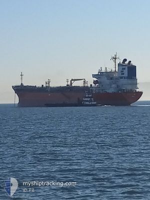
ARGENT ASTER
Oil/Chemical Tanker

Current Trip
CND-VCR
| Time Travelled | 5 h, 44 mins |
|---|---|
| Remaining Time | --- |
| Distance Travelled | 5.35 nm |
| Remaining Distance | --- |
| AVG Speed | 5.4 Knots |
| MAX Speed | 6.8 Knots |
| AVG Wind | 1.3 knots |
| MAX Wind | 2 knots |
| MIN Temp | 4.1°C / 39.38°F |
| MAX Temp | 5.4°C / 41.72°F |
| Draught | 9.3 m |
| Position Received | 5 m ago |
Current Position
| Longitude | -122.86827° |
|---|---|
| Latitude | 49.29043° |
| Status | Moored |
| Speed | |
| Course | 320° |
| Area | The Coastal Waters of Southeast Alaska and British Columbia |
| Station | T-AIS |
| Position Received | 5 m ago |
Information
The current position of ARGENT ASTER is in The Coastal Waters of Southeast Alaska and British Columbia with coordinates 49.29043° / -122.86827° as reported on 2025-04-16 15:01 by AIS to our vessel tracker app. The vessel's current speed is 0 Knots
The vessel ARGENT ASTER (IMO: 9379959, MMSI: 372956000) is a Oil/Chemical Tanker that was built in 2007 ( 18 years old ). It's sailing under the flag of [PA] Panama.
In this page you can find informations about the vessels current position, last detected port calls, and current voyage information. If the vessels is not in coverage by AIS you will find the latest position.
The current position of ARGENT ASTER is detected by our AIS receivers and we are not responsible for the reliability of the data. The last position was recorded while the vessel was in Coverage by the Ais receivers of our vessel tracking app.
The current draught of ARGENT ASTER as reported by AIS is 9.3 meters
Weather
| Temperature | 7.4°C / 45.32°F |
|---|---|
| Wind Speed | --- |
| Direction | 175° S |
| Pressure | 1018.2 hPa |
| Humidity | 71.6 % |
| Cloud Coverage | 6 % |


Featured Company
Last Port Calls
Last Trips
| Origin | Departure | Destination | Arrival | Distance | |
|---|---|---|---|---|---|
| 2025-04-07 12:24 | 2025-04-13 07:10 | 1372.72 nm | |||
| 2025-03-12 03:02 | 2025-04-06 08:06 | 7515.49 nm | |||
| 2025-03-08 09:24 | 2025-03-11 06:17 | 246.66 nm | |||
| 2025-03-03 18:10 | 2025-03-07 12:17 | 952.15 nm | |||
| 2025-01-27 23:42 | 2025-02-28 13:33 | 5795.50 nm |
Events
| Time | Event | Details | Position / Dest | Info |
|---|---|---|---|---|
| 2025-04-16 14:25 | Status Changed | Moored Default |
49.29038 / -122.86828
CND-VCR
|
Speed: 0.1 kn Course: 320° |
| 2025-04-16 14:22 | Status Changed | Default Moored |
49.29038 / -122.86826
CND-VCR
|
Speed: 0.1 kn Course: 320° |
| 2025-04-16 12:49 | Status Changed | Moored Default |
49.29043 / -122.86828
CND-VCR
|
Speed: Course: 320° |
| 2025-04-16 12:46 | Status Changed | Default Moored |
49.29043 / -122.86829
CND-VCR
|
Speed: Course: 320° |
| 2025-04-16 12:34 | Status Changed | Moored Default |
49.29040 / -122.86827
CND-VCR
|
Speed: Course: 320° |
| 2025-04-16 12:31 | Status Changed | Default Moored |
49.29042 / -122.86829
CND-VCR
|
Speed: Course: 320° |
| 2025-04-16 11:17 | Status Changed | Moored Under way using engine |
49.29037 / -122.86828
CND-VCR
|
Speed: Course: 320° |
| 2025-04-16 10:36 | STOP Moving | 6.34 nm, North of FRASER SURREY |
49.29055 / -122.86770
CND-VCR
|
Speed: 0.3 kn Course: 15° |
| 2025-04-16 09:23 | PORT DEPARTURE |
|
49.29555 / -123.00048
CND-VCR
|
Speed: 5.7 kn Course: 77° |
| 2025-04-16 09:11 | START Moving |
49.29448 / -123.03203
[CA] VANCOUVER
|
Speed: 3.2 kn Course: 88° |