

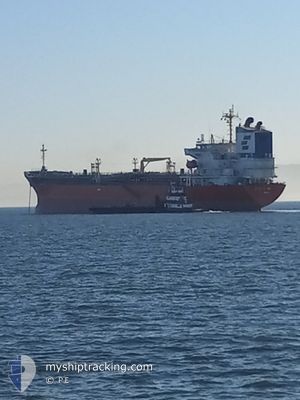
ARGENT ASTER
Oil/Chemical Tanker

Current Trip
US VRW
| Time Travelled | 19 days |
|---|---|
| Remaining Time | --- |
| Distance Travelled | 5746.62 nm |
| Remaining Distance | --- |
| AVG Speed | 13.1 Noeuds |
| MAX Speed | 16.5 Noeuds |
| AVG Wind | 14.3 knots |
| MAX Wind | 36 knots |
| MIN Temp | 5.1°C / 41.18°F |
| MAX Temp | 28.8°C / 83.84°F |
| Tirant d eau | 12.1 m |
| Position reçue | 1 m depuis |
Current Position
| Longitude | -126.53062° |
|---|---|
| Latitude | 46.33228° |
| Etat | Under way using engine |
| Vitesse | 11.6 Noeuds |
| Parcours | 90° |
| Zone | North Pacific Ocean |
| Station | T-AIS |
| Position reçue | 1 m depuis |
Information
The current position of ARGENT ASTER is in North Pacific Ocean with coordinates 46.33228° / -126.53062° as reported on 2025-06-11 04:32 by AIS to our vessel tracker app. The vessel's current speed is 11.6 Noeuds
The vessel ARGENT ASTER (IMO: 9379959, MMSI: 372956000) is a Oil/Chemical Tanker that was built in 2007 ( 18 Age ). It's sailing under the flag of [PA] Panama.
In this page you can find informations about the vessels current position, last detected port calls, and current voyage information. If the vessels is not in coverage by AIS you will find the latest position.
The current position of ARGENT ASTER is detected by our AIS receivers and we are not responsible for the reliability of the data. The last position was recorded while the vessel was in Coverage by the Ais receivers of our vessel tracking app.
The current draught of ARGENT ASTER as reported by AIS is 12.1 meters
Weather
| Temperature | 12.4°C / 54.32°F |
|---|---|
| Wind Speed | 23 knots |
| Direction | 331° NNW |
| Pressure | 1016.6 hPa |
| Humidity | 79.3 % |
| Cloud Coverage | 29 % |


Featured Company
Last Port Calls
| Port | Arrival | Departure | Time In Port |
|---|---|---|---|
| 2025-05-21 18:22 | 2025-05-22 23:05 | 1 d | |
| 2025-05-10 11:58 | 2025-05-12 06:31 | 1 d | |
| 2025-04-13 07:10 | 2025-04-16 02:23 | 2 d | |
| 2025-04-06 08:06 | 2025-04-07 12:24 | 1 d |
Last Trips
| Origin | Departure | Destination | Arrival | Distance | |
|---|---|---|---|---|---|
| 2025-05-12 06:31 | 2025-05-21 18:22 | 1423.34 nm | |||
| 2025-04-16 02:23 | 2025-05-10 11:58 | 5408.89 nm | |||
| 2025-04-07 12:24 | 2025-04-13 07:10 | 1372.72 nm | |||
| 2025-03-12 03:02 | 2025-04-06 08:06 | 7515.49 nm |
Events
| Heure | Evenement | Détails | Position/ Destination | Info |
|---|---|---|---|---|
| 2025-06-11 04:31 | Etat Changé | Under way using engine Default |
46.33235 / -126.53675
US VRW
|
Vitesse: 11.8 kn Parcours: 94° |
| 2025-06-11 04:29 | Dans la zone couverte |
46.33227 / -126.53438
North Pacific Ocean
US VRW
|
Vitesse: 11.4 kn Parcours: 91° |
|
| 2025-06-11 01:47 | Etat Changé | Default Under way using engine |
46.37538 / -127.29436
US VRW
|
Vitesse: 11.7 kn Parcours: 95° |
| 2025-06-11 01:41 | Hors de la zone couverte |
46.37818 / -127.32383
North Pacific Ocean
US VRW
|
Vitesse: 11.7 kn Parcours: 95° |
|
| 2025-06-11 00:07 | Detecté en mer | United States part of the North Pacific Ocean |
46.41613 / -127.75728
North Pacific Ocean
US VRW
|
Vitesse: 11.3 kn Parcours: 94° |
| 2025-06-11 00:07 | Etat Changé | Under way using engine Default |
46.41613 / -127.75728
US VRW
|
Vitesse: 11.6 kn Parcours: 94° |
| 2025-06-10 23:48 | Dans la zone couverte |
46.41613 / -127.75728
North Pacific Ocean
US VRW
|
Vitesse: 11.3 kn Parcours: 94° |
|
| 2025-06-10 18:08 | Etat Changé | Default Under way using engine |
46.51945 / -129.38336
US VRW
|
Vitesse: 11.1 kn Parcours: 90° |
| 2025-06-10 18:03 | Hors de la zone couverte |
46.51992 / -129.40990
North Pacific Ocean
US VRW
|
Vitesse: 11.1 kn Parcours: 90° |
|
| 2025-06-10 18:01 | Etat Changé | Under way using engine Default |
46.51995 / -129.41498
US VRW
|
Vitesse: 11.2 kn Parcours: 89° |