

ASPHALT SYNERGY
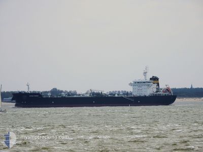
Tanker

Current Trip
| Time Travelled | 1 day |
|---|---|
| Remaining Time | --- |
| Distance Travelled | 179.92 nm |
| Remaining Distance | --- |
| AVG Speed | 10.4 Knots |
| MAX Speed | 13.4 Knots |
| AVG Wind | 9.9 knots |
| MAX Wind | 14.6 knots |
| MIN Temp | 17°C / 62.6°F |
| MAX Temp | 30.9°C / 87.62°F |
| Draught | 10.4 m |
| Position Received | 11 m ago |
Current Position
| Longitude | 26.26811° |
|---|---|
| Latitude | 40.05894° |
| Status | Under way using engine |
| Speed | 11.2 Knots |
| Course | 240.8° |
| Area | Sea of Marmara |
| Station | T-AIS |
| Position Received | 11 m ago |
Information
The current position of ASPHALT SYNERGY is in Sea of Marmara with coordinates 40.05894° / 26.26811° as reported on 2025-06-09 09:08 by AIS to our vessel tracker app. The vessel's current speed is 11.2 Knots and is heading at the port of ANTWERP. The estimated time of arrival as calculated by MyShipTracking vessel tracking app is 2025-06-20 12:00 LT
The vessel ASPHALT SYNERGY (IMO: 9794159, MMSI: 538007666) is a Tanker It's sailing under the flag of [MH] Marshall Is.
In this page you can find informations about the vessels current position, last detected port calls, and current voyage information. If the vessels is not in coverage by AIS you will find the latest position.
The current position of ASPHALT SYNERGY is detected by our AIS receivers and we are not responsible for the reliability of the data. The last position was recorded while the vessel was in Coverage by the Ais receivers of our vessel tracking app.
The current draught of ASPHALT SYNERGY as reported by AIS is 10.4 meters
Weather
| Temperature | 31°C / 87.8°F |
|---|---|
| Wind Speed | 13 knots |
| Direction | 19° NNE |
| Pressure | 1012.5 hPa |
| Humidity | 25.8 % |
| Cloud Coverage | --- |


Featured Company
Last Port Calls
| Port | Arrival | Departure | Time In Port |
|---|---|---|---|
| 2025-06-07 04:34 | 2025-06-07 22:39 | 18 h | |
| 2025-06-05 21:39 | 2025-06-07 04:01 | 1 d | |
| 2025-06-02 05:07 | 2025-06-03 23:01 | 1 d | |
| 2025-05-09 12:10 | 2025-05-18 15:00 | 9 d | |
| 2025-04-25 16:07 | 2025-04-26 12:11 | 20 h | |
| 2025-04-23 23:04 | 2025-04-25 15:46 | 1 d | |
| 2025-04-19 15:43 | 2025-04-21 09:36 | 1 d | |
| 2025-04-06 22:21 | 2025-04-07 15:20 | 16 h | |
| 2025-04-04 06:18 | 2025-04-05 10:46 | 1 d | |
| 2025-04-01 11:06 |
Last Trips
| Origin | Departure | Destination | Arrival | Distance | |
|---|---|---|---|---|---|
| 2025-06-07 04:01 | 2025-06-07 04:34 | 1.73 nm | |||
| 2025-06-03 23:01 | 2025-06-05 21:39 | 313.25 nm | |||
| 2025-05-18 15:00 | 2025-06-02 05:07 | 3156.18 nm | |||
| 2025-04-26 12:11 | 2025-05-09 12:10 | 3282.29 nm | |||
| 2025-04-25 15:46 | 2025-04-25 16:07 | 0.91 nm | |||
| 2025-04-21 09:36 | 2025-04-23 23:04 | 312.48 nm | |||
| 2025-04-07 15:20 | 2025-04-19 15:43 | 3073.04 nm | |||
| 2025-04-05 10:46 | 2025-04-06 22:21 | 338.98 nm | |||
| 2025-04-01 11:06 | 2025-04-04 06:18 | 331.20 nm |
Events
| Time | Event | Details | Position / Dest | Info |
|---|---|---|---|---|
| 2025-06-09 09:14 | Status Changed | Default Under way using engine |
40.05055 / 26.24880
BEANR
|
Speed: 11.2 kn Course: 240.8° |
| 2025-06-09 08:10 | Draught Changed | 10.4 9 |
40.19662 / 26.38135
BEANR
|
Speed: 8.7 kn Course: 213.5° |
| 2025-06-09 07:39 | Status Changed | Under way using engine Default |
40.23377 / 26.46983
BEANR
|
Speed: 12.2 kn Course: 230° |
| 2025-06-09 07:20 | IN Coverage |
40.23377 / 26.46983
Sea of Marmara
BEANR
|
Speed: 10.5 kn Course: 230.4° |
|
| 2025-06-09 04:24 | START Moving | 2.81 nm, South West of SARKOY |
40.57402 / 27.07006
BEANR
|
Speed: 3.1 kn Course: 215° |
| 2025-06-08 22:23 | Status Changed | Default At anchor |
40.57855 / 27.06536
BEANR
|
Speed: 0.1 kn Course: 83° |
| 2025-06-08 22:17 | OUT of Coverage |
40.57869 / 27.06545
Sea of Marmara
BEANR
|
Speed: 0.1 kn Course: 112.5° |
|
| 2025-06-08 22:11 | Status Changed | At anchor Default |
40.57885 / 27.06534
BEANR
|
Speed: Course: 92° |
| 2025-06-08 21:56 | Status Changed | Default At anchor |
40.57901 / 27.06516
BEANR
|
Speed: Course: 92° |
| 2025-06-08 21:56 | Status Changed | At anchor Default |
40.57901 / 27.06516
BEANR
|
Speed: Course: 92° |