
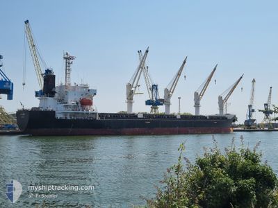
ATALANTE
Bulk Carrier
Current Trip
| Trip Time | 14 days |
|---|---|
| Trip Distance | 3098.83 nm |
| AVG Speed | 8.7 Knots |
| MAX Speed | 15.7 Knots |
| Draught | 5.6 m |
| AVG Wind | 16 knots |
| MAX Wind | 31 knots |
| MIN Temp | -3.1°C / 26.42°F |
| MAX Temp | 18.3°C / 64.94°F |
| Position Received | 2 d ago |
Current Position
| Longitude | 28.61209° |
|---|---|
| Latitude | 60.03736° |
| Status | Under way using engine |
| Speed | 12.4 Knots |
| Course | 92.9° |
| Area | Gulf of Finland |
| Station | T-AIS |
| Position Received | 2 d ago |
Info
Information
The current position of ATALANTE is in Gulf of Finland with coordinates 60.03736° / 28.61209° as reported on 2025-02-08 05:56 by AIS to our vessel tracker app. The vessel's current speed is 12.4 Knots and is currently inside the port of KRONSHTADT.
The vessel ATALANTE (IMO: 9363168, MMSI: 229720000) is a Bulk Carrier that was built in 2008 ( 17 years old ). It's sailing under the flag of [MT] Malta.
In this page you can find informations about the vessels current position, last detected port calls, and current voyage information. If the vessels is not in coverage by AIS you will find the latest position.
The current position of ATALANTE is detected by our AIS receivers and we are not responsible for the reliability of the data. The last position was recorded while the vessel was in Coverage by the Ais receivers of our vessel tracking app.
The current draught of ATALANTE as reported by AIS is 5.6 meters
Weather
| Temperature | -6.8°C / 19.76°F |
|---|---|
| Wind Speed | 3 knots |
| Direction | 178° S |
| Pressure | 1043.1 hPa |
| Humidity | 92.5 % |
| Cloud Coverage | 4 % |
Featured Company
Last Port Calls
| Port | Arrival | Departure | Time In Port |
|---|---|---|---|
| 2025-02-08 08:48 | |||
| 2025-01-21 10:10 | 2025-01-25 03:54 | 3 d | |
| 2025-01-14 11:47 | 2025-01-18 12:53 | 4 d | |
| 2024-12-15 12:01 | 2024-12-20 01:03 | 4 d |
Most Visited Ports (Last year)
| Port | Arrivals | |
|---|---|---|
| 3 | ||
| 3 | ||
| 1 | ||
| 1 | ||
| 1 | ||
| 1 |
Last Trips
| Origin | Departure | Destination | Arrival | Distance | |
|---|---|---|---|---|---|
| 2025-01-25 04:54 | 2025-02-08 11:48 | 3098.83 nm | |||
| 2025-01-18 13:53 | 2025-01-21 11:10 | 713.37 nm | |||
| 2024-12-20 02:03 | 2025-01-14 12:47 | 3812.94 nm | |||
| 2024-11-12 23:16 | 2024-12-15 13:01 | 5016.09 nm |
Events
| Time | Event | Details | Position / Dest | Info |
|---|---|---|---|---|
| 2025-02-08 08:48 | PORT ARRIVAL |
|
59.98863 / 29.79449
[RU] KRONSHTADT
|
Speed: 12.4 kn Course: 92.9° |
| 2025-02-08 05:56 | OUT of Coverage |
60.03736 / 28.61209
Gulf of Finland
RU LED
|
Speed: 12.4 kn Course: 92.9° |
|
| 2025-02-08 00:04 | Change Sea Area | Russian part of the Gulf of Finland Estonian part of the Gulf of Finland |
59.95825 / 26.42972
Gulf of Finland
RU LED
|
Speed: 12.6 kn Course: 74° |
| 2025-02-07 23:31 | Status Changed | Under way using engine Default |
59.92878 / 26.20630
RU LED
|
Speed: 12.5 kn Course: 74° |
| 2025-02-07 23:21 | IN Coverage |
59.92878 / 26.20630
Gulf of Finland
RU LED
|
Speed: 12.5 kn Course: 74° |
|
| 2025-02-07 22:25 | Status Changed | Default Under way using engine |
59.86960 / 25.77333
RU LED
|
Speed: 11.9 kn Course: 79° |
| 2025-02-07 22:18 | Status Changed | Under way using engine Default |
59.86515 / 25.72110
RU LED
|
Speed: 11.9 kn Course: 79° |
| 2025-02-07 22:18 | OUT of Coverage |
59.86515 / 25.72110
Gulf of Finland
RU LED
|
Speed: 11.9 kn Course: 79° |
|
| 2025-02-07 21:45 | Status Changed | Default Under way using engine |
59.84355 / 25.50873
RU LED
|
Speed: 12.4 kn Course: 77° |
| 2025-02-07 21:37 | Status Changed | Under way using engine Default |
59.83730 / 25.45585
RU LED
|
Speed: 12.5 kn Course: 76° |