
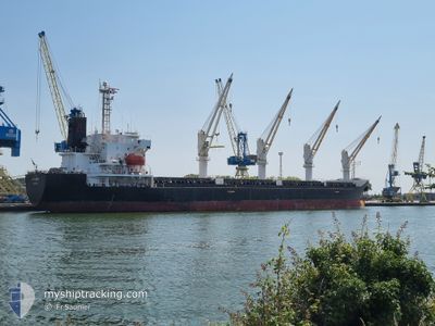
ATALANTE
Bulk Carrier
Current Trip
| Time Travelled | 1 day |
|---|---|
| Remaining Time | --- |
| Distance Travelled | 374.86 nm |
| Remaining Distance | --- |
| AVG Speed | 11.8 Knopen |
| MAX Speed | 13.8 Knopen |
| AVG Wind | 14.1 knots |
| MAX Wind | 22.8 knots |
| MIN Temp | -1.7°C / 28.94°F |
| MAX Temp | 0.6°C / 33.08°F |
| Diepgang | 9.7 M |
| Positie ontvangen | 1 m geleden |
Current Position
| Lengtegraad | 18.98727° |
|---|---|
| Breedtegraat | 57.21770° |
| Status | Under way using engine |
| Snelheid | 11.8 Knopen |
| Koers | 220° |
| Gebied | Baltic Sea |
| Station | T-AIS |
| Positie ontvangen | 1 m geleden |
Info
Information
The current position of ATALANTE is in Baltic Sea with coordinates 57.21770° / 18.98727° as reported on 2025-02-14 01:16 by AIS to our vessel tracker app. The vessel's current speed is 11.8 Knopen and is heading at the port of ISKENDERUN. The estimated time of arrival as calculated by MyShipTracking vessel tracking app is 2025-03-01 15:00 LT
The vessel ATALANTE (IMO: 9363168, MMSI: 229720000) is a Bulk Carrier that was built in 2008 ( 17 Jaar oud ). It's sailing under the flag of [MT] Malta.
In this page you can find informations about the vessels current position, last detected port calls, and current voyage information. If the vessels is not in coverage by AIS you will find the latest position.
The current position of ATALANTE is detected by our AIS receivers and we are not responsible for the reliability of the data. The last position was recorded while the vessel was in Coverage by the Ais receivers of our vessel tracking app.
The current draught of ATALANTE as reported by AIS is 9.7 meters
Weather
| Temperature | 0.5°C / 32.9°F |
|---|---|
| Wind Speed | 20 knots |
| Direction | 27° NNE |
| Pressure | 1022.3 hPa |
| Humidity | 59.4 % |
| Cloud Coverage | 100 % |
Featured Company
Last Port Calls
| Port | Arrival | Departure | Time In Port |
|---|---|---|---|
| 2025-02-08 11:48 | 2025-02-12 17:39 | 4 d | |
| 2025-01-21 11:10 | 2025-01-25 04:54 | 3 d | |
| 2025-01-14 12:47 | 2025-01-18 13:53 | 4 d | |
| 2024-12-15 13:01 | 2024-12-20 02:03 | 4 d |
Most Visited Ports (Last year)
| Port | Arrivals | |
|---|---|---|
| 3 | ||
| 3 | ||
| 1 | ||
| 1 | ||
| 1 | ||
| 1 |
Last Trips
| Origin | Departure | Destination | Arrival | Distance | |
|---|---|---|---|---|---|
| 2025-01-25 04:54 | 2025-02-08 11:48 | 3098.83 nm | |||
| 2025-01-18 13:53 | 2025-01-21 11:10 | 713.37 nm | |||
| 2024-12-20 02:03 | 2025-01-14 12:47 | 3812.94 nm | |||
| 2024-11-12 23:16 | 2024-12-15 13:01 | 5016.09 nm |
Events
| Tijd | Evenement | Details | Positie / Bestemming | Info |
|---|---|---|---|---|
| 2025-02-14 00:19 | Status Changed | Under way using engine Default |
57.35757 / 19.20722
TR ISK
|
Snelheid: 11.3 kn Koers: 221° |
| 2025-02-14 00:09 | Status Changed | Default Under way using engine |
57.37995 / 19.24275
TR ISK
|
Snelheid: 11.2 kn Koers: 220° |
| 2025-02-13 22:28 | Status Changed | Under way using engine Default |
57.63192 / 19.61145
TR ISK
|
Snelheid: 11.5 kn Koers: 216° |
| 2025-02-13 22:01 | Status Changed | Default Under way using engine |
57.70040 / 19.70812
TR ISK
|
Snelheid: 11.2 kn Koers: 218° |
| 2025-02-13 21:53 | Status Changed | Under way using engine Default |
57.72013 / 19.73697
TR ISK
|
Snelheid: 11.2 kn Koers: 217° |
| 2025-02-13 21:18 | Status Changed | Default Under way using engine |
57.80898 / 19.86343
TR ISK
|
Snelheid: 11.5 kn Koers: 217.8° |
| 2025-02-13 21:11 | Status Changed | Under way using engine Default |
57.82654 / 19.88826
TR ISK
|
Snelheid: 11.5 kn Koers: 218° |
| 2025-02-13 21:09 | Status Changed | Default Under way using engine |
57.82947 / 19.89250
TR ISK
|
Snelheid: 11.6 kn Koers: 215.2° |
| 2025-02-13 21:04 | Wijzig zee gebeid | Swedish part of the Baltic Sea Finnish part of the Baltic Sea |
57.84427 / 19.91393
Baltic Sea
TR ISK
|
Snelheid: 11.6 kn Koers: 215.2° |
| 2025-02-13 21:02 | Status Changed | Under way using engine Default |
57.84720 / 19.91814
TR ISK
|
Snelheid: 11.6 kn Koers: 217° |