
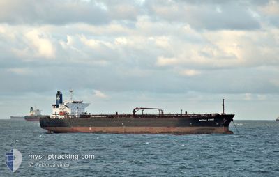
BASTILLE STREET
Tanker
Current Trip
| Time Travelled | 1 day |
|---|---|
| Remaining Time | 1 day |
| Distance Travelled | 200.72 nm |
| Remaining Distance | 341.39 nm |
| AVG Speed | 7.2 Knots |
| MAX Speed | 10 Knots |
| AVG Wind | 9.5 knots |
| MAX Wind | 19.1 knots |
| MIN Temp | 18.6°C / 65.48°F |
| MAX Temp | 24.2°C / 75.56°F |
| Draught | 7.8 m |
| Position Received | 21 h, 56 m ago |
Current Position
| Longitude | -97.55476° |
|---|---|
| Latitude | 22.42051° |
| Status | Under way using engine |
| Speed | 7 Knots |
| Course | 53° |
| Area | Gulf of Mexico |
| Station | T-AIS |
| Position Received | 21 h, 56 m ago |
Info
Information
The current position of BASTILLE STREET is in Gulf of Mexico with coordinates 22.42051° / -97.55476° as reported on 2025-02-15 00:54 by AIS to our vessel tracker app. The vessel's current speed is 7 Knots and is heading at the port of HOUSTON. The estimated time of arrival as calculated by MyShipTracking vessel tracking app is 2025-02-17 03:06 LT
The vessel BASTILLE STREET (IMO: 957370100, MMSI: 636015161) is a Tanker It's sailing under the flag of [LR] Liberia.
In this page you can find informations about the vessels current position, last detected port calls, and current voyage information. If the vessels is not in coverage by AIS you will find the latest position.
The current position of BASTILLE STREET is detected by our AIS receivers and we are not responsible for the reliability of the data. The last position was recorded while the vessel was in Coverage by the Ais receivers of our vessel tracking app.
The current draught of BASTILLE STREET as reported by AIS is 7.8 meters
Weather
| Temperature | 24.1°C / 75.38°F |
|---|---|
| Wind Speed | 20 knots |
| Direction | 170° S |
| Pressure | 1008.5 hPa |
| Humidity | 89.7 % |
| Cloud Coverage | 35 % |
Featured Company
Last Port Calls
| Port | Arrival | Departure | Time In Port |
|---|---|---|---|
| 2025-02-11 18:46 | 2025-02-14 16:04 | 2 d | |
| 2025-01-19 16:16 | 2025-01-22 16:16 | 3 d | |
| 2024-12-09 23:31 | 2024-12-10 11:49 | 12 h | |
| 2024-12-05 12:33 | 2024-12-06 16:40 | 1 d |
Most Visited Ports (Last year)
| Port | Arrivals | |
|---|---|---|
| 7 | ||
| 5 | ||
| 5 | ||
| 4 | ||
| 3 | ||
| 2 |
Last Trips
| Origin | Departure | Destination | Arrival | Distance | |
|---|---|---|---|---|---|
| 2025-01-22 16:16 | 2025-02-11 18:46 | 1202.99 nm | |||
| 2024-12-10 11:49 | 2025-01-19 16:16 | 5783.98 nm | |||
| 2024-12-06 16:40 | 2024-12-09 23:31 | 311.26 nm | |||
| 2024-11-16 16:54 | 2024-12-05 12:33 | 3974.49 nm |
Events
| Time | Event | Details | Position / Dest | Info |
|---|---|---|---|---|
| 2025-02-15 00:55 | Status Changed | Default Under way using engine |
22.42107 / -97.55395
USHPY
|
Speed: 7 kn Course: 53° |
| 2025-02-15 00:54 | OUT of Coverage |
22.42051 / -97.55476
Gulf of Mexico
USHPY
|
Speed: 7 kn Course: 53° |
|
| 2025-02-14 23:50 | ETA Changed | 2025/02/17 14:00 2025/02/17 05:00 |
22.34001 / -97.66107
USHPY
|
Speed: 7.1 kn Course: 43.5° |
| 2025-02-14 22:10 | ETA Changed | 2025/02/17 05:00 2025/02/16 17:00 |
22.24829 / -97.81794
USHPY
|
Speed: 5.3 kn Course: 59° |
| 2025-02-14 22:04 | PORT DEPARTURE |
|
22.24336 / -97.82569
USHPY
|
Speed: 5.9 kn Course: 53° |
| 2025-02-14 21:42 | Draught Changed | 7.8 7.4 |
22.20991 / -97.83868
[MX] TAMPICO
|
Speed: 6.3 kn Course: 21° |
| 2025-02-14 21:42 | Destination Changed | USHPY MXTAM |
22.20991 / -97.83868
[MX] TAMPICO
|
Speed: 6.3 kn Course: 21° |
| 2025-02-14 21:42 | ETA Changed | 2025/02/16 17:00 2025/02/11 21:00 |
22.20991 / -97.83868
[MX] TAMPICO
|
Speed: 6.3 kn Course: 21° |
| 2025-02-14 21:34 | Status Changed | Under way using engine Default |
22.20745 / -97.85186
[MX] TAMPICO
|
Speed: 5.4 kn Course: 105° |
| 2025-02-14 21:31 | START Moving |
22.20844 / -97.85546
[MX] TAMPICO
|
Speed: 5.4 kn Course: 105° |