
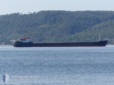
BELFAST
General Cargo
Current Trip
| Time Travelled | 11 h, 39 mins |
|---|---|
| Remaining Time | --- |
| Distance Travelled | 76.59 nm |
| Remaining Distance | --- |
| AVG Speed | 6.6 Knots |
| MAX Speed | 7.6 Knots |
| AVG Wind | 8.2 knots |
| MAX Wind | 18 knots |
| MIN Temp | 6.1°C / 42.98°F |
| MAX Temp | 15.7°C / 60.26°F |
| Draught | 2.8 m |
| Position Received | 14 m ago |
Current Position
| Longitude | 26.02025° |
|---|---|
| Latitude | 39.68926° |
| Status | Under way using engine |
| Speed | 6 Knots |
| Course | 1.5° |
| Area | Aegean Sea |
| Station | T-AIS |
| Position Received | 14 m ago |
Info
Information
The current position of BELFAST is in Aegean Sea with coordinates 39.68926° / 26.02025° as reported on 2025-03-06 13:52 by AIS to our vessel tracker app. The vessel's current speed is 6 Knots and is heading at the port of ROSTOV-ON-DON. The estimated time of arrival as calculated by MyShipTracking vessel tracking app is 2025-03-10 16:00 LT
The vessel BELFAST (IMO: 8035166, MMSI: 677073600) is a General Cargo that was built in 1982 ( 43 years old ). It's sailing under the flag of [TZ] Tanzania.
In this page you can find informations about the vessels current position, last detected port calls, and current voyage information. If the vessels is not in coverage by AIS you will find the latest position.
The current position of BELFAST is detected by our AIS receivers and we are not responsible for the reliability of the data. The last position was recorded while the vessel was in Coverage by the Ais receivers of our vessel tracking app.
The current draught of BELFAST as reported by AIS is 2.8 meters
Weather
| Temperature | 15.2°C / 59.36°F |
|---|---|
| Wind Speed | 18 knots |
| Direction | 13° NNE |
| Pressure | 1025 hPa |
| Humidity | 54.4 % |
| Cloud Coverage | 11 % |
Featured Company
Last Port Calls
| Port | Arrival | Departure | Time In Port |
|---|---|---|---|
| 2025-03-04 13:29 | 2025-03-06 05:27 | 1 d | |
| 2025-01-24 14:45 | 2025-01-25 11:57 | 21 h | |
| 2025-01-15 12:01 | 2025-01-16 07:58 | 19 h | |
| 2025-01-01 21:51 | 2025-01-01 22:00 | 9 m | |
| 2025-01-01 20:21 | 2025-01-01 20:53 | 32 m |
Last Trips
| Origin | Departure | Destination | Arrival | Distance | |
|---|---|---|---|---|---|
| 2025-01-25 11:57 | 2025-03-04 13:29 | 1151.34 nm | |||
| 2025-01-16 07:58 | 2025-01-24 14:45 | 62.16 nm | |||
| 2025-01-01 22:00 | 2025-01-15 12:01 | 822.02 nm | |||
| 2025-01-01 20:53 | 2025-01-01 21:51 | 13.67 nm | |||
| 2024-12-31 04:21 | 2025-01-01 20:21 | 296.35 nm |
Events
| Time | Event | Details | Position / Dest | Info |
|---|---|---|---|---|
| 2025-03-06 09:14 | Change Sea Area | Turkish part of the Aegean Sea Greek part of the Aegean Sea |
39.43414 / 26.38566
Aegean Sea
ROSTOV
|
Speed: 7.6 kn Course: 327.1° |
| 2025-03-06 09:13 | Status Changed | Under way using engine Default |
39.43354 / 26.38615
ROSTOV
|
Speed: 7.2 kn Course: 327° |
| 2025-03-06 08:57 | Status Changed | Default Under way using engine |
39.40536 / 26.40895
ROSTOV
|
Speed: 7.2 kn Course: 326.6° |
| 2025-03-06 08:53 | Status Changed | Under way using engine Default |
39.39895 / 26.41463
ROSTOV
|
Speed: 6.8 kn Course: 326° |
| 2025-03-06 08:53 | IN Coverage |
39.40229 / 26.41163
Aegean Sea
ROSTOV
|
Speed: 7.2 kn Course: 326.6° |
|
| 2025-03-06 07:52 | Status Changed | Default Under way using engine |
39.30138 / 26.50048
ROSTOV
|
Speed: 7.2 kn Course: 334.9° |
| 2025-03-06 07:49 | OUT of Coverage |
39.29413 / 26.50514
Aegean Sea
ROSTOV
|
Speed: 7.2 kn Course: 334.9° |
|
| 2025-03-06 07:08 | Status Changed | Under way using engine Default |
39.21932 / 26.55418
ROSTOV
|
Speed: 7.3 kn Course: 333° |
| 2025-03-06 07:00 | Status Changed | Default Under way using engine |
39.20495 / 26.56369
ROSTOV
|
Speed: 7.3 kn Course: 335.1° |
| 2025-03-06 06:44 | Status Changed | Under way using engine Default |
39.17621 / 26.58253
ROSTOV
|
Speed: 7.5 kn Course: 334° |