
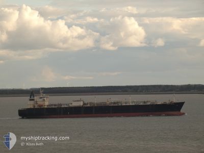
BERGE NANTONG
Lpg Tanker
Current Trip
| Time Travelled | 22 days |
|---|---|
| Remaining Time | 13 h, 30 mins |
| Distance Travelled | 5764.13 nm |
| Remaining Distance | 63.33 nm |
| AVG Speed | 12 Knots |
| MAX Speed | 17.3 Knots |
| AVG Wind | 14.7 knots |
| MAX Wind | 37.3 knots |
| MIN Temp | 1°C / 33.8°F |
| MAX Temp | 19.1°C / 66.38°F |
| Draught | 8 m |
| Position Received | 1 m ago |
Current Position
| Longitude | -132.11267° |
|---|---|
| Latitude | 54.36975° |
| Status | Under way using engine |
| Speed | 0.6 Knots |
| Course | 313° |
| Area | The Coastal Waters of Southeast Alaska and British Columbia |
| Station | T-AIS |
| Position Received | 1 m ago |
Info
Information
The current position of BERGE NANTONG is in The Coastal Waters of Southeast Alaska and British Columbia with coordinates 54.36975° / -132.11267° as reported on 2026-01-06 02:35 by AIS to our vessel tracker app. The vessel's current speed is 0.6 Knots and is heading at the port of PRINCE RUPERT. The estimated time of arrival as calculated by MyShipTracking vessel tracking app is 2026-01-06 08:06 LT
The vessel BERGE NANTONG (IMO: 9317987, MMSI: 477241500) is a Lpg Tanker that was built in 2006 ( 20 years old ). It's sailing under the flag of [HK] Hong Kong.
In this page you can find informations about the vessels current position, last detected port calls, and current voyage information. If the vessels is not in coverage by AIS you will find the latest position.
The current position of BERGE NANTONG is detected by our AIS receivers and we are not responsible for the reliability of the data. The last position was recorded while the vessel was in Coverage by the Ais receivers of our vessel tracking app.
The current draught of BERGE NANTONG as reported by AIS is 8 meters
Weather
| Temperature | 6.7°C / 44.06°F |
|---|---|
| Wind Speed | 17 knots |
| Direction | 257° WSW |
| Pressure | 992.3 hPa |
| Humidity | 83.2 % |
| Cloud Coverage | 100 % |
Featured Company
Last Trips
| Origin | Departure | Destination | Arrival | Distance | |
|---|---|---|---|---|---|
| 2025-11-22 16:14 | 2025-12-13 11:57 | 5550.76 nm | |||
| 2025-11-01 02:19 | 2025-11-20 21:48 | 3783.35 nm |
Events
| Time | Event | Details | Position / Dest | Info |
|---|---|---|---|---|
| 2026-01-06 02:29 | Status Changed | Under way using engine Default |
54.36877 / -132.11175
CA PRR
|
Speed: 0.8 kn Course: 303° |
| 2026-01-06 02:19 | IN Coverage |
54.36877 / -132.11175
The Coastal Waters of Southeast Alaska and British Columbia
|
Speed: 0.6 kn Course: 312° |
|
| 2026-01-06 01:15 | Status Changed | Default Under way using engine |
54.35510 / -132.06779
CA PRR
|
Speed: 0.8 kn Course: 277° |
| 2026-01-06 01:14 | Status Changed | Under way using engine Default |
54.35508 / -132.06773
CA PRR
|
Speed: 0.9 kn Course: 279° |
| 2026-01-06 01:14 | OUT of Coverage |
54.35508 / -132.06773
The Coastal Waters of Southeast Alaska and British Columbia
|
Speed: 0.8 kn Course: 305° |
|
| 2026-01-06 00:55 | Status Changed | Default Under way using engine |
54.35213 / -132.06032
CA PRR
|
Speed: 1.1 kn Course: 274° |
| 2026-01-06 00:13 | Status Changed | Under way using engine Default |
54.34307 / -132.04262
CA PRR
|
Speed: 1 kn Course: 255° |
| 2026-01-06 00:11 | Status Changed | Default Under way using engine |
54.34268 / -132.04179
CA PRR
|
Speed: 1.2 kn Course: 258° |
| 2026-01-05 22:35 | STOP Moving |
54.30777 / -132.00678
CA PRR
|
Speed: 0.3 kn Course: 209° |
|
| 2026-01-05 20:53 | Change Sea Area | Canadian part of the The Coastal Waters of Southeast Alaska and British Columbia United States (Alaska) part of the The Coastal Waters of Southeast Alaska and British Columbia |
54.39820 / -131.95107
The Coastal Waters of Southeast Alaska and British Columbia
|
Speed: 7.4 kn Course: 211° |