
BSG BAHAMAS
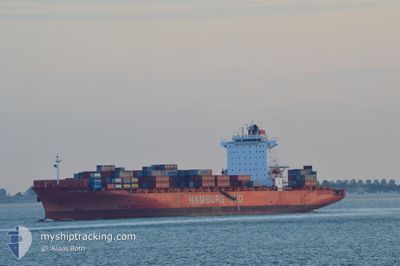
Container Ship
Current Trip
| Time Travelled | 3 days |
|---|---|
| Remaining Time | --- |
| Distance Travelled | 1152.34 nm |
| Remaining Distance | --- |
| AVG Speed | 14.1 Knots |
| MAX Speed | 21.4 Knots |
| AVG Wind | 15.9 knots |
| MAX Wind | 29 knots |
| MIN Temp | 23.7°C / 74.66°F |
| MAX Temp | 27.1°C / 80.78°F |
| Draught | 11.9 m |
| Position Received | 2 h, 23 m ago |
Current Position
| Longitude | -75.91922° |
|---|---|
| Latitude | 10.52321° |
| Status | Under way using engine |
| Speed | 6.3 Knots |
| Course | 80.3° |
| Area | Caribbean Sea |
| Station | T-AIS |
| Position Received | 2 h, 23 m ago |
Info
Information
The current position of BSG BAHAMAS is in Caribbean Sea with coordinates 10.52321° / -75.91922° as reported on 2025-02-11 08:58 by AIS to our vessel tracker app. The vessel's current speed is 6.3 Knots
The vessel BSG BAHAMAS (IMO: 9439498, MMSI: 636093031) is a Container Ship that was built in 2009 ( 16 years old ). It's sailing under the flag of [LR] Liberia.
In this page you can find informations about the vessels current position, last detected port calls, and current voyage information. If the vessels is not in coverage by AIS you will find the latest position.
The current position of BSG BAHAMAS is detected by our AIS receivers and we are not responsible for the reliability of the data. The last position was recorded while the vessel was in Coverage by the Ais receivers of our vessel tracking app.
The current draught of BSG BAHAMAS as reported by AIS is 11.9 meters
Weather
| Temperature | 26.1°C / 78.98°F |
|---|---|
| Wind Speed | 20 knots |
| Direction | 64° ENE |
| Pressure | 1007.4 hPa |
| Humidity | 82.6 % |
| Cloud Coverage | 100 % |
Featured Company
Last Port Calls
| Port | Arrival | Departure | Time In Port |
|---|---|---|---|
| 2025-02-07 03:03 | 2025-02-07 19:28 | 16 h | |
| 2025-02-07 02:39 | 2025-02-07 02:53 | 14 m | |
| 2025-02-04 19:43 | 2025-02-05 14:10 | 18 h | |
| 2025-02-02 12:34 | 2025-02-03 03:37 | 15 h | |
| 2025-01-31 09:29 | 2025-02-01 08:49 | 23 h | |
| 2025-01-28 01:56 | 2025-01-28 15:50 | 13 h | |
| 2025-01-28 01:31 | 2025-01-28 01:45 | 14 m | |
| 2025-01-22 23:51 | 2025-01-24 08:28 | 1 d | |
| 2025-01-21 00:20 | 2025-01-22 02:33 | 1 d | |
| 2025-01-17 00:16 | 2025-01-17 12:33 | 12 h |
Most Visited Ports (Last year)
| Port | Arrivals | |
|---|---|---|
| 31 | ||
| 20 | ||
| 16 | ||
| 16 | ||
| 16 | ||
| 14 |
Last Trips
| Origin | Departure | Destination | Arrival | Distance | |
|---|---|---|---|---|---|
| 2025-02-06 21:53 | 2025-02-06 22:03 | 0.63 nm | |||
| 2025-02-05 09:10 | 2025-02-06 21:39 | 419.68 nm | |||
| 2025-02-02 22:37 | 2025-02-04 14:43 | 589.23 nm | |||
| 2025-02-01 03:49 | 2025-02-02 07:34 | 451.42 nm | |||
| 2025-01-28 10:50 | 2025-01-31 04:29 | 975.14 nm | |||
| 2025-01-27 20:45 | 2025-01-27 20:56 | 0.62 nm | |||
| 2025-01-24 03:28 | 2025-01-27 20:31 | 1307.20 nm | |||
| 2025-01-21 21:33 | 2025-01-22 18:51 | 282.10 nm | |||
| 2025-01-17 07:33 | 2025-01-20 19:20 | 1155.26 nm | |||
| 2025-01-16 19:07 | 2025-01-16 19:16 | 0.64 nm |
Events
| Time | Event | Details | Position / Dest | Info |
|---|---|---|---|---|
| 2025-02-11 09:12 | STOP Moving |
10.52750 / -75.91102
COCTG
|
Speed: 0.3 kn Course: 47° |
|
| 2025-02-11 09:00 | Status Changed | Default Under way using engine |
10.52366 / -75.91637
COCTG
|
Speed: 6.3 kn Course: 80.3° |
| 2025-02-11 08:58 | Status Changed | Under way using engine Default |
10.52321 / -75.91922
COCTG
|
Speed: 9.7 kn Course: 81° |
| 2025-02-11 08:58 | OUT of Coverage |
10.52321 / -75.91922
Caribbean Sea
COCTG
|
Speed: 6.3 kn Course: 80.3° |
|
| 2025-02-11 08:46 | Status Changed | Default Under way using engine |
10.51870 / -75.94818
COCTG
|
Speed: 9.7 kn Course: 78.3° |
| 2025-02-11 08:39 | Status Changed | Under way using engine Default |
10.51565 / -75.96847
COCTG
|
Speed: 9.1 kn Course: 90° |
| 2025-02-11 08:24 | IN Coverage |
10.51565 / -75.96847
Caribbean Sea
COCTG
|
Speed: 9.4 kn Course: 81.9° |
|
| 2025-02-11 06:11 | Status Changed | Default Under way using engine |
10.51281 / -76.00017
COCTG
|
Speed: 1.6 kn Course: 137° |
| 2025-02-11 06:04 | Status Changed | Under way using engine Default |
10.51267 / -75.99688
COCTG
|
Speed: 1.5 kn Course: 138° |
| 2025-02-11 06:04 | OUT of Coverage |
10.51267 / -75.99688
Caribbean Sea
COCTG
|
Speed: 1.6 kn Course: 270.3° |