
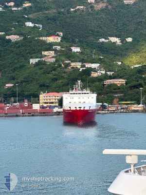
CARIBBEAN FORCE
Ro-Ro Cargo
Current Trip
| Time Travelled | 13 h, 59 mins |
|---|---|
| Remaining Time | --- |
| Distance Travelled | 84.75 nm |
| Remaining Distance | --- |
| AVG Speed | 13.9 Knots |
| MAX Speed | 15.4 Knots |
| AVG Wind | 19.3 knots |
| MAX Wind | 20 knots |
| MIN Temp | 24.5°C / 76.1°F |
| MAX Temp | 26.2°C / 79.16°F |
| Draught | 5 m |
| Position Received | 8 h, 7 m ago |
Current Position
| Longitude | -65.90785° |
|---|---|
| Latitude | 18.51837° |
| Status | Under way using engine |
| Speed | 14.6 Knots |
| Course | 271.4° |
| Area | North Atlantic Ocean |
| Station | T-AIS |
| Position Received | 8 h, 7 m ago |
Info
Information
The current position of CARIBBEAN FORCE is in North Atlantic Ocean with coordinates 18.51837° / -65.90785° as reported on 2025-02-07 00:19 by AIS to our vessel tracker app. The vessel's current speed is 14.6 Knots
The vessel CARIBBEAN FORCE (IMO: 9335161, MMSI: 212703000) is a Ro-Ro Cargo that was built in 2007 ( 18 years old ). It's sailing under the flag of [CY] Cyprus.
In this page you can find informations about the vessels current position, last detected port calls, and current voyage information. If the vessels is not in coverage by AIS you will find the latest position.
The current position of CARIBBEAN FORCE is detected by our AIS receivers and we are not responsible for the reliability of the data. The last position was recorded while the vessel was in Coverage by the Ais receivers of our vessel tracking app.
The current draught of CARIBBEAN FORCE as reported by AIS is 5 meters
Weather
| Temperature | 24.5°C / 76.1°F |
|---|---|
| Wind Speed | 16 knots |
| Direction | 76° ENE |
| Pressure | 1017.2 hPa |
| Humidity | 79.9 % |
| Cloud Coverage | 7 % |
Featured Company
Last Port Calls
| Port | Arrival | Departure | Time In Port |
|---|---|---|---|
| 2025-02-06 11:41 | 2025-02-06 18:27 | 6 h | |
| 2025-02-05 15:00 | 2025-02-06 00:26 | 9 h | |
| 2025-02-04 10:10 | 2025-02-04 23:01 | 12 h | |
| 2025-01-30 23:19 | 2025-01-31 04:38 | 5 h | |
| 2025-01-29 12:03 | 2025-01-30 00:18 | 12 h | |
| 2025-01-23 22:59 | 2025-01-24 02:28 | 3 h | |
| 2025-01-22 15:16 | 2025-01-23 03:19 | 12 h | |
| 2025-01-18 14:31 | 2025-01-19 04:24 | 13 h | |
| 2025-01-16 16:14 | 2025-01-17 01:38 | 9 h | |
| 2025-01-16 01:13 | 2025-01-16 04:44 | 3 h |
Most Visited Ports (Last year)
| Port | Arrivals | |
|---|---|---|
| 7 | ||
| 5 | ||
| 4 |
Last Trips
| Origin | Departure | Destination | Arrival | Distance | |
|---|---|---|---|---|---|
| 2025-02-05 20:26 | 2025-02-06 07:41 | 66.66 nm | |||
| 2025-02-04 19:01 | 2025-02-05 11:00 | 113.29 nm | |||
| 2025-01-31 00:38 | 2025-02-04 06:10 | 694.22 nm | |||
| 2025-01-29 20:18 | 2025-01-30 19:19 | 21.30 nm | |||
| 2025-01-23 22:28 | 2025-01-29 08:03 | 729.33 nm | |||
| 2025-01-22 23:19 | 2025-01-23 18:59 | 64.24 nm | |||
| 2025-01-19 00:24 | 2025-01-22 11:16 | 279.18 nm | |||
| 2025-01-16 21:38 | 2025-01-18 10:31 | 347.79 nm | |||
| 2025-01-16 00:44 | 2025-01-16 12:14 | 103.85 nm | |||
| 2025-01-15 17:20 | 2025-01-15 21:13 | 26.69 nm |
Events
| Time | Event | Details | Position / Dest | Info |
|---|---|---|---|---|
| 2025-02-07 00:19 | OUT of Coverage |
18.51837 / -65.90785
North Atlantic Ocean
PR SJU
|
Speed: 14.6 kn Course: 271.4° |
|
| 2025-02-06 23:14 | Change Sea Area | Puerto Rican part of the North Atlantic Ocean Puerto Rican part of the Caribbean Sea |
18.47456 / -65.62851
North Atlantic Ocean
PR SJU
|
Speed: 15.1 kn Course: 280° |
| 2025-02-06 19:11 | Change Sea Area | Puerto Rican part of the Caribbean Sea British Virgin Islands part of the Caribbean Sea |
18.32185 / -64.64122
Caribbean Sea
PR SJU
|
Speed: 14.4 kn Course: 197.9° |
| 2025-02-06 18:45 | Destination Changed | PR SJU VG TOR |
18.39964 / -64.58056
PR SJU
|
Speed: 11 kn Course: 204° |
| 2025-02-06 18:45 | ETA Changed | 2025/02/07 01:00 2025/02/06 04:00 |
18.39964 / -64.58056
PR SJU
|
Speed: 11 kn Course: 204° |
| 2025-02-06 18:28 | START Moving | 0.21 nm, South of PORT PURCELL |
18.42120 / -64.60944
VG TOR
|
Speed: 4 kn Course: 166° |
| 2025-02-06 18:27 | PORT DEPARTURE |
|
18.42120 / -64.60944
VG TOR
|
Speed: 3 kn Course: 167° |
| 2025-02-06 18:01 | Status Changed | Under way using engine Moored |
18.42473 / -64.61005
[VG] PORT PURCELL
|
Speed: 0.1 kn Course: 233° |
| 2025-02-06 12:09 | Status Changed | Moored Under way using engine |
18.42468 / -64.60999
[VG] PORT PURCELL
|
Speed: Course: 229° |
| 2025-02-06 11:41 | PORT ARRIVAL |
|
18.42422 / -64.61034
[VG] PORT PURCELL
|
Speed: 0.9 kn Course: 243° |