
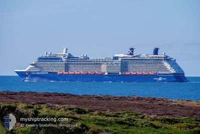
CELEBRITY SILHOUETTE
Passengers Ship
Current Trip
USEWY
| Time Travelled | 18 h, 48 mins |
|---|---|
| Remaining Time | --- |
| Distance Travelled | 311.60 nm |
| Remaining Distance | --- |
| AVG Speed | 17.4 Knots |
| MAX Speed | 19 Knots |
| AVG Wind | 8.8 knots |
| MAX Wind | 11 knots |
| MIN Temp | 22.4°C / 72.32°F |
| MAX Temp | 25.5°C / 77.9°F |
| Draught | 8.7 m |
| Position Received | 18 h, 41 m ago |
Current Position
| Longitude | -81.81576° |
|---|---|
| Latitude | 24.53753° |
| Status | Under way using engine |
| Speed | 9.7 Knots |
| Course | 182.9° |
| Area | North Atlantic Ocean |
| Station | T-AIS |
| Position Received | 18 h, 41 m ago |
Info
Information
The current position of CELEBRITY SILHOUETTE is in North Atlantic Ocean with coordinates 24.53753° / -81.81576° as reported on 2026-01-05 22:25 by AIS to our vessel tracker app. The vessel's current speed is 9.7 Knots
The vessel CELEBRITY SILHOUETTE (IMO: 9451094, MMSI: 248939000) is a Passengers Ship that was built in 2011 ( 15 years old ). It's sailing under the flag of [MT] Malta.
In this page you can find informations about the vessels current position, last detected port calls, and current voyage information. If the vessels is not in coverage by AIS you will find the latest position.
The current position of CELEBRITY SILHOUETTE is detected by our AIS receivers and we are not responsible for the reliability of the data. The last position was recorded while the vessel was in Coverage by the Ais receivers of our vessel tracking app.
The current draught of CELEBRITY SILHOUETTE as reported by AIS is 8.7 meters
Weather
| Temperature | 24.8°C / 76.64°F |
|---|---|
| Wind Speed | 12 knots |
| Direction | 69° ENE |
| Pressure | 1017.3 hPa |
| Humidity | 71.3 % |
| Cloud Coverage | --- |
Featured Company
Last Port Calls
| Port | Arrival | Departure | Time In Port |
|---|---|---|---|
| 2026-01-05 07:34 | 2026-01-05 17:19 | 9 h | |
| 2026-01-04 04:45 | 2026-01-04 17:25 | 12 h | |
| 2026-01-04 04:19 | 2026-01-04 04:38 | 18 m | |
| 2025-12-30 08:15 | 2025-12-30 18:18 | 10 h | |
| 2025-12-27 06:35 | 2025-12-27 16:14 | 9 h | |
| 2025-12-25 10:15 | 2025-12-25 20:54 | 10 h | |
| 2025-12-22 07:13 | 2025-12-22 17:23 | 10 h | |
| 2025-12-21 04:59 | 2025-12-21 17:11 | 12 h | |
| 2025-12-21 04:35 | 2025-12-21 04:53 | 18 m | |
| 2025-12-17 07:16 | 2025-12-17 18:04 | 10 h |
Most Visited Ports (Last year)
| Port | Arrivals | |
|---|---|---|
| 41 | ||
| 33 | ||
| 18 | ||
| 9 | ||
| 8 | ||
| 7 |
Last Trips
| Origin | Departure | Destination | Arrival | Distance | |
|---|---|---|---|---|---|
| 2026-01-04 17:25 | 2026-01-05 07:34 | 177.55 nm | |||
| 2026-01-04 04:38 | 2026-01-04 04:45 | 0.16 nm | |||
| 2025-12-30 18:18 | 2026-01-04 04:19 | 1297.37 nm | |||
| 2025-12-27 16:14 | 2025-12-30 08:15 | 1152.21 nm | |||
| 2025-12-25 20:54 | 2025-12-27 06:35 | 551.30 nm | |||
| 2025-12-22 17:23 | 2025-12-25 10:15 | 856.63 nm | |||
| 2025-12-21 17:11 | 2025-12-22 07:13 | 186.64 nm | |||
| 2025-12-21 04:53 | 2025-12-21 04:59 | 0.18 nm | |||
| 2025-12-17 18:04 | 2025-12-21 04:35 | 1191.13 nm | |||
| 2025-12-13 16:17 | 2025-12-17 07:16 | 1237.93 nm |
Events
| Time | Event | Details | Position / Dest | Info |
|---|---|---|---|---|
| 2026-01-05 22:27 | Status Changed | Default Under way using engine |
24.53297 / -81.81589
USEWY
|
Speed: 9.7 kn Course: 182.9° |
| 2026-01-05 22:25 | OUT of Coverage |
24.53753 / -81.81576
North Atlantic Ocean
|
Speed: 9.7 kn Course: 182.9° |
|
| 2026-01-05 22:19 | START Moving | 0.95 nm, South West of KEY WEST |
24.55185 / -81.81453
USEWY
|
Speed: 6.4 kn Course: 193° |
| 2026-01-05 22:19 | PORT DEPARTURE |
|
24.55185 / -81.81453
USEWY
|
Speed: 1.9 kn Course: 183° |
| 2026-01-05 22:08 | Status Changed | Under way using engine Default |
24.55806 / -81.80970
[US] KEY WEST
|
Speed: Course: -1° |
| 2026-01-05 21:13 | Status Changed | Default Moored |
24.55833 / -81.80833
[US] KEY WEST
|
Speed: Course: 20° |
| 2026-01-05 21:09 | Status Changed | Moored Default |
24.55910 / -81.80856
[US] KEY WEST
|
Speed: Course: -1° |
| 2026-01-05 20:31 | Status Changed | Default Moored |
24.55833 / -81.80833
[US] KEY WEST
|
Speed: Course: 20° |
| 2026-01-05 20:21 | Status Changed | Moored Default |
24.55910 / -81.80856
[US] KEY WEST
|
Speed: Course: -1° |
| 2026-01-05 20:07 | Status Changed | Default Moored |
24.55833 / -81.80833
[US] KEY WEST
|
Speed: Course: 20° |