
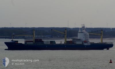
CHIQUITA PROGRESS
Not available
Current Trip
| Trip Time | 8 h, 31 mins |
|---|---|
| Trip Distance | 127.87 nm |
| AVG Speed | 12.8 Knots |
| MAX Speed | 18.1 Knots |
| Draught | 8 m |
| AVG Wind | 5.2 knots |
| MAX Wind | 7.1 knots |
| MIN Temp | 23.9°C / 75.02°F |
| MAX Temp | 28.3°C / 82.94°F |
| Position Received | 1 d ago |
Current Position
| Longitude | -95.28782° |
|---|---|
| Latitude | 15.31336° |
| Status | Under way using engine |
| Speed | 18.8 Knots |
| Course | 103.5° |
| Area | North Pacific Ocean |
| Station | T-AIS |
| Position Received | 1 d ago |
Info
Information
The current position of CHIQUITA PROGRESS is in North Pacific Ocean with coordinates 15.31336° / -95.28782° as reported on 2025-02-10 23:06 by AIS to our vessel tracker app. The vessel's current speed is 18.8 Knots and is currently inside the port of PUERTO QUETZAL.
The vessel CHIQUITA PROGRESS (MMSI: 636017731) is a Not available It's sailing under the flag of [LR] Liberia.
In this page you can find informations about the vessels current position, last detected port calls, and current voyage information. If the vessels is not in coverage by AIS you will find the latest position.
The current position of CHIQUITA PROGRESS is detected by our AIS receivers and we are not responsible for the reliability of the data. The last position was recorded while the vessel was in Coverage by the Ais receivers of our vessel tracking app.
The current draught of CHIQUITA PROGRESS as reported by AIS is 8 meters
Weather
| Temperature | 31.7°C / 89.06°F |
|---|---|
| Wind Speed | 12 knots |
| Direction | 206° SSW |
| Pressure | 1008.4 hPa |
| Humidity | 50.2 % |
| Cloud Coverage | 23 % |
Featured Company
Last Port Calls
| Port | Arrival | Departure | Time In Port |
|---|---|---|---|
| 2025-02-12 01:15 | |||
| 2025-02-11 05:25 | 2025-02-11 16:44 | 11 h | |
| 2025-02-08 17:47 | 2025-02-09 04:54 | 11 h | |
| 2025-02-04 06:23 | 2025-02-05 17:44 | 1 d | |
| 2025-01-29 06:35 | 2025-01-30 07:31 | 1 d | |
| 2025-01-28 04:58 | 2025-01-28 16:06 | 11 h | |
| 2025-01-25 20:15 | 2025-01-26 06:38 | 10 h | |
| 2025-01-21 12:27 | 2025-01-22 20:19 | 1 d | |
| 2025-01-16 08:25 | 2025-01-16 17:28 | 9 h | |
| 2025-01-15 08:51 | 2025-01-16 00:23 | 15 h |
Most Visited Ports (Last year)
| Port | Arrivals | |
|---|---|---|
| 26 | ||
| 25 | ||
| 12 | ||
| 8 | ||
| 4 |
Last Trips
| Origin | Departure | Destination | Arrival | Distance | |
|---|---|---|---|---|---|
| 2025-02-11 16:44 | 2025-02-12 01:15 | 127.87 nm | |||
| 2025-02-09 04:54 | 2025-02-11 05:25 | 747.67 nm | |||
| 2025-02-05 17:44 | 2025-02-08 17:47 | 1258.17 nm | |||
| 2025-01-30 07:31 | 2025-02-04 06:23 | 2114.55 nm | |||
| 2025-01-28 16:06 | 2025-01-29 06:35 | 129.33 nm | |||
| 2025-01-26 06:38 | 2025-01-28 04:58 | 758.24 nm | |||
| 2025-01-22 20:19 | 2025-01-25 20:15 | 1259.72 nm | |||
| 2025-01-16 17:28 | 2025-01-21 12:27 | 2016.84 nm | |||
| 2025-01-16 00:23 | 2025-01-16 08:25 | 129.10 nm | |||
| 2025-01-13 07:14 | 2025-01-15 08:51 | 873.03 nm |
Events
| Time | Event | Details | Position / Dest | Info |
|---|---|---|---|---|
| 2025-02-12 07:15 | STOP Moving |
13.92410 / -90.78610
[GT] PUERTO QUETZAL
|
Speed: 0.1 kn Course: 338° |
|
| 2025-02-12 07:15 | PORT ARRIVAL |
|
13.92410 / -90.78610
[GT] PUERTO QUETZAL
|
Speed: 1.6 kn Course: 20° |
| 2025-02-11 22:44 | PORT DEPARTURE |
|
14.69711 / -92.41241
MXZLO>>MXPMD
|
Speed: Course: 186° |
| 2025-02-11 11:25 | PORT ARRIVAL |
|
14.70972 / -92.40191
[MX] PUERTO MADERO
|
Speed: 8.7 kn Course: 66° |
| 2025-02-10 23:06 | OUT of Coverage |
15.31336 / -95.28782
North Pacific Ocean
|
Speed: 18.8 kn Course: 103.5° |
|
| 2025-02-10 19:30 | IN Coverage |
15.48122 / -96.03817
North Pacific Ocean
|
Speed: 11.7 kn Course: 102° |
|
| 2025-02-10 09:16 | OUT of Coverage |
16.15491 / -98.56081
North Pacific Ocean
|
Speed: 15.9 kn Course: 110.3° |
|
| 2025-02-10 06:35 | Status Changed | Under way using engine Default |
16.43771 / -99.26371
MXZLO>>MXPMD
|
Speed: 16.5 kn Course: 113° |
| 2025-02-10 06:35 | IN Coverage |
16.43771 / -99.26371
North Pacific Ocean
|
Speed: 16.5 kn Course: 114.6° |
|
| 2025-02-09 22:12 | OUT of Coverage |
17.41148 / -101.58941
North Pacific Ocean
|
Speed: 17 kn Course: 113.6° |