
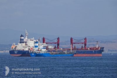
CL DENGSHA HE
Not available
Current Trip
CAPUABA
| Time Travelled | 20 h, 14 mins |
|---|---|
| Remaining Time | --- |
| Distance Travelled | 284.47 nm |
| Remaining Distance | --- |
| AVG Speed | 14.1 Knots |
| MAX Speed | 15.6 Knots |
| AVG Wind | 18 knots |
| MAX Wind | 23.5 knots |
| MIN Temp | 24.2°C / 75.56°F |
| MAX Temp | 27°C / 80.6°F |
| Draught | 11.7 m |
| Position Received | 18 d ago |
Current Position
| Longitude | -72.54495° |
|---|---|
| Latitude | 12.49888° |
| Status | Under way using engine |
| Speed | 10 Knots |
| Course | 67° |
| Area | Caribbean Sea |
| Station | T-AIS |
| Position Received | 18 d ago |
Info
Information
The current position of CL DENGSHA HE is in Caribbean Sea with coordinates 12.49888° / -72.54495° as reported on 2025-01-15 17:54 by AIS to our vessel tracker app. The vessel's current speed is 10 Knots
The vessel CL DENGSHA HE (IMO: 9890642, MMSI: 636019789) is a Not available It's sailing under the flag of [LR] Liberia.
In this page you can find informations about the vessels current position, last detected port calls, and current voyage information. If the vessels is not in coverage by AIS you will find the latest position.
The current position of CL DENGSHA HE is detected by our AIS receivers and we are not responsible for the reliability of the data. The last position was recorded while the vessel was in Coverage by the Ais receivers of our vessel tracking app.
The current draught of CL DENGSHA HE as reported by AIS is 11.7 meters
Weather
| Temperature | 25.8°C / 78.44°F |
|---|---|
| Wind Speed | 5 knots |
| Direction | 26° NNE |
| Pressure | 1011.2 hPa |
| Humidity | 84.2 % |
| Cloud Coverage | 76 % |
Featured Company
Last Port Calls
| Port | Arrival | Departure | Time In Port |
|---|---|---|---|
| 2025-01-28 18:40 | 2025-02-02 21:05 | 5 d | |
| 2024-12-29 15:10 | 2025-01-06 15:09 | 7 d | |
| 2024-12-27 19:56 | 2024-12-27 21:35 | 1 h | |
| 2024-12-24 05:07 | 2024-12-27 02:34 | 2 d | |
| 2024-12-04 22:33 | 2024-12-10 23:52 | 6 d | |
| 2024-12-02 09:37 |
Most Visited Ports (Last year)
| Port | Arrivals | |
|---|---|---|
| 3 | ||
| 2 | ||
| 2 | ||
| 2 | ||
| 1 | ||
| 1 |
Last Trips
| Origin | Departure | Destination | Arrival | Distance | |
|---|---|---|---|---|---|
| 2025-01-06 10:09 | 2025-01-28 15:40 | 4121.91 nm | |||
| 2024-12-27 16:35 | 2024-12-29 10:10 | 140.85 nm | |||
| 2024-12-26 21:34 | 2024-12-27 14:56 | 79.38 nm | |||
| 2024-12-10 17:52 | 2024-12-24 00:07 | 1539.23 nm | |||
| 2024-12-02 03:37 | 2024-12-04 16:33 | 744.71 nm |
Events
| Time | Event | Details | Position / Dest | Info |
|---|---|---|---|---|
| 2025-02-02 21:05 | PORT DEPARTURE |
|
-20.32126 / -40.28416
CAPUABA
|
Speed: 7.2 kn Course: 85° |
| 2025-02-02 20:50 | START Moving |
-20.32086 / -40.31860
[BR] BAIA DE VITORIA
|
Speed: 8.4 kn Course: 93° |
|
| 2025-01-28 18:55 | STOP Moving |
-20.32483 / -40.33548
[BR] BAIA DE VITORIA
|
Speed: Course: 266° |
|
| 2025-01-28 18:40 | PORT ARRIVAL |
|
-20.32475 / -40.33545
[BR] BAIA DE VITORIA
|
Speed: 1.5 kn Course: 266° |
| 2025-01-28 17:15 | START Moving | 4.79 nm, South East of BAIA DE VITORIA |
-20.37589 / -40.24987
CAPUABA
|
Speed: 3.3 kn Course: 41° |
| 2025-01-28 02:21 | STOP Moving | 4.88 nm, South East of BAIA DE VITORIA |
-20.38272 / -40.25474
CAPUABA
|
Speed: 0.3 kn Course: 25° |