

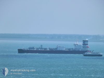
CLIPPER ENYO
Tanker D
Current Trip
| Time Travelled | 30 days |
|---|---|
| Remaining Time | --- |
| Distance Travelled | 6785.91 nm |
| Remaining Distance | --- |
| AVG Speed | 13.4 Knots |
| MAX Speed | 16.2 Knots |
| AVG Wind | 12.9 knots |
| MAX Wind | 30.4 knots |
| MIN Temp | 5.9°C / 42.62°F |
| MAX Temp | 31.4°C / 88.52°F |
| Draught | 9 m |
| Position Received | 2 m ago |
Current Position
| Longitude | 9.61018° |
|---|---|
| Latitude | 59.11351° |
| Status | At anchor |
| Speed | 0.1 Knots |
| Course | 120° |
| Area | Skaggerak |
| Station | T-AIS |
| Position Received | 2 m ago |
Information
The current position of CLIPPER ENYO is in Skaggerak with coordinates 59.11351° / 9.61018° as reported on 2025-06-07 16:46 by AIS to our vessel tracker app. The vessel's current speed is 0.1 Knots and is heading at the port of RAFNES. The estimated time of arrival as calculated by MyShipTracking vessel tracking app is 2025-06-03 21:00 LT
The vessel CLIPPER ENYO (IMO: 9827217, MMSI: 257066990) is a Tanker D It's sailing under the flag of [NO] Norway.
In this page you can find informations about the vessels current position, last detected port calls, and current voyage information. If the vessels is not in coverage by AIS you will find the latest position.
The current position of CLIPPER ENYO is detected by our AIS receivers and we are not responsible for the reliability of the data. The last position was recorded while the vessel was in Coverage by the Ais receivers of our vessel tracking app.
The current draught of CLIPPER ENYO as reported by AIS is 9 meters
Weather
| Temperature | 17.7°C / 63.86°F |
|---|---|
| Wind Speed | 10 knots |
| Direction | 200° SSW |
| Pressure | 998.4 hPa |
| Humidity | 39.4 % |
| Cloud Coverage | 97 % |

Featured Company
Last Port Calls
| Port | Arrival | Departure | Time In Port |
|---|---|---|---|
| 2025-05-07 02:31 | 2025-05-08 09:13 | 1 d | |
| 2025-04-28 08:28 | 2025-05-04 07:48 | 5 d | |
| 2025-04-19 11:16 | 2025-04-21 21:11 | 2 d | |
| 2025-04-09 21:44 | 2025-04-17 07:34 | 7 d | |
| 2025-04-02 05:16 | 2025-04-03 07:17 | 1 d |
Most Visited Ports (Last year)
| Port | Arrivals | |
|---|---|---|
| 11 | ||
| 8 | ||
| 5 |
Last Trips
| Origin | Departure | Destination | Arrival | Distance | |
|---|---|---|---|---|---|
| 2025-05-04 07:48 | 2025-05-07 02:31 | 706.78 nm | |||
| 2025-04-21 21:11 | 2025-04-28 08:28 | 700.86 nm | |||
| 2025-04-17 07:34 | 2025-04-19 11:16 | 698.53 nm | |||
| 2025-04-03 07:17 | 2025-04-09 21:44 | 776.72 nm | |||
| 2025-03-26 11:50 | 2025-04-02 05:16 | 707.30 nm |
Events
| Time | Event | Details | Position / Dest | Info |
|---|---|---|---|---|
| 2025-06-07 16:28 | Status Changed | At anchor Default |
59.11351 / 9.61021
NORAF
|
Speed: 0.1 kn Course: 122° |
| 2025-06-07 16:25 | Status Changed | Default At anchor |
59.11356 / 9.61030
NORAF
|
Speed: 0.1 kn Course: 124° |
| 2025-06-07 15:52 | Status Changed | At anchor Default |
59.11366 / 9.61048
NORAF
|
Speed: 0.1 kn Course: 131° |
| 2025-06-07 15:49 | Status Changed | Default At anchor |
59.11366 / 9.61062
NORAF
|
Speed: 0.1 kn Course: 132° |
| 2025-06-07 15:40 | Status Changed | At anchor Default |
59.11367 / 9.61085
NORAF
|
Speed: 0.1 kn Course: 136° |
| 2025-06-07 15:37 | Status Changed | Default At anchor |
59.11374 / 9.61081
NORAF
|
Speed: 0.1 kn Course: 138° |
| 2025-06-07 15:28 | Status Changed | At anchor Default |
59.11375 / 9.61098
NORAF
|
Speed: Course: 141° |
| 2025-06-07 15:25 | Status Changed | Default At anchor |
59.11375 / 9.61103
NORAF
|
Speed: 0.1 kn Course: 141° |
| 2025-06-07 14:25 | Status Changed | At anchor Default |
59.11382 / 9.61078
NORAF
|
Speed: Course: 137° |
| 2025-06-07 14:22 | Status Changed | Default At anchor |
59.11381 / 9.61077
NORAF
|
Speed: Course: 141° |