
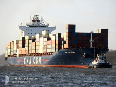
CMA CGM OSAKA
Container Ship
Current Trip
| Time Travelled | 1 day |
|---|---|
| Remaining Time | --- |
| Distance Travelled | 310.56 nm |
| Remaining Distance | --- |
| AVG Speed | 11.2 Knots |
| MAX Speed | 14.6 Knots |
| AVG Wind | 6.7 knots |
| MAX Wind | 10.8 knots |
| MIN Temp | 15.8°C / 60.44°F |
| MAX Temp | 24.4°C / 75.92°F |
| Draught | 10.6 m |
| Position Received | 3 m ago |
Current Position
| Longitude | 27.79346° |
|---|---|
| Latitude | 40.73122° |
| Status | Under way using engine |
| Speed | 14.3 Knots |
| Course | 81.2° |
| Area | Sea of Marmara |
| Station | T-AIS |
| Position Received | 3 m ago |
Information
The current position of CMA CGM OSAKA is in Sea of Marmara with coordinates 40.73122° / 27.79346° as reported on 2025-06-03 07:59 by AIS to our vessel tracker app. The vessel's current speed is 14.3 Knots and is heading at the port of CONSTANTA. The estimated time of arrival as calculated by MyShipTracking vessel tracking app is 2025-06-05 05:00 LT
The vessel CMA CGM OSAKA (IMO: 9400291, MMSI: 256229000) is a Container Ship that was built in 2008 ( 17 years old ). It's sailing under the flag of [MT] Malta.
In this page you can find informations about the vessels current position, last detected port calls, and current voyage information. If the vessels is not in coverage by AIS you will find the latest position.
The current position of CMA CGM OSAKA is detected by our AIS receivers and we are not responsible for the reliability of the data. The last position was recorded while the vessel was in Coverage by the Ais receivers of our vessel tracking app.
The current draught of CMA CGM OSAKA as reported by AIS is 10.6 meters
Weather
| Temperature | 20.2°C / 68.36°F |
|---|---|
| Wind Speed | 2 knots |
| Direction | 112° ESE |
| Pressure | 1019.9 hPa |
| Humidity | 63.7 % |
| Cloud Coverage | --- |
Featured Company
Last Port Calls
| Port | Arrival | Departure | Time In Port |
|---|---|---|---|
| 2025-06-01 00:43 | 2025-06-02 07:01 | 1 d | |
| 2025-05-28 10:43 | 2025-05-29 08:02 | 21 h | |
| 2025-05-25 00:40 | 2025-05-26 05:46 | 1 d | |
| 2025-05-22 14:02 | 2025-05-23 05:06 | 15 h | |
| 2025-05-16 12:09 | 2025-05-21 00:29 | 4 d | |
| 2025-05-11 15:41 | 2025-05-13 01:36 | 1 d | |
| 2025-05-05 19:13 | 2025-05-06 22:38 | 1 d | |
| 2025-04-29 03:37 | 2025-04-29 18:50 | 15 h | |
| 2025-04-27 08:09 | 2025-04-27 23:34 | 15 h | |
| 2025-04-25 06:33 | 2025-04-26 05:56 | 23 h |
Most Visited Ports (Last year)
| Port | Arrivals | |
|---|---|---|
| 16 | ||
| 9 | ||
| 7 | ||
| 7 | ||
| 7 | ||
| 6 |
Last Trips
| Origin | Departure | Destination | Arrival | Distance | |
|---|---|---|---|---|---|
| 2025-05-29 08:02 | 2025-06-01 00:43 | 553.58 nm | |||
| 2025-05-26 05:46 | 2025-05-28 10:43 | 763.10 nm | |||
| 2025-05-23 05:06 | 2025-05-25 00:40 | 423.85 nm | |||
| 2025-05-21 00:29 | 2025-05-22 14:02 | 272.93 nm | |||
| 2025-05-13 01:36 | 2025-05-16 12:09 | 627.03 nm | |||
| 2025-05-06 22:38 | 2025-05-11 15:41 | 761.79 nm | |||
| 2025-04-29 18:50 | 2025-05-05 19:13 | 778.67 nm | |||
| 2025-04-27 23:34 | 2025-04-29 03:37 | 309.06 nm | |||
| 2025-04-26 05:56 | 2025-04-27 08:09 | 54.80 nm | |||
| 2025-04-23 16:11 | 2025-04-25 06:33 | 113.40 nm |
Events
| Time | Event | Details | Position / Dest | Info |
|---|---|---|---|---|
| 2025-06-03 06:19 | Status Changed | Under way using engine Default |
40.61262 / 27.29968
ROCND
|
Speed: 14.2 kn Course: 69° |
| 2025-06-03 06:04 | Status Changed | Default Under way using engine |
40.59147 / 27.22802
ROCND
|
Speed: 14.4 kn Course: 66° |
| 2025-06-03 05:53 | Status Changed | Under way using engine Default |
40.57193 / 27.17012
ROCND
|
Speed: 14.4 kn Course: 66° |
| 2025-06-03 05:53 | IN Coverage |
40.57193 / 27.17012
Sea of Marmara
ROCND
|
Speed: 14.4 kn Course: 66° |
|
| 2025-06-03 03:23 | Status Changed | Default Under way using engine |
40.28010 / 26.55539
ROCND
|
Speed: 14.6 kn Course: 47.9° |
| 2025-06-03 03:19 | OUT of Coverage |
40.26873 / 26.53892
Sea of Marmara
ROCND
|
Speed: 14.6 kn Course: 47.9° |
|
| 2025-06-03 01:37 | Change Sea Area | Turkish part of the Sea of Marmara Turkish part of the Aegean Sea |
40.02012 / 26.20303
Sea of Marmara
ROCND
|
Speed: 10.1 kn Course: 74.6° |
| 2025-06-03 01:12 | Change Sea Area | Turkish part of the Aegean Sea Greek part of the Aegean Sea |
40.00731 / 26.13245
Aegean Sea
ROCND
|
Speed: 9.6 kn Course: 77.2° |
| 2025-06-03 01:12 | Status Changed | Under way using engine Default |
40.00731 / 26.13245
ROCND
|
Speed: 13.2 kn Course: 70° |
| 2025-06-03 01:05 | IN Coverage |
40.00731 / 26.13245
Aegean Sea
ROCND
|
Speed: 9.6 kn Course: 77.2° |