

CMA CGM RED
Cargo

Current Trip
| Trip Time | 5 days |
|---|---|
| Trip Distance | 1838.34 nm |
| AVG Speed | 15.4 Knots |
| MAX Speed | 20 Knots |
| Draught | 10 m |
| AVG Wind | 18.2 knots |
| MAX Wind | 26.8 knots |
| MIN Temp | 12.8°C / 55.04°F |
| MAX Temp | 31.4°C / 88.52°F |
| Position Received | 4 m ago |
Current Position
| Longitude | -75.13413° |
|---|---|
| Latitude | 39.90212° |
| Status | Moored |
| Speed | |
| Course | 21° |
| Area | North Atlantic Ocean |
| Station | T-AIS |
| Position Received | 4 m ago |
Information
The current position of CMA CGM RED is in North Atlantic Ocean with coordinates 39.90212° / -75.13413° as reported on 2025-06-02 04:50 by AIS to our vessel tracker app. The vessel's current speed is 0 Knots and is currently inside the port of PHILADELPHIA.
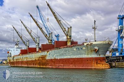
The vessel CMA CGM RED (IMO: 9690107, MMSI: 249200000) is a Cargo It's sailing under the flag of [MT] Malta.
In this page you can find informations about the vessels current position, last detected port calls, and current voyage information. If the vessels is not in coverage by AIS you will find the latest position.
The current position of CMA CGM RED is detected by our AIS receivers and we are not responsible for the reliability of the data. The last position was recorded while the vessel was in Coverage by the Ais receivers of our vessel tracking app.
The current draught of CMA CGM RED as reported by AIS is 10 meters
Weather
| Temperature | 13.8°C / 56.84°F |
|---|---|
| Wind Speed | 7 knots |
| Direction | 307° NW |
| Pressure | 1012.8 hPa |
| Humidity | 61 % |
| Cloud Coverage | 73 % |


Featured Company
Last Port Calls
| Port | Arrival | Departure | Time In Port |
|---|---|---|---|
| 2025-06-01 16:10 | |||
| 2025-05-27 04:19 | 2025-05-27 12:35 | 8 h | |
| 2025-05-05 06:56 | 2025-05-06 19:47 | 1 d | |
| 2025-05-02 12:09 | 2025-05-02 20:22 | 8 h | |
| 2025-04-27 04:56 | 2025-04-28 02:52 | 21 h | |
| 2025-04-24 09:19 | 2025-04-25 08:30 | 23 h | |
| 2025-04-21 08:26 | 2025-04-22 10:55 | 1 d | |
| 2025-04-18 06:39 | 2025-04-18 20:24 | 13 h |
Last Trips
| Origin | Departure | Destination | Arrival | Distance | |
|---|---|---|---|---|---|
| 2025-05-27 12:35 | 2025-06-01 16:10 | 1838.34 nm | |||
| 2025-05-06 19:47 | 2025-05-27 04:19 | 7069.56 nm | |||
| 2025-05-02 20:22 | 2025-05-05 06:56 | 185.89 nm | |||
| 2025-04-28 02:52 | 2025-05-02 12:09 | 1663.52 nm | |||
| 2025-04-25 08:30 | 2025-04-27 04:56 | 567.12 nm | |||
| 2025-04-22 10:55 | 2025-04-24 09:19 | 565.54 nm | |||
| 2025-04-18 20:24 | 2025-04-21 08:26 | 818.83 nm | |||
| 2025-03-24 00:27 | 2025-04-18 06:39 | 8702.54 nm |
Events
| Time | Event | Details | Position / Dest | Info |
|---|---|---|---|---|
| 2025-06-02 01:10 | ETA Changed | 2025/06/11 00:01 2025/06/10 00:01 |
39.90213 / -75.13413
[US] PHILADELPHIA
|
Speed: Course: 21° |
| 2025-06-02 00:43 | Destination Changed | US PHL > BE ZEE CO CTG > US PHL |
39.90212 / -75.13412
[US] PHILADELPHIA
|
Speed: Course: 20° |
| 2025-06-02 00:43 | ETA Changed | 2025/06/10 00:01 2025/06/01 13:00 |
39.90212 / -75.13412
[US] PHILADELPHIA
|
Speed: Course: 20° |
| 2025-06-01 20:34 | Status Changed | Moored Under way using engine |
39.90212 / -75.13413
[US] PHILADELPHIA
|
Speed: 0.1 kn Course: 20° |
| 2025-06-01 20:25 | STOP Moving |
39.90193 / -75.13378
[US] PHILADELPHIA
|
Speed: 0.3 kn Course: 19° |
|
| 2025-06-01 20:10 | PORT ARRIVAL |
|
39.89435 / -75.13590
[US] PHILADELPHIA
|
Speed: 6 kn Course: 18.2° |
| 2025-06-01 11:38 | ETA Changed | 2025/06/01 13:00 2025/06/01 13:30 |
38.57452 / -74.77528
CO CTG > US PHL
|
Speed: 9.4 kn Course: 321.6° |
| 2025-06-01 07:47 | IN Coverage |
37.86615 / -74.27921
North Atlantic Ocean
CO CTG > US PHL
|
Speed: 14.1 kn Course: 334° |
|
| 2025-06-01 01:03 | OUT of Coverage |
36.48217 / -74.10162
North Atlantic Ocean
CO CTG > US PHL
|
Speed: 6.7 kn Course: 353.1° |
|
| 2025-05-31 16:49 | IN Coverage |
34.13752 / -74.10568
North Atlantic Ocean
CO CTG > US PHL
|
Speed: 16.7 kn Course: 0° |