
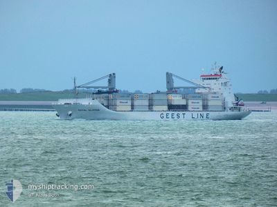
COOL ROYAL
Reefer
Current Trip
| Time Travelled | 10 days |
|---|---|
| Remaining Time | 14 h, 27 mins |
| Distance Travelled | 4558.56 nm |
| Remaining Distance | 384.95 nm |
| AVG Speed | 17.8 Knots |
| MAX Speed | 20.7 Knots |
| AVG Wind | 8.5 knots |
| MAX Wind | 21 knots |
| MIN Temp | 14.5°C / 58.1°F |
| MAX Temp | 27.7°C / 81.86°F |
| Draught | 7.5 m |
| Position Received | 8 d ago |
Current Position
| Longitude | -109.69248° |
|---|---|
| Latitude | 18.68193° |
| Status | Under way using engine |
| Speed | 19 Knots |
| Course | 146° |
| Area | North Pacific Ocean |
| Station | T-AIS |
| Position Received | 8 d ago |
Info
Information
The current position of COOL ROYAL is in North Pacific Ocean with coordinates 18.68193° / -109.69248° as reported on 2025-02-25 20:32 by AIS to our vessel tracker app. The vessel's current speed is 19 Knots and is heading at the port of VALPARAISO. The estimated time of arrival as calculated by MyShipTracking vessel tracking app is 2025-03-06 23:44 LT
The vessel COOL ROYAL (IMO: 9172959, MMSI: 311001084) is a Reefer that was built in 2000 ( 25 years old ). It's sailing under the flag of [BS] Bahamas.
In this page you can find informations about the vessels current position, last detected port calls, and current voyage information. If the vessels is not in coverage by AIS you will find the latest position.
The current position of COOL ROYAL is detected by our AIS receivers and we are not responsible for the reliability of the data. The last position was recorded while the vessel was in Coverage by the Ais receivers of our vessel tracking app.
The current draught of COOL ROYAL as reported by AIS is 7.5 meters
Weather
| Temperature | 18.9°C / 66.02°F |
|---|---|
| Wind Speed | 1 knots |
| Direction | 316° NW |
| Pressure | 1012.7 hPa |
| Humidity | 82.8 % |
| Cloud Coverage | 26 % |
Featured Company
Last Port Calls
| Port | Arrival | Departure | Time In Port |
|---|---|---|---|
| 2025-02-18 13:12 | 2025-02-23 13:54 | 5 d | |
| 2025-02-04 11:41 | 2025-02-05 10:53 | 23 h | |
| 2025-01-31 23:13 | 2025-02-03 22:56 | 2 d | |
| 2025-01-14 18:47 | 2025-01-19 10:00 | 4 d |
Most Visited Ports (Last year)
| Port | Arrivals | |
|---|---|---|
| 3 | ||
| 3 | ||
| 2 | ||
| 2 | ||
| 2 | ||
| 1 |
Last Trips
| Origin | Departure | Destination | Arrival | Distance | |
|---|---|---|---|---|---|
| 2025-02-05 07:53 | 2025-02-18 05:12 | 4684.15 nm | |||
| 2025-02-03 19:56 | 2025-02-04 08:41 | 204.09 nm | |||
| 2025-01-19 05:00 | 2025-01-31 20:13 | 4628.33 nm | |||
| 2024-12-29 07:23 | 2025-01-14 13:47 | 3887.12 nm |
Events
| Time | Event | Details | Position / Dest | Info |
|---|---|---|---|---|
| 2025-03-06 00:56 | START Moving |
-27.87980 / -76.36562
CLVAP
|
Speed: 8.1 kn Course: 123° |
|
| 2025-03-05 20:17 | STOP Moving |
-27.85297 / -76.39205
CLVAP
|
Speed: 0.2 kn Course: 145° |
|
| 2025-02-25 20:39 | Status Changed | Default Under way using engine |
18.64987 / -109.67052
CLVAP
|
Speed: 19 kn Course: 146° |
| 2025-02-25 20:32 | OUT of Coverage |
18.68193 / -109.69248
North Pacific Ocean
CLVAP
|
Speed: 19 kn Course: 146° |
|
| 2025-02-25 20:15 | Status Changed | Under way using engine Default |
18.75452 / -109.74350
CLVAP
|
Speed: 19.2 kn Course: 142° |
| 2025-02-25 20:02 | IN Coverage |
18.75273 / -109.74227
North Pacific Ocean
CLVAP
|
Speed: 19 kn Course: 145° |
|
| 2025-02-24 21:49 | Status Changed | Default Under way using engine |
24.78668 / -114.07388
CLVAP
|
Speed: 19.6 kn Course: 147° |
| 2025-02-24 21:46 | Status Changed | Under way using engine Default |
24.79933 / -114.08310
CLVAP
|
Speed: 20 kn Course: 145° |
| 2025-02-24 21:46 | OUT of Coverage |
24.79933 / -114.08310
North Pacific Ocean
CLVAP
|
Speed: 19.6 kn Course: 147° |
|
| 2025-02-24 21:29 | IN Coverage |
24.79933 / -114.08310
North Pacific Ocean
CLVAP
|
Speed: 19.6 kn Course: 147° |