
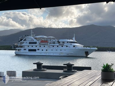
CORAL DISCOVERER
Passengers Ship
Current Trip
| Time Travelled | 6 days |
|---|---|
| Remaining Time | 6 h, 46 mins |
| Distance Travelled | 434.30 nm |
| Remaining Distance | 71.16 nm |
| AVG Speed | 9.6 Knots |
| MAX Speed | 14.7 Knots |
| AVG Wind | 11.2 knots |
| MAX Wind | 29.6 knots |
| MIN Temp | 9.5°C / 49.1°F |
| MAX Temp | 23.8°C / 74.84°F |
| Draught | 3.3 m |
| Position Received | 2 h, 57 m ago |
Current Position
| Longitude | 148.01180° |
|---|---|
| Latitude | -42.86973° |
| Status | Under way using engine |
| Speed | 9.8 Knots |
| Course | 172.7° |
| Area | Tasman Sea |
| Station | T-AIS |
| Position Received | 2 h, 57 m ago |
Info
Information
The current position of CORAL DISCOVERER is in Tasman Sea with coordinates -42.86973° / 148.01180° as reported on 2025-02-23 16:33 by AIS to our vessel tracker app. The vessel's current speed is 9.8 Knots and is heading at the port of COLES BAY. The estimated time of arrival as calculated by MyShipTracking vessel tracking app is 2025-02-24 02:17 LT
The vessel CORAL DISCOVERER (IMO: 9292747, MMSI: 503492000) is a Passengers Ship that was built in 2005 ( 20 years old ). It's sailing under the flag of [AU] Australia.
In this page you can find informations about the vessels current position, last detected port calls, and current voyage information. If the vessels is not in coverage by AIS you will find the latest position.
The current position of CORAL DISCOVERER is detected by our AIS receivers and we are not responsible for the reliability of the data. The last position was recorded while the vessel was in Coverage by the Ais receivers of our vessel tracking app.
The current draught of CORAL DISCOVERER as reported by AIS is 3.3 meters
Weather
| Temperature | 15.3°C / 59.54°F |
|---|---|
| Wind Speed | 17 knots |
| Direction | 284° WNW |
| Pressure | 1011.2 hPa |
| Humidity | 63.5 % |
| Cloud Coverage | 71 % |
Featured Company
Last Port Calls
| Port | Arrival | Departure | Time In Port |
|---|---|---|---|
| 2025-02-16 20:07 | 2025-02-17 05:58 | 9 h | |
| 2025-02-15 05:27 | 2025-02-16 05:40 | 1 d | |
| 2025-02-06 20:31 | 2025-02-07 05:58 | 9 h | |
| 2025-02-05 06:20 | 2025-02-06 06:16 | 23 h | |
| 2025-01-27 19:45 | 2025-01-28 06:18 | 10 h | |
| 2025-01-26 07:58 | 2025-01-27 03:26 | 19 h | |
| 2025-01-17 19:54 | 2025-01-18 07:31 | 11 h | |
| 2025-01-16 22:04 | 2025-01-17 05:28 | 7 h | |
| 2025-01-16 20:52 | 2025-01-16 21:07 | 15 m | |
| 2025-01-02 06:26 | 2025-01-02 06:53 | 27 m |
Last Trips
| Origin | Departure | Destination | Arrival | Distance | |
|---|---|---|---|---|---|
| 2025-02-16 16:40 | 2025-02-17 07:07 | 47.47 nm | |||
| 2025-02-07 16:58 | 2025-02-15 16:27 | 584.24 nm | |||
| 2025-02-06 17:16 | 2025-02-07 07:31 | 54.76 nm | |||
| 2025-01-28 17:18 | 2025-02-05 17:20 | 634.97 nm | |||
| 2025-01-27 14:26 | 2025-01-28 06:45 | 47.57 nm | |||
| 2025-01-18 18:31 | 2025-01-26 18:58 | 454.94 nm | |||
| 2025-01-17 16:28 | 2025-01-18 06:54 | 46.13 nm | |||
| 2025-01-17 08:07 | 2025-01-17 09:04 | 7.49 nm | |||
| 2025-01-02 17:53 | 2025-01-17 07:52 | 1194.42 nm | |||
| 2025-01-02 17:20 | 2025-01-02 17:26 | 0.31 nm |
Events
| Time | Event | Details | Position / Dest | Info |
|---|---|---|---|---|
| 2025-02-23 16:41 | Status Changed | Default Under way using engine |
-42.88808 / 148.01393
COLES BAY
|
Speed: 9.8 kn Course: 172.7° |
| 2025-02-23 16:33 | IN Coverage |
-42.86973 / 148.01180
Tasman Sea
|
Speed: 9.8 kn Course: 172.7° |
|
| 2025-02-23 16:33 | OUT of Coverage |
-42.86973 / 148.01180
Tasman Sea
|
Speed: 9.8 kn Course: 172.7° |
|
| 2025-02-23 16:32 | Status Changed | Under way using engine Default |
-42.86652 / 148.01136
COLES BAY
|
Speed: 10 kn Course: 173° |
| 2025-02-23 14:44 | START Moving | 4.15 nm, North of MARIA ISLAND |
-42.60457 / 148.02834
COLES BAY
|
Speed: 6.3 kn Course: 232° |
| 2025-02-23 08:06 | Status Changed | Default At anchor |
-42.60262 / 148.03645
COLES BAY
|
Speed: 0.7 kn Course: 278° |
| 2025-02-23 08:00 | Status Changed | At anchor Default |
-42.60166 / 148.03633
COLES BAY
|
Speed: 0.1 kn Course: 301° |
| 2025-02-23 08:00 | IN Coverage |
-42.60166 / 148.03633
Tasman Sea
|
Speed: 0.7 kn Course: 336.6° |
|
| 2025-02-23 08:00 | OUT of Coverage |
-42.60166 / 148.03633
Tasman Sea
|
Speed: 0.7 kn Course: 336.6° |
|
| 2025-02-23 05:28 | STOP Moving | 4.13 nm, North of MARIA ISLAND |
-42.60332 / 148.03571
COLES BAY
|
Speed: 0.3 kn Course: 341° |