
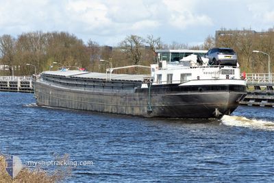
CORNELIS B
Not available
Current Trip
HELMOND
| Time Travelled | 1 day |
|---|---|
| Remaining Time | --- |
| Distance Travelled | 17.63 nm |
| Remaining Distance | --- |
| AVG Speed | 8.8 Knots |
| MAX Speed | 9.4 Knots |
| AVG Wind | 6.5 knots |
| MAX Wind | 10 knots |
| MIN Temp | 0.6°C / 33.08°F |
| MAX Temp | 1.6°C / 34.88°F |
| Draught | 0 m |
| Position Received | 1 m ago |
Current Position
| Longitude | 4.99474° |
|---|---|
| Latitude | 52.17844° |
| Status | Default |
| Speed | |
| Course | --- |
| Area | North Sea |
| Station | T-AIS |
| Position Received | 1 m ago |
Info
Information
The current position of CORNELIS B is in North Sea with coordinates 52.17844° / 4.99474° as reported on 2026-01-09 18:12 by AIS to our vessel tracker app. The vessel's current speed is 0 Knots
The vessel CORNELIS B (MMSI: 244660722) is a Not available It's sailing under the flag of [NL] Netherlands.
In this page you can find informations about the vessels current position, last detected port calls, and current voyage information. If the vessels is not in coverage by AIS you will find the latest position.
The current position of CORNELIS B is detected by our AIS receivers and we are not responsible for the reliability of the data. The last position was recorded while the vessel was in Coverage by the Ais receivers of our vessel tracking app.
Weather
| Temperature | --- |
|---|---|
| Wind Speed | 12 knots |
| Direction | 35° NE |
| Pressure | 988 hPa |
| Humidity | 95.8 % |
| Cloud Coverage | 100 % |
Featured Company
Last Port Calls
| Port | Arrival | Departure | Time In Port |
|---|---|---|---|
| 2026-01-08 16:48 | 2026-01-08 17:31 | 42 m | |
| 2026-01-08 12:41 | 2026-01-08 13:16 | 34 m | |
| 2026-01-08 10:43 | 2026-01-08 11:07 | 23 m | |
| 2026-01-07 07:14 | 2026-01-07 07:34 | 19 m | |
| 2026-01-06 13:28 | 2026-01-06 17:28 | 3 h | |
| 2026-01-05 13:08 | 2026-01-06 13:02 | 23 h | |
| 2025-12-15 17:33 | 2026-01-05 10:50 | 20 d | |
| 2025-12-15 13:45 | 2025-12-15 14:16 | 31 m | |
| 2025-12-15 11:43 | 2025-12-15 12:08 | 25 m | |
| 2025-12-10 19:20 | 2025-12-11 12:09 | 16 h |
Most Visited Ports (Last year)
| Port | Arrivals | |
|---|---|---|
| 79 | ||
| 27 | ||
| 27 | ||
| 20 | ||
| 16 | ||
| 13 |
Last Trips
| Origin | Departure | Destination | Arrival | Distance | |
|---|---|---|---|---|---|
| 2026-01-08 13:16 | 2026-01-08 16:48 | 23.71 nm | |||
| 2026-01-08 11:07 | 2026-01-08 12:41 | 7.00 nm | |||
| 2026-01-07 07:34 | 2026-01-08 10:43 | 31.70 nm | |||
| 2026-01-06 17:28 | 2026-01-07 07:14 | 51.98 nm | |||
| 2026-01-06 13:02 | 2026-01-06 13:28 | 2.93 nm | |||
| 2026-01-05 10:50 | 2026-01-05 13:08 | 15.63 nm | |||
| 2025-12-15 14:16 | 2025-12-15 17:33 | 26.30 nm | |||
| 2025-12-15 12:08 | 2025-12-15 13:45 | 7.05 nm | |||
| 2025-12-11 12:09 | 2025-12-15 11:43 | 25.57 nm | |||
| 2025-12-10 17:34 | 2025-12-10 19:20 | 9.23 nm |
Events
| Time | Event | Details | Position / Dest | Info |
|---|---|---|---|---|
| 2026-01-08 18:28 | STOP Moving | 1.26 nm, South of NIEUWERSLUIS |
52.17667 / 4.99463
HELMOND
|
Speed: 0.2 kn Course: 511° |
| 2026-01-08 16:31 | PORT DEPARTURE |
|
51.97602 / 5.28972
HELMOND
|
Speed: 8.9 kn Course: 295.2° |
| 2026-01-08 16:24 | START Moving |
51.96874 / 5.31624
[NL] WIJK BIJ DUURSTEDE
|
Speed: 8.1 kn Course: 292.6° |
|
| 2026-01-08 15:48 | STOP Moving |
51.96785 / 5.31933
[NL] WIJK BIJ DUURSTEDE
|
Speed: 0.3 kn Course: 511° |
|
| 2026-01-08 15:48 | PORT ARRIVAL |
|
51.96784 / 5.31936
[NL] WIJK BIJ DUURSTEDE
|
Speed: 0.6 kn Course: 511° |
| 2026-01-08 13:25 | START Moving | 0.6 nm, North East of ROSSUM |
51.79918 / 5.35589
HELMOND
|
Speed: 4.4 kn Course: 316.9° |
| 2026-01-08 13:11 | STOP Moving | 0.64 nm, East of ROSSUM |
51.79771 / 5.35804
HELMOND
|
Speed: Course: 511° |
| 2026-01-08 12:37 | START Moving | 1.87 nm, South West of KERKDRIEL |
51.74113 / 5.33253
HELMOND
|
Speed: 5.9 kn Course: 337° |
| 2026-01-08 12:23 | STOP Moving | 1.95 nm, South of KERKDRIEL |
51.73924 / 5.33377
HELMOND
|
Speed: 0.3 kn Course: 511° |
| 2026-01-08 12:16 | PORT DEPARTURE |
|
51.72953 / 5.33931
HELMOND
|
Speed: 7.8 kn Course: 353.1° |