
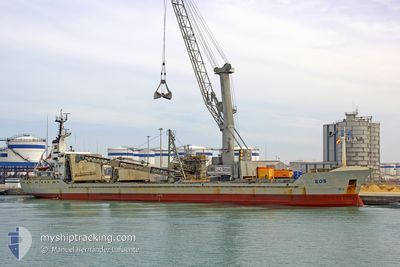
MATILDA
General Cargo
Current Trip
| Trip Time | 20 days |
|---|---|
| Trip Distance | 1430.55 nm |
| AVG Speed | 12 Knots |
| MAX Speed | 14.3 Knots |
| Draught | 7 m |
| AVG Wind | 8.1 knots |
| MAX Wind | 17 knots |
| MIN Temp | 14.4°C / 57.92°F |
| MAX Temp | 19.9°C / 67.82°F |
| Position Received | 22 d ago |
Current Position
| Longitude | -71.72980° |
|---|---|
| Latitude | -32.73726° |
| Status | Under way using engine |
| Speed | 12.9 Knots |
| Course | 348.2° |
| Area | South Pacific Ocean |
| Station | T-AIS |
| Position Received | 22 d ago |
Info
Information
The current position of MATILDA is in South Pacific Ocean with coordinates -32.73726° / -71.72980° as reported on 2025-11-22 20:05 by AIS to our vessel tracker app. The vessel's current speed is 12.9 Knots and is currently inside the port of MEJILLONES.
The vessel MATILDA (IMO: 9402043, MMSI: 255804970) is a General Cargo that was built in 2007 ( 18 years old ). It's sailing under the flag of [PT] Portugal.
In this page you can find informations about the vessels current position, last detected port calls, and current voyage information. If the vessels is not in coverage by AIS you will find the latest position.
The current position of MATILDA is detected by our AIS receivers and we are not responsible for the reliability of the data. The last position was recorded while the vessel was in Coverage by the Ais receivers of our vessel tracking app.
The current draught of MATILDA as reported by AIS is 7 meters
Weather
| Temperature | 18.4°C / 65.12°F |
|---|---|
| Wind Speed | 11 knots |
| Direction | 188° S |
| Pressure | 1015.1 hPa |
| Humidity | 77.8 % |
| Cloud Coverage | --- |
Featured Company
Last Port Calls
| Port | Arrival | Departure | Time In Port |
|---|---|---|---|
| 2025-12-13 10:30 | |||
| 2025-11-20 20:20 | 2025-11-22 15:35 | 1 d | |
| 2025-11-16 19:55 | 2025-11-17 17:05 | 21 h | |
| 2025-11-13 13:41 | 2025-11-13 22:17 | 8 h | |
| 2025-11-11 03:35 | 2025-11-11 14:53 | 11 h | |
| 2025-11-07 22:53 | 2025-11-09 04:39 | 1 d | |
| 2025-10-19 17:53 | 2025-10-27 08:38 | 7 d | |
| 2025-10-13 18:22 | 2025-10-14 21:02 | 1 d | |
| 2025-10-09 20:12 | 2025-10-12 01:08 | 2 d | |
| 2025-10-06 11:24 | 2025-10-07 15:50 | 1 d |
Last Trips
| Origin | Departure | Destination | Arrival | Distance | |
|---|---|---|---|---|---|
| 2025-11-22 15:35 | 2025-12-13 10:30 | 1430.55 nm | |||
| 2025-11-17 17:05 | 2025-11-20 20:20 | 967.43 nm | |||
| 2025-11-13 22:17 | 2025-11-16 19:55 | 468.33 nm | |||
| 2025-11-11 14:53 | 2025-11-13 13:41 | 522.97 nm | |||
| 2025-11-09 04:39 | 2025-11-11 03:35 | 276.55 nm | |||
| 2025-10-27 08:38 | 2025-11-07 22:53 | 2743.67 nm | |||
| 2025-10-14 21:02 | 2025-10-19 17:53 | 597.22 nm | |||
| 2025-10-12 01:08 | 2025-10-13 18:22 | 574.94 nm | |||
| 2025-10-07 15:50 | 2025-10-09 20:12 | 583.38 nm | |||
| 2025-09-20 21:12 | 2025-10-06 11:24 | 4975.25 nm |
Events
| Time | Event | Details | Position / Dest | Info |
|---|---|---|---|---|
| 2025-12-13 13:37 | STOP Moving |
-23.06161 / -70.41245
[CL] MEJILLONES
|
Speed: 0.2 kn Course: 163° |
|
| 2025-12-13 13:30 | PORT ARRIVAL |
|
-23.06126 / -70.41249
[CL] MEJILLONES
|
Speed: 2.4 kn Course: 163° |
| 2025-12-13 09:24 | START Moving |
-22.27333 / -70.60500
CL PAG
|
Speed: 4 kn Course: -1° |
|
| 2025-12-13 01:42 | STOP Moving |
-22.35833 / -70.61500
CL PAG
|
Speed: Course: -1° |
|
| 2025-12-12 23:55 | START Moving | 15 nm, South of TOCOPILLA |
-22.32818 / -70.30104
CL PAG
|
Speed: 3.7 kn Course: 267° |
| 2025-12-10 19:24 | STOP Moving | 11.43 nm, North West of MEJILLONES |
-22.94500 / -70.56834
CL PAG
|
Speed: Course: -1° |
| 2025-12-10 13:00 | START Moving |
-21.74167 / -70.40833
CL PAG
|
Speed: 4 kn Course: -1° |
|
| 2025-12-07 17:21 | STOP Moving | 14.79 nm, North West of MEJILLONES |
-22.92833 / -70.63167
CL PAG
|
Speed: Course: -1° |
| 2025-12-07 11:36 | START Moving | 11.51 nm, North West of TOCOPILLA |
-21.92500 / -70.31667
CL PAG
|
Speed: 6 kn Course: 192° |