

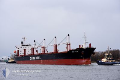
CS JOLA
Cargo

Current Trip
| Trip Time | 25 days |
|---|---|
| Trip Distance | 6431.68 nm |
| AVG Speed | 10.9 Knots |
| MAX Speed | 13.8 Knots |
| Draught | 10.3 m |
| AVG Wind | 10.3 knots |
| MAX Wind | 28.9 knots |
| MIN Temp | 16.8°C / 62.24°F |
| MAX Temp | 40°C / 104°F |
| Position Received | 7 d ago |
Current Position
| Longitude | 16.86686° |
|---|---|
| Latitude | -33.67325° |
| Status | Under way using engine |
| Speed | 11.7 Knots |
| Course | 318.4° |
| Area | South Atlantic Ocean |
| Station | T-AIS |
| Position Received | 7 d ago |
Information
The current position of CS JOLA is in South Atlantic Ocean with coordinates -33.67325° / 16.86686° as reported on 2025-05-17 16:48 by AIS to our vessel tracker app. The vessel's current speed is 11.7 Knots and is currently inside the port of LUANDA.
The vessel CS JOLA (IMO: 9791896, MMSI: 538007348) is a Cargo It's sailing under the flag of [MH] Marshall Is.
In this page you can find informations about the vessels current position, last detected port calls, and current voyage information. If the vessels is not in coverage by AIS you will find the latest position.
The current position of CS JOLA is detected by our AIS receivers and we are not responsible for the reliability of the data. The last position was recorded while the vessel was in Coverage by the Ais receivers of our vessel tracking app.
The current draught of CS JOLA as reported by AIS is 10.3 meters
Weather
| Temperature | 25.1°C / 77.18°F |
|---|---|
| Wind Speed | 1 knots |
| Direction | 168° SSE |
| Pressure | 1012.8 hPa |
| Humidity | 92.3 % |
| Cloud Coverage | 1 % |


Featured Company
Events
| Time | Event | Details | Position / Dest | Info |
|---|---|---|---|---|
| 2025-05-24 12:51 | PORT ARRIVAL |
|
-8.79595 / 13.24677
[AO] LUANDA
|
Speed: Course: 255° |
| 2025-05-17 16:53 | Status Changed | Default Under way using engine |
-33.66195 / 16.85502
AO LAD
|
Speed: 11.7 kn Course: 318.4° |
| 2025-05-17 16:48 | OUT of Coverage |
-33.67325 / 16.86686
South Atlantic Ocean
AO LAD
|
Speed: 11.7 kn Course: 318.4° |
|
| 2025-05-17 16:34 | Status Changed | Under way using engine Default |
-33.70898 / 16.90347
AO LAD
|
Speed: 11.8 kn Course: 321° |
| 2025-05-17 16:15 | Status Changed | Default Under way using engine |
-33.75824 / 16.94811
AO LAD
|
Speed: 11.8 kn Course: 326.5° |
| 2025-05-17 16:10 | Status Changed | Under way using engine Default |
-33.77118 / 16.95923
AO LAD
|
Speed: 11.8 kn Course: 323° |
| 2025-05-17 16:05 | Status Changed | Default Under way using engine |
-33.78418 / 16.97036
AO LAD
|
Speed: 11.9 kn Course: 321.7° |
| 2025-05-17 16:03 | Status Changed | Under way using engine Default |
-33.79095 / 16.97597
AO LAD
|
Speed: 11.8 kn Course: 321° |
| 2025-05-17 15:25 | Status Changed | Default Under way using engine |
-33.88195 / 17.08151
AO LAD
|
Speed: 12.2 kn Course: 314.5° |
| 2025-05-17 15:20 | Status Changed | Under way using engine Default |
-33.89366 / 17.09537
AO LAD
|
Speed: 12.2 kn Course: 317° |