
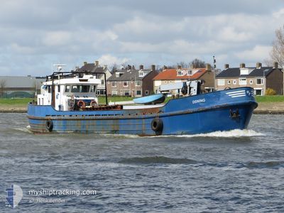
DEINING
Dredging or underwater ops
Current Trip
| Trip Time | --- |
|---|---|
| Trip Distance | --- |
| AVG Speed | --- |
| MAX Speed | --- |
| Draught | --- |
| AVG Wind | --- |
| MAX Wind | --- |
| MIN Temp | --- |
| MAX Temp | --- |
| Position Received | 3 d ago |
Current Position
| Longitude | 4.76661° |
|---|---|
| Latitude | 51.82023° |
| Status | Under way using engine |
| Speed | |
| Course | --- |
| Area | North Sea |
| Station | T-AIS |
| Position Received | 3 d ago |
Info
Information
The current position of DEINING is in North Sea with coordinates 51.82023° / 4.76661° as reported on 2025-03-06 16:00 by AIS to our vessel tracker app. The vessel's current speed is 0 Knots and is currently inside the port of SLIEDRECHT.
The vessel DEINING (MMSI: 244740862) is a Dredging or underwater ops It's sailing under the flag of [NL] Netherlands.
In this page you can find informations about the vessels current position, last detected port calls, and current voyage information. If the vessels is not in coverage by AIS you will find the latest position.
The current position of DEINING is detected by our AIS receivers and we are not responsible for the reliability of the data. The last position was recorded while the vessel was in Coverage by the Ais receivers of our vessel tracking app.
Weather
| Temperature | 14.3°C / 57.74°F |
|---|---|
| Wind Speed | 9 knots |
| Direction | 205° SSW |
| Pressure | 1016.2 hPa |
| Humidity | 56.9 % |
| Cloud Coverage | 89 % |
Featured Company
Last Port Calls
| Port | Arrival | Departure | Time In Port |
|---|---|---|---|
| 2025-03-01 09:14 | |||
| 2025-02-07 21:01 | |||
| 2025-02-07 00:04 | |||
| 2025-01-29 14:35 | 2025-02-03 06:03 | 4 d | |
| 2025-01-18 10:33 | 2025-01-27 11:00 | 9 d | |
| 2025-01-06 06:31 |
Last Trips
| Origin | Departure | Destination | Arrival | Distance | |
|---|---|---|---|---|---|
| 2025-01-27 12:00 | 2025-01-29 15:35 | 5.65 nm | |||
| 2025-01-06 07:31 | 2025-01-18 11:33 | 5.83 nm |
Events
| Time | Event | Details | Position / Dest | Info |
|---|---|---|---|---|
| 2025-03-06 16:00 | OUT of Coverage |
51.82023 / 4.76661
North Sea
[NL] SLIEDRECHT
|
Speed: Course: 511° |
|
| 2025-03-06 13:00 | IN Coverage |
51.82065 / 4.76713
North Sea
[NL] SLIEDRECHT
|
Speed: Course: 511° |
|
| 2025-03-06 07:51 | OUT of Coverage |
51.82064 / 4.76718
North Sea
[NL] SLIEDRECHT
|
Speed: Course: 511° |
|
| 2025-03-06 05:42 | IN Coverage |
51.82022 / 4.76661
North Sea
[NL] SLIEDRECHT
|
Speed: Course: 511° |
|
| 2025-03-05 16:17 | OUT of Coverage |
51.82022 / 4.76663
North Sea
[NL] SLIEDRECHT
|
Speed: Course: 511° |
|
| 2025-03-05 14:38 | IN Coverage |
51.82024 / 4.76664
North Sea
[NL] SLIEDRECHT
|
Speed: Course: 511° |
|
| 2025-03-04 07:53 | OUT of Coverage |
51.82024 / 4.76661
North Sea
[NL] SLIEDRECHT
|
Speed: Course: 511° |
|
| 2025-03-04 07:04 | IN Coverage |
51.82024 / 4.76660
North Sea
[NL] SLIEDRECHT
|
Speed: Course: 511° |
|
| 2025-03-03 16:18 | OUT of Coverage |
51.82023 / 4.76663
North Sea
[NL] SLIEDRECHT
|
Speed: Course: 511° |
|
| 2025-03-03 06:11 | IN Coverage |
51.82012 / 4.76668
North Sea
[NL] SLIEDRECHT
|
Speed: Course: 511° |