

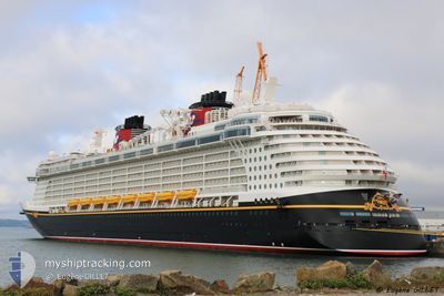
DISNEY FANTASY
Passengers Ship

Current Trip
| Time Travelled | 11 h, 12 mins |
|---|---|
| Remaining Time | 4 h, 49 mins |
| Distance Travelled | 207.55 nm |
| Remaining Distance | 99.64 nm |
| AVG Speed | 18.8 Knots |
| MAX Speed | 20.4 Knots |
| AVG Wind | 13.9 knots |
| MAX Wind | 18.8 knots |
| MIN Temp | 23°C / 73.4°F |
| MAX Temp | 24.3°C / 75.74°F |
| Draught | 8.6 m |
| Position Received | 1 h, 22 m ago |
Current Position
| Longitude | 14.07088° |
|---|---|
| Latitude | 39.75620° |
| Status | Under way using engine |
| Speed | 20 Knots |
| Course | 129° |
| Area | Tyrrhenian Sea |
| Station | T-AIS |
| Position Received | 1 h, 22 m ago |
Information
The current position of DISNEY FANTASY is in Tyrrhenian Sea with coordinates 39.75620° / 14.07088° as reported on 2025-06-08 01:15 by AIS to our vessel tracker app. The vessel's current speed is 20 Knots and is heading at the port of MESSINA. The estimated time of arrival as calculated by MyShipTracking vessel tracking app is 2025-06-08 09:27 LT
The vessel DISNEY FANTASY (IMO: 9445590, MMSI: 311058700) is a Passengers Ship that was built in 2012 ( 13 years old ). It's sailing under the flag of [BS] Bahamas.
In this page you can find informations about the vessels current position, last detected port calls, and current voyage information. If the vessels is not in coverage by AIS you will find the latest position.
The current position of DISNEY FANTASY is detected by our AIS receivers and we are not responsible for the reliability of the data. The last position was recorded while the vessel was in Coverage by the Ais receivers of our vessel tracking app.
The current draught of DISNEY FANTASY as reported by AIS is 8.6 meters
Weather
| Temperature | 24.3°C / 75.74°F |
|---|---|
| Wind Speed | 6 knots |
| Direction | 165° SSE |
| Pressure | 1016.3 hPa |
| Humidity | 66.8 % |
| Cloud Coverage | --- |


Featured Company
Last Port Calls
| Port | Arrival | Departure | Time In Port |
|---|---|---|---|
| 2025-06-07 05:55 | 2025-06-07 17:26 | 11 h | |
| 2025-06-06 05:36 | 2025-06-06 19:48 | 14 h | |
| 2025-06-04 05:55 | 2025-06-04 19:49 | 13 h | |
| 2025-06-03 05:53 | 2025-06-03 20:39 | 14 h | |
| 2025-06-01 08:37 | 2025-06-01 20:18 | 11 h | |
| 2025-05-31 04:39 | 2025-05-31 17:47 | 13 h | |
| 2025-05-29 06:57 | 2025-05-29 20:42 | 13 h | |
| 2025-05-28 05:16 | 2025-05-28 19:58 | 14 h | |
| 2025-05-27 05:54 | 2025-05-27 19:27 | 13 h | |
| 2025-05-26 06:14 | 2025-05-26 19:40 | 13 h |
Most Visited Ports (Last year)
| Port | Arrivals | |
|---|---|---|
| 62 | ||
| 28 | ||
| 11 | ||
| 11 | ||
| 10 | ||
| 10 |
Last Trips
| Origin | Departure | Destination | Arrival | Distance | |
|---|---|---|---|---|---|
| 2025-06-06 19:48 | 2025-06-07 05:55 | 170.96 nm | |||
| 2025-06-04 19:49 | 2025-06-06 05:36 | 314.51 nm | |||
| 2025-06-03 20:39 | 2025-06-04 05:55 | 87.21 nm | |||
| 2025-06-01 20:18 | 2025-06-03 05:53 | 266.23 nm | |||
| 2025-05-31 17:47 | 2025-06-01 08:37 | 192.81 nm | |||
| 2025-05-29 20:42 | 2025-05-31 04:39 | 393.46 nm | |||
| 2025-05-28 19:58 | 2025-05-29 06:57 | 140.13 nm | |||
| 2025-05-27 19:27 | 2025-05-28 05:16 | 171.79 nm | |||
| 2025-05-26 19:40 | 2025-05-27 05:54 | 169.83 nm | |||
| 2025-05-24 17:40 | 2025-05-26 06:14 | 580.18 nm |
Events
| Time | Event | Details | Position / Dest | Info |
|---|---|---|---|---|
| 2025-06-08 01:22 | Status Changed | Default Under way using engine |
39.72962 / 14.11243
IT CVV>IT MSN
|
Speed: 20 kn Course: 129° |
| 2025-06-08 01:15 | OUT of Coverage |
39.75620 / 14.07088
Tyrrhenian Sea
IT CVV>IT MSN
|
Speed: 20 kn Course: 129° |
|
| 2025-06-08 00:39 | Status Changed | Under way using engine Default |
39.88206 / 13.87227
IT CVV>IT MSN
|
Speed: 20.1 kn Course: 129° |
| 2025-06-08 00:39 | Status Changed | Default Under way using engine |
39.88418 / 13.86890
IT CVV>IT MSN
|
Speed: 20 kn Course: 129° |
| 2025-06-07 17:34 | Destination Changed | IT CVV>IT MSN IT NAP>IT CVV |
41.62663 / 11.94940
IT CVV>IT MSN
|
Speed: 20 kn Course: 150.6° |
| 2025-06-07 17:34 | ETA Changed | 2025/06/08 07:45 2025/06/07 03:30 |
41.62663 / 11.94940
IT CVV>IT MSN
|
Speed: 20 kn Course: 150.6° |
| 2025-06-07 17:12 | Status Changed | Under way using engine Default |
41.72988 / 11.88027
IT NAP>IT CVV
|
Speed: 19.5 kn Course: 155° |
| 2025-06-07 16:40 | Status Changed | Default Under way using engine |
41.88727 / 11.78023
IT NAP>IT CVV
|
Speed: 19.5 kn Course: 155.1° |
| 2025-06-07 16:08 | Status Changed | Under way using engine Default |
42.03517 / 11.68948
IT NAP>IT CVV
|
Speed: 15.1 kn Course: 208° |
| 2025-06-07 15:41 | Status Changed | Default Under way using engine |
42.11343 / 11.74012
IT NAP>IT CVV
|
Speed: 0.8 kn Course: 290° |