
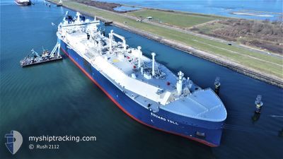
EDUARD TOLL
Tanker
Current Trip
FOR ORDERS
| Time Travelled | 9 days |
|---|---|
| Remaining Time | --- |
| Distance Travelled | 3095.15 nm |
| Remaining Distance | --- |
| AVG Speed | 15.3 Knots |
| MAX Speed | 17.7 Knots |
| AVG Wind | 10 knots |
| MAX Wind | 25 knots |
| MIN Temp | -19.1°C / -2.38°F |
| MAX Temp | 14.7°C / 58.46°F |
| Draught | 12 m |
| Position Received | 1 m ago |
Current Position
| Longitude | -2.77899° |
|---|---|
| Latitude | 46.93408° |
| Status | Under way using engine |
| Speed | 0.7 Knots |
| Course | 72° |
| Area | Bay of Biscay |
| Station | T-AIS |
| Position Received | 1 m ago |
Information
The current position of EDUARD TOLL is in Bay of Biscay with coordinates 46.93408° / -2.77899° as reported on 2025-04-25 17:50 by AIS to our vessel tracker app. The vessel's current speed is 0.7 Knots
The vessel EDUARD TOLL (IMO: 9750696, MMSI: 311000548) is a Tanker It's sailing under the flag of [BS] Bahamas.
In this page you can find informations about the vessels current position, last detected port calls, and current voyage information. If the vessels is not in coverage by AIS you will find the latest position.
The current position of EDUARD TOLL is detected by our AIS receivers and we are not responsible for the reliability of the data. The last position was recorded while the vessel was in Coverage by the Ais receivers of our vessel tracking app.
The current draught of EDUARD TOLL as reported by AIS is 12 meters
Weather
| Temperature | 14.6°C / 58.28°F |
|---|---|
| Wind Speed | 10 knots |
| Direction | 357° N |
| Pressure | 1017.1 hPa |
| Humidity | 77.6 % |
| Cloud Coverage | 89 % |
Featured Company
Last Port Calls
| Port | Arrival | Departure | Time In Port |
|---|---|---|---|
| 2025-04-16 14:23 | |||
| 2025-04-07 23:10 | 2025-04-08 23:20 | 1 d | |
| 2025-03-22 14:47 | 2025-03-23 15:35 | 1 d | |
| 2025-03-04 00:09 | 2025-03-05 02:54 | 1 d | |
| 2025-02-23 08:09 | |||
| 2025-02-12 22:32 | 2025-02-13 21:45 | 23 h | |
| 2025-02-04 20:21 |
Last Trips
| Origin | Departure | Destination | Arrival | Distance | |
|---|---|---|---|---|---|
| 2025-03-23 15:35 | 2025-04-07 23:10 | 5294.42 nm | |||
| 2025-03-05 02:54 | 2025-03-22 14:47 | 5343.01 nm | |||
| 2025-02-23 08:09 | 2025-03-04 00:09 | 2618.90 nm | |||
| 2025-02-04 20:21 | 2025-02-12 22:32 | 2694.24 nm |
Events
| Time | Event | Details | Position / Dest | Info |
|---|---|---|---|---|
| 2025-04-25 15:59 | Status Changed | Under way using engine Default |
46.95262 / -2.77688
FOR ORDERS
|
Speed: 0.4 kn Course: 62° |
| 2025-04-25 15:56 | Status Changed | Default Under way using engine |
46.95299 / -2.77699
FOR ORDERS
|
Speed: 0.7 kn Course: 63° |
| 2025-04-25 14:52 | STOP Moving |
46.96015 / -2.78444
FOR ORDERS
|
Speed: 0.3 kn Course: 83° |
|
| 2025-04-25 10:48 | Draught Changed | 12 12.2 |
46.96488 / -2.86672
FOR ORDERS
|
Speed: 1.3 kn Course: 93° |
| 2025-04-25 10:48 | ETA Changed | 2025/04/25 10:00 2025/04/25 06:00 |
46.96488 / -2.86672
FOR ORDERS
|
Speed: 1.3 kn Course: 93° |
| 2025-04-25 06:59 | Status Changed | Under way using engine Default |
46.85772 / -3.31283
FOR ORDERS
|
Speed: 13.1 kn Course: 64° |
| 2025-04-25 06:59 | IN Coverage |
46.85879 / -3.30769
Bay of Biscay
FOR ORDERS
|
Speed: 13.2 kn Course: 72.3° |
|
| 2025-04-25 05:58 | Status Changed | Default Under way using engine |
46.79779 / -3.62162
FOR ORDERS
|
Speed: 13.1 kn Course: 64.4° |
| 2025-04-25 05:55 | IN Coverage |
46.79251 / -3.63763
Bay of Biscay
FOR ORDERS
|
Speed: 13.1 kn Course: 64.4° |
|
| 2025-04-25 05:55 | OUT of Coverage |
46.79251 / -3.63763
Bay of Biscay
FOR ORDERS
|
Speed: 13.1 kn Course: 64.4° |