
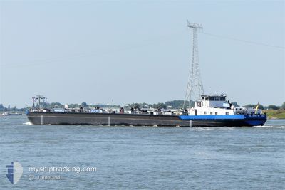
EILTANK 19
Tanker D
Current Trip
NACH HAUSE
| Time Travelled | 15 h, 43 mins |
|---|---|
| Remaining Time | --- |
| Distance Travelled | 17.72 nm |
| Remaining Distance | --- |
| AVG Speed | 3.9 Knots |
| MAX Speed | 6.2 Knots |
| AVG Wind | 1.7 knots |
| MAX Wind | 2.7 knots |
| MIN Temp | 13.2°C / 55.76°F |
| MAX Temp | 17.7°C / 63.86°F |
| Draught | 2.3 m |
| Position Received | 10 h, 58 m ago |
Current Position
| Longitude | 8.11287° |
|---|---|
| Latitude | 48.83201° |
| Status | Under way using engine |
| Speed | |
| Course | --- |
| Area | North Sea |
| Station | T-AIS |
| Position Received | 10 h, 58 m ago |
Info
Information
The current position of EILTANK 19 is in North Sea with coordinates 48.83201° / 8.11287° as reported on 2025-03-20 15:08 by AIS to our vessel tracker app. The vessel's current speed is 0 Knots
The vessel EILTANK 19 (MMSI: 211486580) is a Tanker D It's sailing under the flag of [DE] Germany.
In this page you can find informations about the vessels current position, last detected port calls, and current voyage information. If the vessels is not in coverage by AIS you will find the latest position.
The current position of EILTANK 19 is detected by our AIS receivers and we are not responsible for the reliability of the data. The last position was recorded while the vessel was in Coverage by the Ais receivers of our vessel tracking app.
The current draught of EILTANK 19 as reported by AIS is 2.3 meters
Weather
| Temperature | 17.2°C / 62.96°F |
|---|---|
| Wind Speed | 1 knots |
| Direction | 37° NE |
| Pressure | 1022.2 hPa |
| Humidity | 45.4 % |
| Cloud Coverage | 52 % |
Featured Company
Last Port Calls
| Port | Arrival | Departure | Time In Port |
|---|---|---|---|
| 2025-03-20 11:24 | |||
| 2025-03-17 15:48 | 2025-03-17 16:09 | 20 m | |
| 2025-03-16 14:12 | 2025-03-17 15:15 | 1 d | |
| 2025-03-14 11:07 | 2025-03-15 04:17 | 17 h | |
| 2025-03-12 17:09 | 2025-03-12 17:31 | 22 m | |
| 2025-03-11 16:49 | 2025-03-12 14:08 | 21 h | |
| 2025-03-09 14:07 | 2025-03-10 06:15 | 16 h | |
| 2025-03-08 14:12 | 2025-03-08 14:15 | 2 m | |
| 2025-03-07 21:34 | 2025-03-08 13:24 | 15 h | |
| 2025-03-03 07:48 | 2025-03-03 09:37 | 1 h |
Last Trips
| Origin | Departure | Destination | Arrival | Distance | |
|---|---|---|---|---|---|
| 2025-03-17 15:15 | 2025-03-17 15:48 | 2.00 nm | |||
| 2025-03-15 04:17 | 2025-03-16 14:12 | 104.27 nm | |||
| 2025-03-12 17:31 | 2025-03-14 11:07 | 100.74 nm | |||
| 2025-03-12 14:08 | 2025-03-12 17:09 | 1.84 nm | |||
| 2025-03-10 06:15 | 2025-03-11 16:49 | 103.42 nm | |||
| 2025-03-08 14:15 | 2025-03-09 14:07 | 100.66 nm | |||
| 2025-03-08 13:24 | 2025-03-08 14:12 | 3.84 nm | |||
| 2025-03-03 09:37 | 2025-03-07 21:34 | 308.36 nm | |||
| 2025-03-01 13:45 | 2025-03-03 07:48 | 32.12 nm | |||
| 2025-03-01 13:45 | 2025-03-01 15:28 | 19.13 nm |
Events
| Time | Event | Details | Position / Dest | Info |
|---|---|---|---|---|
| 2025-03-20 15:08 | OUT of Coverage |
48.83201 / 8.11287
North Sea
|
Speed: Course: 208° |
|
| 2025-03-20 15:08 | STOP Moving | 5.34 nm, South of MUNCHHAUSEN |
48.83201 / 8.11287
NACH HAUSE
|
Speed: Course: 511° |
| 2025-03-20 10:24 | PORT DEPARTURE |
|
49.07504 / 8.33362
NACH HAUSE
|
Speed: 4.3 kn Course: 228.8° |
| 2025-03-20 10:12 | START Moving |
49.07285 / 8.33927
[DE] KARLSRUHE
|
Speed: 3.5 kn Course: 12.5° |
|
| 2025-03-20 10:08 | STOP Moving |
49.07120 / 8.33818
[DE] KARLSRUHE
|
Speed: Course: 511° |
|
| 2025-03-20 10:03 | START Moving |
49.06995 / 8.34002
[DE] KARLSRUHE
|
Speed: 3.4 kn Course: 81.3° |
|
| 2025-03-19 08:03 | IN Coverage |
49.07119 / 8.33788
North Sea
[DE] KARLSRUHE
|
Speed: Course: 270.1° |
|
| 2025-03-18 17:53 | OUT of Coverage |
48.90209 / 8.14612
North Sea
|
Speed: 11.2 kn Course: 37.2° |
|
| 2025-03-18 17:27 | START Moving | 5.26 nm, South of MUNCHHAUSEN |
48.83332 / 8.11314
NACH HAUSE
|
Speed: 6.8 kn Course: 6.7° |
| 2025-03-18 17:04 | STOP Moving | 5.45 nm, South of MUNCHHAUSEN |
48.83033 / 8.11232
NACH HAUSE
|
Speed: Course: 511° |