

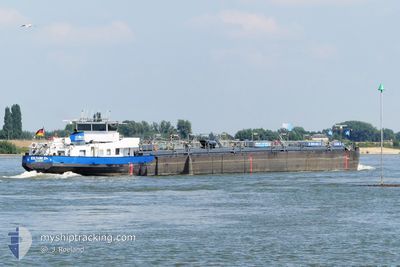
EILTANK 24
Tanker

Current Trip
| Time Travelled | 3 days |
|---|---|
| Remaining Time | 15 mins |
| Distance Travelled | 286.26 nm |
| Remaining Distance | 4.24 nm |
| AVG Speed | 5.4 Knots |
| MAX Speed | 10.6 Knots |
| AVG Wind | 6.2 knots |
| MAX Wind | 12.3 knots |
| MIN Temp | 5.2°C / 41.36°F |
| MAX Temp | 19.9°C / 67.82°F |
| Draught | 0.2 m |
| Position Received | 6 m ago |
Current Position
| Longitude | 8.48075° |
|---|---|
| Latitude | 49.44392° |
| Status | Under way using engine |
| Speed | 9.8 Knots |
| Course | 266.5° |
| Area | North Sea |
| Station | T-AIS |
| Position Received | 6 m ago |
Information
The current position of EILTANK 24 is in North Sea with coordinates 49.44392° / 8.48075° as reported on 2025-05-20 02:17 by AIS to our vessel tracker app. The vessel's current speed is 9.8 Knots and is heading at the port of MANNHEIM. The estimated time of arrival as calculated by MyShipTracking vessel tracking app is 2025-05-20 04:39 LT
The vessel EILTANK 24 (MMSI: 211490510) is a Tanker It's sailing under the flag of [DE] Germany.
In this page you can find informations about the vessels current position, last detected port calls, and current voyage information. If the vessels is not in coverage by AIS you will find the latest position.
The current position of EILTANK 24 is detected by our AIS receivers and we are not responsible for the reliability of the data. The last position was recorded while the vessel was in Coverage by the Ais receivers of our vessel tracking app.
The current draught of EILTANK 24 as reported by AIS is 0.2 meters
Weather
| Temperature | 12.5°C / 54.5°F |
|---|---|
| Wind Speed | 3 knots |
| Direction | 31° NNE |
| Pressure | 1017 hPa |
| Humidity | 71.3 % |
| Cloud Coverage | 98 % |


Featured Company
Last Port Calls
| Port | Arrival | Departure | Time In Port |
|---|---|---|---|
| 2025-05-16 08:11 | 2025-05-16 18:41 | 10 h | |
| 2025-05-15 14:17 | 2025-05-16 07:53 | 17 h | |
| 2025-05-15 02:37 | 2025-05-15 11:47 | 9 h | |
| 2025-05-13 20:47 | 2025-05-14 09:33 | 12 h | |
| 2025-05-09 10:46 | 2025-05-13 18:41 | 4 d | |
| 2025-05-06 18:32 | 2025-05-09 10:29 | 2 d | |
| 2025-05-03 23:16 | 2025-05-04 11:14 | 11 h | |
| 2025-05-02 22:09 | 2025-05-03 21:11 | 23 h | |
| 2025-04-29 21:40 | 2025-04-30 11:25 | 13 h | |
| 2025-04-26 02:37 | 2025-04-26 20:31 | 17 h |
Last Trips
| Origin | Departure | Destination | Arrival | Distance | |
|---|---|---|---|---|---|
| 2025-05-16 07:53 | 2025-05-16 08:11 | 1.29 nm | |||
| 2025-05-15 11:47 | 2025-05-15 14:17 | 19.45 nm | |||
| 2025-05-14 09:33 | 2025-05-15 02:37 | 150.28 nm | |||
| 2025-05-13 18:41 | 2025-05-13 20:47 | 12.02 nm | |||
| 2025-05-09 10:29 | 2025-05-09 10:46 | 2.45 nm | |||
| 2025-05-04 11:14 | 2025-05-06 18:32 | 232.25 nm | |||
| 2025-05-03 21:11 | 2025-05-03 23:16 | 11.82 nm | |||
| 2025-04-30 11:25 | 2025-05-02 22:09 | 232.94 nm | |||
| 2025-04-26 20:31 | 2025-04-29 21:40 | 223.34 nm | |||
| 2025-04-26 01:44 | 2025-04-26 02:37 | 4.13 nm |
Events
| Time | Event | Details | Position / Dest | Info |
|---|---|---|---|---|
| 2025-05-20 02:22 | Status Changed | Default Under way using engine |
49.44314 / 8.45915
MANNHEIM
|
Speed: 9.8 kn Course: 266.5° |
| 2025-05-20 02:09 | Status Changed | Under way using engine Default |
49.43863 / 8.50964
MANNHEIM
|
Speed: 3.6 kn Course: -1° |
| 2025-05-20 02:05 | Status Changed | Default Under way using engine |
49.43591 / 8.51415
MANNHEIM
|
Speed: 3.6 kn Course: 314.3° |
| 2025-05-20 01:58 | IN Coverage |
49.43163 / 8.52117
North Sea
|
Speed: 3.2 kn Course: 318.1° |
|
| 2025-05-19 06:06 | OUT of Coverage |
49.43545 / 8.51488
North Sea
|
Speed: 3.4 kn Course: 135.2° |
|
| 2025-05-19 05:54 | IN Coverage |
49.44315 / 8.49820
North Sea
|
Speed: 4.8 kn Course: 109.5° |
|
| 2025-05-19 00:35 | OUT of Coverage |
49.74034 / 8.45338
North Sea
|
Speed: 4.1 kn Course: 210.9° |
|
| 2025-05-18 23:55 | IN Coverage |
49.76859 / 8.46168
North Sea
|
Speed: 4.4 kn Course: 76.3° |
|
| 2025-05-18 22:13 | OUT of Coverage |
49.86130 / 8.37555
North Sea
|
Speed: 4.6 kn Course: 127.1° |
|
| 2025-05-18 22:12 | IN Coverage |
49.86130 / 8.37555
North Sea
|
Speed: 4.6 kn Course: 127.1° |