
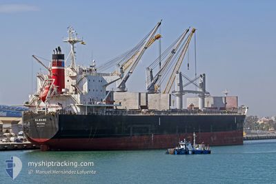
ELBABE
Cargo
Current Trip
| Time Travelled | 19 days |
|---|---|
| Remaining Time | 15 h, 15 mins |
| Distance Travelled | 5252.66 nm |
| Remaining Distance | 175.65 nm |
| AVG Speed | 10.9 Knots |
| MAX Speed | 13.6 Knots |
| AVG Wind | 20.7 knots |
| MAX Wind | 39 knots |
| MIN Temp | 11.4°C / 52.52°F |
| MAX Temp | 24.7°C / 76.46°F |
| Draught | 11.3 m |
| Position Received | 48 m ago |
Current Position
| Longitude | 0.24079° |
|---|---|
| Latitude | 50.33158° |
| Status | Under way using engine |
| Speed | 10.9 Knots |
| Course | 74.9° |
| Area | English Channel |
| Station | T-AIS |
| Position Received | 48 m ago |
Info
Information
The current position of ELBABE is in English Channel with coordinates 50.33158° / 0.24079° as reported on 2025-12-16 01:41 by AIS to our vessel tracker app. The vessel's current speed is 10.9 Knots and is heading at the port of GENT. The estimated time of arrival as calculated by MyShipTracking vessel tracking app is 2025-12-16 18:44 LT
The vessel ELBABE (IMO: 9725471, MMSI: 538007258) is a Cargo It's sailing under the flag of [MH] Marshall Is.
In this page you can find informations about the vessels current position, last detected port calls, and current voyage information. If the vessels is not in coverage by AIS you will find the latest position.
The current position of ELBABE is detected by our AIS receivers and we are not responsible for the reliability of the data. The last position was recorded while the vessel was in Coverage by the Ais receivers of our vessel tracking app.
The current draught of ELBABE as reported by AIS is 11.3 meters
Weather
| Temperature | 11.6°C / 52.88°F |
|---|---|
| Wind Speed | 19 knots |
| Direction | 171° S |
| Pressure | 1005.8 hPa |
| Humidity | 88.4 % |
| Cloud Coverage | 100 % |
Featured Company
Last Port Calls
| Port | Arrival | Departure | Time In Port |
|---|---|---|---|
| 2025-11-20 23:21 | 2025-11-25 21:45 | 4 d | |
| 2025-11-20 20:21 | 2025-11-20 21:25 | 1 h | |
| 2025-11-02 08:57 | 2025-11-09 15:07 | 7 d |
Most Visited Ports (Last year)
| Port | Arrivals | |
|---|---|---|
| 3 | ||
| 2 | ||
| 2 | ||
| 2 | ||
| 2 | ||
| 1 |
Last Trips
| Origin | Departure | Destination | Arrival | Distance | |
|---|---|---|---|---|---|
| 2025-11-20 21:25 | 2025-11-20 23:21 | 10.75 nm | |||
| 2025-11-09 15:07 | 2025-11-20 20:21 | 2468.16 nm |
Events
| Time | Event | Details | Position / Dest | Info |
|---|---|---|---|---|
| 2025-12-16 01:46 | Status Changed | Default Under way using engine |
50.33571 / .26434
BEGNE
|
Speed: 10.9 kn Course: 74.9° |
| 2025-12-16 01:41 | Status Changed | Under way using engine Default |
50.33158 / .24079
BEGNE
|
Speed: 10.9 kn Course: 75° |
| 2025-12-16 01:14 | Status Changed | Default Under way using engine |
50.31083 / .11779
BEGNE
|
Speed: 10.9 kn Course: 75° |
| 2025-12-15 21:50 | Status Changed | Under way using engine Default |
50.16219 / -.77602
BEGNE
|
Speed: 10.4 kn Course: 75° |
| 2025-12-15 21:48 | Status Changed | Default Under way using engine |
50.16048 / -.78608
BEGNE
|
Speed: 10.4 kn Course: 75.2° |
| 2025-12-15 21:33 | Status Changed | Under way using engine Default |
50.14928 / -.85093
BEGNE
|
Speed: 10.6 kn Course: 75° |
| 2025-12-15 21:32 | Status Changed | Default Under way using engine |
50.14850 / -.85522
BEGNE
|
Speed: 10.5 kn Course: 75.3° |
| 2025-12-15 21:17 | Change Sea Area | United Kingdom part of the English Channel French part of the English Channel |
50.13661 / -.92169
English Channel
BEGNE
|
Speed: 10.6 kn Course: 74.6° |
| 2025-12-15 21:04 | Detected in Sea | French part of the English Channel |
50.12692 / -.97879
English Channel
BEGNE
|
Speed: 10.7 kn Course: 73.3° |
| 2025-12-15 21:04 | Status Changed | Under way using engine Default |
50.12692 / -.97879
BEGNE
|
Speed: 10.8 kn Course: 74° |