
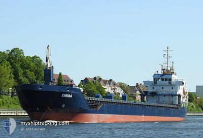
EMMA
General Cargo
Current Trip
| Time Travelled | 17 days |
|---|---|
| Remaining Time | 1 day |
| Distance Travelled | 2453.89 nm |
| Remaining Distance | 466.38 nm |
| AVG Speed | 8.2 Knots |
| MAX Speed | 8.2 Knots |
| AVG Wind | 18.7 knots |
| MAX Wind | 32.8 knots |
| MIN Temp | -12°C / 10.4°F |
| MAX Temp | 10.9°C / 51.62°F |
| Draught | 5.7 m |
| Position Received | 20 h, 14 m ago |
Current Position
| Longitude | 3.46456° |
|---|---|
| Latitude | 55.88581° |
| Status | Under way using engine |
| Speed | 5.6 Knots |
| Course | 186.2° |
| Area | North Sea |
| Station | T-AIS |
| Position Received | 20 h, 14 m ago |
Info
Information
The current position of EMMA is in North Sea with coordinates 55.88581° / 3.46456° as reported on 2025-12-16 01:53 by AIS to our vessel tracker app. The vessel's current speed is 5.6 Knots and is heading at the port of BREST. The estimated time of arrival as calculated by MyShipTracking vessel tracking app is 2025-12-18 16:19 LT
The vessel EMMA (IMO: 9285433, MMSI: 209072000) is a General Cargo that was built in 2004 ( 21 years old ). It's sailing under the flag of [CY] Cyprus.
In this page you can find informations about the vessels current position, last detected port calls, and current voyage information. If the vessels is not in coverage by AIS you will find the latest position.
The current position of EMMA is detected by our AIS receivers and we are not responsible for the reliability of the data. The last position was recorded while the vessel was in Coverage by the Ais receivers of our vessel tracking app.
The current draught of EMMA as reported by AIS is 5.7 meters
Weather
| Temperature | 9.1°C / 48.38°F |
|---|---|
| Wind Speed | 14 knots |
| Direction | 347° NNW |
| Pressure | 1013.4 hPa |
| Humidity | 89.7 % |
| Cloud Coverage | 100 % |
Featured Company
Last Port Calls
| Port | Arrival | Departure | Time In Port |
|---|---|---|---|
| 2025-11-21 18:15 | 2025-11-29 16:35 | 7 d | |
| 2025-11-09 19:54 | 2025-11-11 12:54 | 1 d | |
| 2025-10-31 07:49 | 2025-11-05 04:57 | 4 d | |
| 2025-10-30 01:22 | 2025-10-30 19:28 | 18 h | |
| 2025-10-28 22:16 | 2025-10-30 00:21 | 1 d | |
| 2025-10-24 12:40 | 2025-10-26 05:57 | 1 d | |
| 2025-10-21 11:47 | 2025-10-23 16:50 | 2 d | |
| 2025-10-17 16:02 | 2025-10-18 15:09 | 23 h | |
| 2025-10-07 07:29 | 2025-10-07 08:54 | 1 h | |
| 2025-10-01 11:44 | 2025-10-02 23:04 | 1 d |
Most Visited Ports (Last year)
| Port | Arrivals | |
|---|---|---|
| 5 | ||
| 4 | ||
| 3 | ||
| 3 | ||
| 2 | ||
| 2 |
Last Trips
| Origin | Departure | Destination | Arrival | Distance | |
|---|---|---|---|---|---|
| 2025-11-11 12:54 | 2025-11-21 18:15 | 1407.08 nm | |||
| 2025-11-05 04:57 | 2025-11-09 19:54 | 1099.46 nm | |||
| 2025-10-30 19:28 | 2025-10-31 07:49 | 113.09 nm | |||
| 2025-10-30 00:21 | 2025-10-30 01:22 | 6.04 nm | |||
| 2025-10-26 05:57 | 2025-10-28 22:16 | 312.71 nm | |||
| 2025-10-23 16:50 | 2025-10-24 12:40 | 148.95 nm | |||
| 2025-10-18 15:09 | 2025-10-21 11:47 | 482.72 nm | |||
| 2025-10-07 08:54 | 2025-10-17 16:02 | 900.76 nm | |||
| 2025-10-02 23:04 | 2025-10-07 07:29 | 138.68 nm | |||
| 2025-09-21 17:20 | 2025-10-01 11:44 | 192.61 nm |
Events
| Time | Event | Details | Position / Dest | Info |
|---|---|---|---|---|
| 2025-12-16 01:55 | Status Changed | Default Under way using engine |
55.88216 / 3.46382
FRBES
|
Speed: 5.6 kn Course: 186.2° |
| 2025-12-16 01:53 | OUT of Coverage |
55.88581 / 3.46456
North Sea
FRBES
|
Speed: 5.6 kn Course: 186.2° |
|
| 2025-12-15 22:50 | Change Sea Area | Danish part of the North Sea Norwegian part of the North Sea |
56.15713 / 3.50531
North Sea
FRBES
|
Speed: 5 kn Course: 186.9° |
| 2025-12-15 20:56 | Status Changed | Under way using engine Default |
56.30548 / 3.53104
FRBES
|
Speed: 4.6 kn Course: 187° |
| 2025-12-15 20:48 | IN Coverage |
56.30548 / 3.53104
North Sea
FRBES
|
Speed: 4.6 kn Course: 182.2° |
|
| 2025-12-15 19:24 | Status Changed | Default Under way using engine |
56.42651 / 3.54732
FRBES
|
Speed: 5.2 kn Course: 186.2° |
| 2025-12-15 19:16 | OUT of Coverage |
56.43768 / 3.54778
North Sea
FRBES
|
Speed: 5.2 kn Course: 186.2° |
|
| 2025-12-15 19:12 | ETA Changed | 2025/12/18 19:00 2025/12/18 07:00 |
56.44519 / 3.54783
FRBES
|
Speed: 5 kn Course: 185.7° |
| 2025-12-15 19:02 | Status Changed | Under way using engine Default |
56.45601 / 3.54812
FRBES
|
Speed: 5 kn Course: 181° |
| 2025-12-15 18:45 | IN Coverage |
56.45601 / 3.54812
North Sea
FRBES
|
Speed: 5.1 kn Course: 179.1° |