

ERGE
General Cargo

Current Trip
| Time Travelled | 6 days |
|---|---|
| Remaining Time | 19 h, 0 mins |
| Distance Travelled | 1486.84 nm |
| Remaining Distance | 235.43 nm |
| AVG Speed | 9.9 Knots |
| MAX Speed | 11.1 Knots |
| AVG Wind | 14.6 knots |
| MAX Wind | 26.5 knots |
| MIN Temp | 15.7°C / 60.26°F |
| MAX Temp | 21.1°C / 69.98°F |
| Draught | 5.5 m |
| Position Received | 5 h, 11 m ago |
Current Position
| Longitude | 30.29272° |
|---|---|
| Latitude | 36.04346° |
| Status | Under way using engine |
| Speed | 9.7 Knots |
| Course | 82.3° |
| Area | Mediterranean Sea - Eastern Basin |
| Station | T-AIS |
| Position Received | 5 h, 11 m ago |
Information
The current position of ERGE is in Mediterranean Sea - Eastern Basin with coordinates 36.04346° / 30.29272° as reported on 2025-05-19 19:37 by AIS to our vessel tracker app. The vessel's current speed is 9.7 Knots and is heading at the port of MERSIN. The estimated time of arrival as calculated by MyShipTracking vessel tracking app is 2025-05-20 22:49 LT
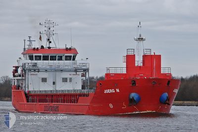
The vessel ERGE (IMO: 9508603, MMSI: 351429000) is a General Cargo that was built in 2010 ( 15 years old ). It's sailing under the flag of [PA] Panama.
In this page you can find informations about the vessels current position, last detected port calls, and current voyage information. If the vessels is not in coverage by AIS you will find the latest position.
The current position of ERGE is detected by our AIS receivers and we are not responsible for the reliability of the data. The last position was recorded while the vessel was in Coverage by the Ais receivers of our vessel tracking app.
The current draught of ERGE as reported by AIS is 5.5 meters
Weather
| Temperature | 20.6°C / 69.08°F |
|---|---|
| Wind Speed | 10 knots |
| Direction | 226° SW |
| Pressure | 1013.2 hPa |
| Humidity | 72 % |
| Cloud Coverage | 1 % |


Featured Company
Last Port Calls
| Port | Arrival | Departure | Time In Port |
|---|---|---|---|
| 2025-05-12 18:36 | 2025-05-13 19:40 | 1 d | |
| 2025-04-30 13:28 | 2025-05-06 12:13 | 5 d | |
| 2025-04-20 11:54 | 2025-04-23 11:44 | 2 d | |
| 2025-04-17 00:12 | 2025-04-18 16:57 | 1 d | |
| 2025-04-14 07:13 | 2025-04-14 18:55 | 11 h | |
| 2025-04-09 09:59 | 2025-04-11 17:44 | 2 d | |
| 2025-03-27 15:34 | 2025-04-04 17:26 | 8 d | |
| 2025-03-16 08:24 | 2025-03-22 07:09 | 5 d | |
| 2025-03-11 17:24 | 2025-03-14 18:30 | 3 d | |
| 2025-03-07 09:19 | 2025-03-08 13:37 | 1 d |
Last Trips
| Origin | Departure | Destination | Arrival | Distance | |
|---|---|---|---|---|---|
| 2025-05-06 12:13 | 2025-05-12 18:36 | 16.89 nm | |||
| 2025-04-23 11:44 | 2025-04-30 13:28 | 1540.96 nm | |||
| 2025-04-18 16:57 | 2025-04-20 11:54 | 405.10 nm | |||
| 2025-04-14 18:55 | 2025-04-17 00:12 | 473.53 nm | |||
| 2025-04-11 17:44 | 2025-04-14 07:13 | 404.61 nm | |||
| 2025-04-04 17:26 | 2025-04-09 09:59 | 110.38 nm | |||
| 2025-03-22 07:09 | 2025-03-27 15:34 | 1125.73 nm | |||
| 2025-03-14 18:30 | 2025-03-16 08:24 | 347.50 nm | |||
| 2025-03-08 13:37 | 2025-03-11 17:24 | 583.34 nm | |||
| 2025-03-04 14:58 | 2025-03-07 09:19 | 245.19 nm |
Events
| Time | Event | Details | Position / Dest | Info |
|---|---|---|---|---|
| 2025-05-19 19:44 | Status Changed | Default Under way using engine |
36.04589 / 30.31708
TRMER
|
Speed: 9.7 kn Course: 82.3° |
| 2025-05-19 19:37 | OUT of Coverage |
36.04346 / 30.29272
Mediterranean Sea - Eastern Basin
TRMER
|
Speed: 9.7 kn Course: 82.3° |
|
| 2025-05-19 17:58 | Status Changed | Under way using engine Default |
36.01644 / 29.94632
TRMER
|
Speed: 10.2 kn Course: 85° |
| 2025-05-19 17:50 | Status Changed | Default Under way using engine |
36.01466 / 29.91931
TRMER
|
Speed: 10.3 kn Course: 84.4° |
| 2025-05-19 17:19 | Status Changed | Under way using engine Default |
36.00741 / 29.81368
TRMER
|
Speed: 9.7 kn Course: 86° |
| 2025-05-19 17:16 | Status Changed | Default Under way using engine |
36.00689 / 29.80425
TRMER
|
Speed: 9.7 kn Course: 86.4° |
| 2025-05-19 17:00 | Status Changed | Under way using engine Default |
36.00386 / 29.74959
TRMER
|
Speed: 9.5 kn Course: 94° |
| 2025-05-19 16:42 | Status Changed | Default Under way using engine |
36.00494 / 29.69069
TRMER
|
Speed: 9.5 kn Course: 92.7° |
| 2025-05-19 16:39 | Change Sea Area | Turkish part of the Mediterranean Sea - Eastern Basin Greek part of the Mediterranean Sea - Eastern Basin |
36.00545 / 29.67977
Mediterranean Sea - Eastern Basin
TRMER
|
Speed: 9.5 kn Course: 92.7° |
| 2025-05-19 15:55 | Status Changed | Under way using engine Default |
36.03723 / 29.54371
TRMER
|
Speed: 9.3 kn Course: 112° |