
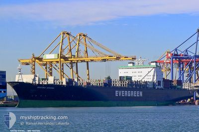
EVER EXCEL
Container Ship
Current Trip
| Time Travelled | 2 days |
|---|---|
| Remaining Time | --- |
| Distance Travelled | 808.87 nm |
| Remaining Distance | --- |
| AVG Speed | 14.1 Knots |
| MAX Speed | 18.7 Knots |
| AVG Wind | 6.8 knots |
| MAX Wind | 17 knots |
| MIN Temp | 5.3°C / 41.54°F |
| MAX Temp | 21.7°C / 71.06°F |
| Draught | 9.6 m |
| Position Received | 1 d ago |
Current Position
| Longitude | -79.97088° |
|---|---|
| Latitude | 31.95135° |
| Status | Under way using engine |
| Speed | 14.3 Knots |
| Course | 74° |
| Area | North Atlantic Ocean |
| Station | T-AIS |
| Position Received | 1 d ago |
Info
Information
The current position of EVER EXCEL is in North Atlantic Ocean with coordinates 31.95135° / -79.97088° as reported on 2025-12-12 17:15 by AIS to our vessel tracker app. The vessel's current speed is 14.3 Knots and is heading at the port of LE HAVRE. The estimated time of arrival as calculated by MyShipTracking vessel tracking app is 2025-12-22 17:45 LT
The vessel EVER EXCEL (IMO: 9241322, MMSI: 235479000) is a Container Ship that was built in 2002 ( 23 years old ). It's sailing under the flag of [GB] United Kingdom.
In this page you can find informations about the vessels current position, last detected port calls, and current voyage information. If the vessels is not in coverage by AIS you will find the latest position.
The current position of EVER EXCEL is detected by our AIS receivers and we are not responsible for the reliability of the data. The last position was recorded while the vessel was in Coverage by the Ais receivers of our vessel tracking app.
The current draught of EVER EXCEL as reported by AIS is 9.6 meters
Weather
| Temperature | 21.8°C / 71.24°F |
|---|---|
| Wind Speed | 16 knots |
| Direction | 167° SSE |
| Pressure | 1020.4 hPa |
| Humidity | 81 % |
| Cloud Coverage | 100 % |
Featured Company
Last Port Calls
| Port | Arrival | Departure | Time In Port |
|---|---|---|---|
| 2025-12-08 14:06 | 2025-12-12 07:15 | 3 d | |
| 2025-12-06 19:34 | 2025-12-07 17:27 | 21 h | |
| 2025-11-24 10:45 | 2025-11-25 01:02 | 14 h | |
| 2025-11-21 06:21 | 2025-11-22 07:35 | 1 d | |
| 2025-11-19 18:32 | 2025-11-20 20:07 | 1 d | |
| 2025-11-15 12:13 | 2025-11-16 17:02 | 1 d | |
| 2025-11-13 22:24 | 2025-11-14 12:35 | 14 h | |
| 2025-11-12 07:15 | 2025-11-13 05:36 | 22 h | |
| 2025-10-09 02:34 | 2025-10-09 15:37 | 13 h | |
| 2025-10-03 19:03 | 2025-10-04 14:04 | 19 h |
Most Visited Ports (Last year)
| Port | Arrivals | |
|---|---|---|
| 8 | ||
| 7 | ||
| 6 | ||
| 6 | ||
| 4 | ||
| 4 |
Last Trips
| Origin | Departure | Destination | Arrival | Distance | |
|---|---|---|---|---|---|
| 2025-12-07 17:27 | 2025-12-08 14:06 | 113.75 nm | |||
| 2025-11-25 01:02 | 2025-12-06 19:34 | 3879.93 nm | |||
| 2025-11-22 07:35 | 2025-11-24 10:45 | 499.00 nm | |||
| 2025-11-20 20:07 | 2025-11-21 06:21 | 118.47 nm | |||
| 2025-11-16 17:02 | 2025-11-19 18:32 | 523.27 nm | |||
| 2025-11-14 12:35 | 2025-11-15 12:13 | 255.28 nm | |||
| 2025-11-13 05:36 | 2025-11-13 22:24 | 254.19 nm | |||
| 2025-10-09 15:37 | 2025-11-12 07:15 | 11928.72 nm | |||
| 2025-10-04 14:04 | 2025-10-09 02:34 | 1652.55 nm | |||
| 2025-09-26 11:44 | 2025-10-03 19:03 | 841.23 nm |
Events
| Time | Event | Details | Position / Dest | Info |
|---|---|---|---|---|
| 2025-12-12 17:23 | Status Changed | Default Under way using engine |
31.96007 / -79.93638
US SAV-FR LEH
|
Speed: 14.3 kn Course: 74° |
| 2025-12-12 17:15 | Status Changed | Under way using engine Default |
31.95135 / -79.97088
US SAV-FR LEH
|
Speed: 14.3 kn Course: 73° |
| 2025-12-12 17:15 | OUT of Coverage |
31.95135 / -79.97088
North Atlantic Ocean
US SAV-FR LEH
|
Speed: 14.3 kn Course: 74° |
|
| 2025-12-12 16:51 | Status Changed | Default Under way using engine |
31.93538 / -80.07959
US SAV-FR LEH
|
Speed: 13.8 kn Course: 89° |
| 2025-12-12 12:15 | PORT DEPARTURE |
|
32.08034 / -81.05138
US SAV-FR LEH
|
Speed: 8.4 kn Course: 90° |
| 2025-12-12 11:49 | START Moving |
32.09185 / -81.10204
[US] SAVANNAH
|
Speed: 3.2 kn Course: 143° |
|
| 2025-12-12 10:53 | Status Changed | Under way using engine Moored |
32.09204 / -81.10457
[US] SAVANNAH
|
Speed: Course: 138° |
| 2025-12-12 10:48 | Status Changed | Moored Default |
32.09199 / -81.10459
[US] SAVANNAH
|
Speed: Course: 138° |
| 2025-12-12 10:45 | Status Changed | Default Moored |
32.09201 / -81.10458
[US] SAVANNAH
|
Speed: Course: 138° |
| 2025-12-12 09:42 | Status Changed | Moored Default |
32.09206 / -81.10467
[US] SAVANNAH
|
Speed: 0.1 kn Course: 138° |