

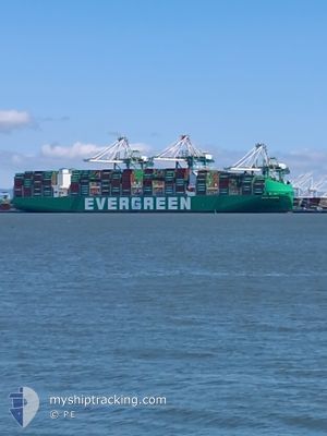
EVER MACRO
Cargo D

Current Trip
| Time Travelled | 6 days |
|---|---|
| Remaining Time | --- |
| Distance Travelled | 106.37 nm |
| Remaining Distance | --- |
| AVG Speed | 11.9 Knots |
| MAX Speed | 18.2 Knots |
| AVG Wind | 8.7 knots |
| MAX Wind | 13.3 knots |
| MIN Temp | 11°C / 51.8°F |
| MAX Temp | 12.8°C / 55.04°F |
| Draught | 14.9 m |
| Position Received | 5 d ago |
Current Position
| Longitude | -124.44700° |
|---|---|
| Latitude | 37.59581° |
| Status | Under way using engine |
| Speed | 18.2 Knots |
| Course | 273.7° |
| Area | North Pacific Ocean |
| Station | T-AIS |
| Position Received | 5 d ago |
Information
The current position of EVER MACRO is in North Pacific Ocean with coordinates 37.59581° / -124.44700° as reported on 2025-05-28 15:22 by AIS to our vessel tracker app. The vessel's current speed is 18.2 Knots and is heading at the port of KAOHSIUNG. The estimated time of arrival as calculated by MyShipTracking vessel tracking app is 2025-06-12 08:01 LT
The vessel EVER MACRO (IMO: 9935351, MMSI: 563249900) is a Cargo D It's sailing under the flag of [SG] Singapore.
In this page you can find informations about the vessels current position, last detected port calls, and current voyage information. If the vessels is not in coverage by AIS you will find the latest position.
The current position of EVER MACRO is detected by our AIS receivers and we are not responsible for the reliability of the data. The last position was recorded while the vessel was in Coverage by the Ais receivers of our vessel tracking app.
The current draught of EVER MACRO as reported by AIS is 14.9 meters
Weather
| Temperature | 12.8°C / 55.04°F |
|---|---|
| Wind Speed | 12 knots |
| Direction | 315° NW |
| Pressure | 1017.1 hPa |
| Humidity | 93.6 % |
| Cloud Coverage | --- |


Featured Company
Last Port Calls
| Port | Arrival | Departure | Time In Port |
|---|---|---|---|
| 2025-05-25 11:23 | 2025-05-28 00:17 | 2 d | |
| 2025-05-19 03:42 | 2025-05-23 20:23 | 4 d | |
| 2025-04-25 07:45 | 2025-04-26 22:54 | 1 d | |
| 2025-04-04 07:56 | 2025-04-05 22:12 | 1 d |
Most Visited Ports (Last year)
| Port | Arrivals | |
|---|---|---|
| 4 | ||
| 2 | ||
| 2 |
Last Trips
| Origin | Departure | Destination | Arrival | Distance | |
|---|---|---|---|---|---|
| 2025-05-23 20:23 | 2025-05-25 11:23 | 394.80 nm | |||
| 2025-04-26 22:54 | 2025-05-19 03:42 | 6095.43 nm | |||
| 2025-04-05 22:12 | 2025-04-25 07:45 | 3506.24 nm | |||
| 2025-03-22 03:26 | 2025-04-04 07:56 | 5826.15 nm |
Events
| Time | Event | Details | Position / Dest | Info |
|---|---|---|---|---|
| 2025-05-28 15:22 | OUT of Coverage |
37.59581 / -124.44700
North Pacific Ocean
USOAK>TWKHH
|
Speed: 18.2 kn Course: 273.7° |
|
| 2025-05-28 07:17 | PORT DEPARTURE |
|
37.80657 / -122.34498
USOAK>TWKHH
|
Speed: 3.7 kn Course: 240° |
| 2025-05-28 07:16 | START Moving |
37.80714 / -122.34366
[US] OAKLAND
|
Speed: 3.1 kn Course: 241° |
|
| 2025-05-28 07:04 | Status Changed | Under way using engine Moored |
37.80711 / -122.34056
[US] OAKLAND
|
Speed: Course: 235° |
| 2025-05-28 06:18 | Draught Changed | 14.9 13.8 |
37.80708 / -122.34066
[US] OAKLAND
|
Speed: Course: 235° |
| 2025-05-25 19:54 | Destination Changed | USOAK>TWKHH USLAX>USOAK |
37.80711 / -122.34060
[US] OAKLAND
|
Speed: Course: 235° |
| 2025-05-25 19:54 | ETA Changed | 2025/06/12 00:01 2025/05/25 17:00 |
37.80711 / -122.34060
[US] OAKLAND
|
Speed: Course: 235° |
| 2025-05-25 19:24 | Status Changed | Moored Under way using engine |
37.80709 / -122.34056
[US] OAKLAND
|
Speed: Course: 235° |
| 2025-05-25 19:13 | STOP Moving |
37.80733 / -122.34049
[US] OAKLAND
|
Speed: 0.3 kn Course: 234° |
|
| 2025-05-25 18:23 | PORT ARRIVAL |
|
37.80868 / -122.34105
[US] OAKLAND
|
Speed: 6.6 kn Course: 59.3° |