

F50
Other Type

Current Trip
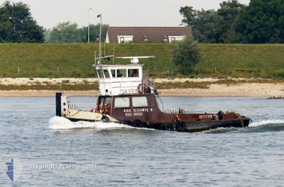
WERKENDAM
| Time Travelled | 12 days |
|---|---|
| Remaining Time | --- |
| Distance Travelled | 93.37 nm |
| Remaining Distance | --- |
| AVG Speed | 5.5 Knots |
| MAX Speed | 8.7 Knots |
| AVG Wind | 5.1 knots |
| MAX Wind | 13 knots |
| MIN Temp | 3.2°C / 37.76°F |
| MAX Temp | 20.4°C / 68.72°F |
| Draught | 0.2 m |
| Position Received | 43 m ago |
Current Position
| Longitude | 4.75774° |
|---|---|
| Latitude | 51.72536° |
| Status | Under way using engine |
| Speed | 4.7 Knots |
| Course | 287.3° |
| Area | North Sea |
| Station | T-AIS |
| Position Received | 43 m ago |
Information
The current position of F50 is in North Sea with coordinates 51.72536° / 4.75774° as reported on 2025-04-08 14:29 by AIS to our vessel tracker app. The vessel's current speed is 4.7 Knots
The vessel F50 (MMSI: 244750298) is a Other Type It's sailing under the flag of [NL] Netherlands.
In this page you can find informations about the vessels current position, last detected port calls, and current voyage information. If the vessels is not in coverage by AIS you will find the latest position.
The current position of F50 is detected by our AIS receivers and we are not responsible for the reliability of the data. The last position was recorded while the vessel was in Coverage by the Ais receivers of our vessel tracking app.
The current draught of F50 as reported by AIS is 0.2 meters
Weather
| Temperature | 15.3°C / 59.54°F |
|---|---|
| Wind Speed | 6 knots |
| Direction | 69° ENE |
| Pressure | 1025.9 hPa |
| Humidity | 44.6 % |
| Cloud Coverage | 100 % |


Featured Company
Last Port Calls
| Port | Arrival | Departure | Time In Port |
|---|---|---|---|
| 2025-03-25 13:42 | 2025-03-27 08:35 | 1 d | |
| 2025-03-24 09:35 | 2025-03-24 14:37 | 5 h | |
| 2025-03-22 17:17 | 2025-03-22 17:25 | 7 m | |
| 2025-03-21 12:39 | 2025-03-21 12:47 | 8 m | |
| 2025-03-21 10:58 | 2025-03-21 11:18 | 20 m | |
| 2025-03-20 15:26 | 2025-03-20 17:36 | 2 h | |
| 2025-03-19 11:11 | 2025-03-19 12:41 | 1 h | |
| 2025-03-18 12:14 | 2025-03-18 13:48 | 1 h | |
| 2025-03-13 15:00 | 2025-03-13 15:19 | 18 m | |
| 2025-03-13 12:29 | 2025-03-13 13:31 | 1 h |
Most Visited Ports (Last year)
| Port | Arrivals | |
|---|---|---|
| 69 | ||
| 51 | ||
| 16 | ||
| 13 | ||
| 9 | ||
| 9 |
Last Trips
| Origin | Departure | Destination | Arrival | Distance | |
|---|---|---|---|---|---|
| 2025-03-24 14:37 | 2025-03-25 13:42 | 36.93 nm | |||
| 2025-03-22 17:25 | 2025-03-24 09:35 | 10.37 nm | |||
| 2025-03-21 12:47 | 2025-03-22 17:17 | 4.84 nm | |||
| 2025-03-21 11:18 | 2025-03-21 12:39 | 4.76 nm | |||
| 2025-03-20 17:36 | 2025-03-21 10:58 | 32.36 nm | |||
| 2025-03-19 12:41 | 2025-03-20 15:26 | 47.16 nm | |||
| 2025-03-18 13:48 | 2025-03-19 11:11 | 26.74 nm | |||
| 2025-03-13 15:19 | 2025-03-18 12:14 | 23.39 nm | |||
| 2025-03-13 13:31 | 2025-03-13 15:00 | 5.60 nm | |||
| 2025-03-13 10:32 | 2025-03-13 12:29 | 5.67 nm |
Events
| Time | Event | Details | Position / Dest | Info |
|---|---|---|---|---|
| 2025-04-08 13:23 | START Moving | 0.3 nm, North West of KEIZERSVEER |
51.71989 / 4.88907
WERKENDAM
|
Speed: 3.8 kn Course: 278.4° |
| 2025-04-08 05:22 | IN Coverage |
51.71677 / 4.89675
North Sea
|
Speed: Course: 0° |
|
| 2025-04-07 14:03 | OUT of Coverage |
51.71680 / 4.89668
North Sea
|
Speed: Course: 0° |
|
| 2025-04-07 13:40 | STOP Moving | 0.04 nm, East of KEIZERSVEER |
51.71681 / 4.89671
WERKENDAM
|
Speed: Course: 511° |
| 2025-04-07 11:53 | IN Coverage |
51.72060 / 4.70318
North Sea
|
Speed: 5 kn Course: 96.3° |
|
| 2025-04-07 10:41 | OUT of Coverage |
51.79663 / 4.77879
North Sea
|
Speed: 5.7 kn Course: 238.1° |
|
| 2025-04-07 09:48 | START Moving | 1.25 nm, North East of WERKENDAM |
51.82154 / 4.90001
WERKENDAM
|
Speed: 5.1 kn Course: 251.7° |
| 2025-04-07 09:01 | IN Coverage |
51.82146 / 4.90358
North Sea
|
Speed: 0.1 kn Course: 287.2° |
|
| 2025-04-04 14:19 | OUT of Coverage |
51.82149 / 4.90356
North Sea
|
Speed: Course: 0° |
|
| 2025-04-04 11:42 | STOP Moving | 1.36 nm, North East of WERKENDAM |
51.82137 / 4.90430
WERKENDAM
|
Speed: Course: 511° |