
FEIJE
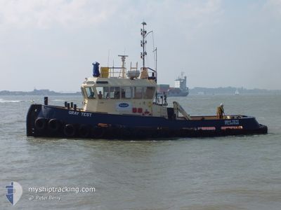
Tug
Current Trip
| Trip Time | 12 h, 29 mins |
|---|---|
| Trip Distance | 107.34 nm |
| AVG Speed | 7.9 Knots |
| MAX Speed | 11 Knots |
| Draught | 2.6 m |
| AVG Wind | 18.1 knots |
| MAX Wind | 24 knots |
| MIN Temp | 4.3°C / 39.74°F |
| MAX Temp | 8.8°C / 47.84°F |
| Position Received | 2 d ago |
Current Position
| Longitude | 1.72456° |
|---|---|
| Latitude | 52.47697° |
| Status | Under way using engine |
| Speed | 6 Knots |
| Course | 295.8° |
| Area | North Sea |
| Station | T-AIS |
| Position Received | 2 d ago |
Info
Information
The current position of FEIJE is in North Sea with coordinates 52.47697° / 1.72456° as reported on 2025-02-04 18:41 by AIS to our vessel tracker app. The vessel's current speed is 6 Knots and is currently inside the port of LOWESTOFT.
The vessel FEIJE (MMSI: 235000164) is a Tug It's sailing under the flag of [GB] United Kingdom.
In this page you can find informations about the vessels current position, last detected port calls, and current voyage information. If the vessels is not in coverage by AIS you will find the latest position.
The current position of FEIJE is detected by our AIS receivers and we are not responsible for the reliability of the data. The last position was recorded while the vessel was in Coverage by the Ais receivers of our vessel tracking app.
The current draught of FEIJE as reported by AIS is 2.6 meters
Weather
| Temperature | 4.3°C / 39.74°F |
|---|---|
| Wind Speed | 8 knots |
| Direction | 265° W |
| Pressure | 1035.3 hPa |
| Humidity | 87 % |
| Cloud Coverage | 3 % |
Featured Company
Last Port Calls
| Port | Arrival | Departure | Time In Port |
|---|---|---|---|
| 2025-02-04 18:26 | |||
| 2025-02-02 07:33 | 2025-02-04 05:57 | 1 d | |
| 2025-01-30 17:35 | 2025-01-31 16:04 | 22 h | |
| 2025-01-30 12:55 | |||
| 2024-12-19 03:33 | |||
| 2024-12-12 05:30 |
Most Visited Ports (Last year)
| Port | Arrivals | |
|---|---|---|
| 14 | ||
| 8 | ||
| 7 | ||
| 2 | ||
| 1 | ||
| 1 |
Events
| Time | Event | Details | Position / Dest | Info |
|---|---|---|---|---|
| 2025-02-04 18:49 | STOP Moving |
52.47504 / 1.71824
[GB] LOWESTOFT
|
Speed: Course: -1° |
|
| 2025-02-04 18:41 | Status Changed | Default Under way using engine |
52.47718 / 1.72327
[GB] LOWESTOFT
|
Speed: 6 kn Course: 295.8° |
| 2025-02-04 18:41 | OUT of Coverage |
52.47697 / 1.72456
North Sea
[GB] LOWESTOFT
|
Speed: 6 kn Course: 295.8° |
|
| 2025-02-04 18:26 | PORT ARRIVAL |
|
52.47256 / 1.75347
[GB] LOWESTOFT
|
Speed: 7.4 kn Course: 237.4° |
| 2025-02-04 16:34 | Status Changed | Under way using engine Default |
52.68080 / 1.72970
LOWESTOFT
|
Speed: 7 kn Course: 161° |
| 2025-02-04 16:25 | Status Changed | Default Under way using engine |
52.69774 / 1.72053
LOWESTOFT
|
Speed: 7.8 kn Course: 165.8° |
| 2025-02-04 16:14 | Status Changed | Under way using engine Default |
52.72131 / 1.71469
LOWESTOFT
|
Speed: 7.6 kn Course: 167° |
| 2025-02-04 16:13 | Status Changed | Default Under way using engine |
52.72345 / 1.71452
LOWESTOFT
|
Speed: 7.5 kn Course: 158.3° |
| 2025-02-04 13:25 | Status Changed | Under way using engine Default |
52.97044 / 1.20870
LOWESTOFT
|
Speed: 10.3 kn Course: 99° |
| 2025-02-04 13:08 | IN Coverage |
52.96907 / 1.22278
North Sea
LOWESTOFT
|
Speed: 10.5 kn Course: 103.3° |