

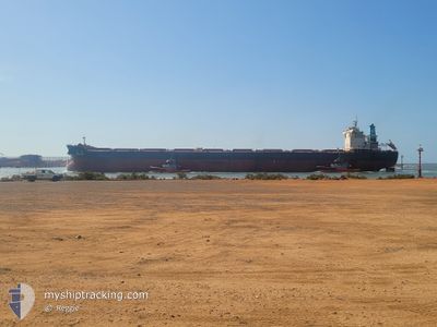
FENG HUA
Cargo

Current Trip
| Trip Time | 15 days |
|---|---|
| Trip Distance | 3871.35 nm |
| AVG Speed | 10.5 Knots |
| MAX Speed | 14.1 Knots |
| Draught | 17.2 m |
| AVG Wind | 10.7 knots |
| MAX Wind | 29.8 knots |
| MIN Temp | 14.7°C / 58.46°F |
| MAX Temp | 31.1°C / 87.98°F |
| Position Received | 13 d ago |
Current Position
| Longitude | 115.75802° |
|---|---|
| Latitude | -9.02498° |
| Status | Under way using engine |
| Speed | 7.1 Knots |
| Course | 344° |
| Area | Indian Ocean |
| Station | T-AIS |
| Position Received | 13 d ago |
Information
The current position of FENG HUA is in Indian Ocean with coordinates -9.02498° / 115.75802° as reported on 2025-05-14 10:12 by AIS to our vessel tracker app. The vessel's current speed is 7.1 Knots and is currently inside the port of JINGTANG.
The vessel FENG HUA (IMO: 9653850, MMSI: 477319200) is a Cargo It's sailing under the flag of [HK] Hong Kong.
In this page you can find informations about the vessels current position, last detected port calls, and current voyage information. If the vessels is not in coverage by AIS you will find the latest position.
The current position of FENG HUA is detected by our AIS receivers and we are not responsible for the reliability of the data. The last position was recorded while the vessel was in Coverage by the Ais receivers of our vessel tracking app.
The current draught of FENG HUA as reported by AIS is 17.2 meters
Weather
| Temperature | 16.4°C / 61.52°F |
|---|---|
| Wind Speed | 6 knots |
| Direction | 111° ESE |
| Pressure | 1013.9 hPa |
| Humidity | 79.9 % |
| Cloud Coverage | 1 % |


Featured Company
Last Port Calls
| Port | Arrival | Departure | Time In Port |
|---|---|---|---|
| 2025-05-27 12:02 | |||
| 2025-05-09 16:55 | 2025-05-11 16:14 | 1 d | |
| 2025-04-25 04:56 | 2025-04-27 02:02 | 1 d | |
| 2025-04-21 03:50 | 2025-04-22 19:14 | 1 d | |
| 2025-04-05 09:25 | 2025-04-06 20:31 | 1 d | |
| 2025-03-21 06:49 | 2025-03-24 00:54 | 2 d | |
| 2025-03-05 08:36 | 2025-03-06 19:21 | 1 d |
Most Visited Ports (Last year)
| Port | Arrivals | |
|---|---|---|
| 9 | ||
| 2 | ||
| 2 | ||
| 1 | ||
| 1 | ||
| 1 |
Last Trips
| Origin | Departure | Destination | Arrival | Distance | |
|---|---|---|---|---|---|
| 2025-05-12 00:14 | 2025-05-27 20:02 | 3871.35 nm | |||
| 2025-04-27 10:02 | 2025-05-10 00:55 | 3353.27 nm | |||
| 2025-04-23 03:14 | 2025-04-25 12:56 | 490.41 nm | |||
| 2025-04-07 04:31 | 2025-04-21 11:50 | 3616.03 nm | |||
| 2025-03-24 08:54 | 2025-04-05 17:25 | 3054.36 nm | |||
| 2025-03-07 03:21 | 2025-03-21 14:49 | 3553.05 nm | |||
| 2025-02-11 09:05 | 2025-03-05 16:36 | 3906.75 nm |
Events
| Time | Event | Details | Position / Dest | Info |
|---|---|---|---|---|
| 2025-05-27 13:10 | STOP Moving |
39.24069 / 119.08015
[CN] JINGTANG
|
Speed: 0.2 kn Course: 59° |
|
| 2025-05-27 12:02 | PORT ARRIVAL |
|
39.18959 / 119.02394
[CN] JINGTANG
|
Speed: 9 kn Course: 316° |
| 2025-05-27 08:46 | START Moving | 19.45 nm, South East of JINGTANG |
38.92198 / 119.23965
QING DAO CN
|
Speed: 3.1 kn Course: 350° |
| 2025-05-27 04:22 | STOP Moving | 19.65 nm, South East of JINGTANG |
38.91276 / 119.22800
QING DAO CN
|
Speed: Course: 84° |
| 2025-05-27 04:18 | START Moving | 19.65 nm, South East of JINGTANG |
38.91301 / 119.22819
QING DAO CN
|
Speed: 6.3 kn Course: 40° |
| 2025-05-26 20:40 | STOP Moving | 19.71 nm, South East of JINGTANG |
38.91395 / 119.23312
QING DAO CN
|
Speed: 0.3 kn Course: 227° |