
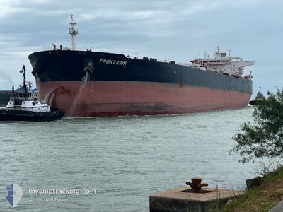
FRONT IDUN
Tanker
Current Trip
| Time Travelled | --- |
|---|---|
| Remaining Time | --- |
| Distance Travelled | 6554.89 nm |
| Remaining Distance | --- |
| AVG Speed | 11.1 Knots |
| MAX Speed | 16.5 Knots |
| AVG Wind | 15.2 knots |
| MAX Wind | 52.8 knots |
| MIN Temp | 1.9°C / 35.42°F |
| MAX Temp | 25°C / 77°F |
| Draught | 16.5 m |
| Position Received | 1 d ago |
Current Position
| Longitude | -15.16933° |
|---|---|
| Latitude | 28.97470° |
| Status | Under way using engine |
| Speed | 12.1 Knots |
| Course | 47.9° |
| Area | North Atlantic Ocean |
| Station | T-AIS |
| Position Received | 1 d ago |
Info
Information
The current position of FRONT IDUN is in North Atlantic Ocean with coordinates 28.97470° / -15.16933° as reported on 2025-12-19 00:11 by AIS to our vessel tracker app. The vessel's current speed is 12.1 Knots and is heading at the port of CARTAGENA. The estimated time of arrival as calculated by MyShipTracking vessel tracking app is 2025-12-22 01:01 LT
The vessel FRONT IDUN (IMO: 9600944, MMSI: 538005762) is a Tanker It's sailing under the flag of [MH] Marshall Is.
In this page you can find informations about the vessels current position, last detected port calls, and current voyage information. If the vessels is not in coverage by AIS you will find the latest position.
The current position of FRONT IDUN is detected by our AIS receivers and we are not responsible for the reliability of the data. The last position was recorded while the vessel was in Coverage by the Ais receivers of our vessel tracking app.
The current draught of FRONT IDUN as reported by AIS is 16.5 meters
Weather
| Temperature | 16°C / 60.8°F |
|---|---|
| Wind Speed | 6 knots |
| Direction | 262° W |
| Pressure | 1022.2 hPa |
| Humidity | 64.3 % |
| Cloud Coverage | 100 % |
Featured Company
Last Port Calls
Last Trips
| Origin | Departure | Destination | Arrival | Distance |
|---|
Events
| Time | Event | Details | Position / Dest | Info |
|---|---|---|---|---|
| 2025-12-19 00:16 | Status Changed | Default Under way using engine |
28.98653 / -15.15548
ESCAR
|
Speed: 12.1 kn Course: 47.9° |
| 2025-12-19 00:11 | Status Changed | Under way using engine Default |
28.97470 / -15.16933
ESCAR
|
Speed: 12 kn Course: 49° |
| 2025-12-19 00:11 | OUT of Coverage |
28.97470 / -15.16933
North Atlantic Ocean
ESCAR
|
Speed: 12.1 kn Course: 47.9° |
|
| 2025-12-18 23:19 | Status Changed | Default Under way using engine |
28.85557 / -15.31583
ESCAR
|
Speed: 11.9 kn Course: 44.6° |
| 2025-12-18 23:15 | Status Changed | Under way using engine Default |
28.84664 / -15.32650
ESCAR
|
Speed: 11.9 kn Course: 47° |
| 2025-12-18 23:12 | Status Changed | Default Under way using engine |
28.84012 / -15.33428
ESCAR
|
Speed: 11.8 kn Course: 42.9° |
| 2025-12-18 23:02 | Status Changed | Under way using engine Default |
28.81779 / -15.36042
ESCAR
|
Speed: 12 kn Course: 46° |
| 2025-12-18 22:25 | Status Changed | Default Under way using engine |
28.72966 / -15.45871
ESCAR
|
Speed: 11.8 kn Course: 43.8° |
| 2025-12-18 21:37 | Status Changed | Under way using engine Default |
28.64718 / -15.54542
ESCAR
|
Speed: 2.3 kn Course: 41° |
| 2025-12-18 21:36 | Status Changed | Default Under way using engine |
28.64661 / -15.54605
ESCAR
|
Speed: 2.2 kn Course: 40° |