
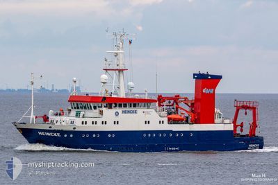
FS HEINCKE
Research/Survey Vessel
Current Trip
DEHGL
| Time Travelled | 6 h, 0 mins |
|---|---|
| Remaining Time | --- |
| Distance Travelled | 36.32 nm |
| Remaining Distance | --- |
| AVG Speed | 8.6 Knots |
| MAX Speed | 13.1 Knots |
| AVG Wind | 16.4 knots |
| MAX Wind | 18 knots |
| MIN Temp | 3.4°C / 38.12°F |
| MAX Temp | 4.6°C / 40.28°F |
| Draught | 4.2 m |
| Position Received | 1 m ago |
Current Position
| Longitude | 8.63290° |
|---|---|
| Latitude | 53.94593° |
| Status | Restricted manoeuverability |
| Speed | 9.1 Knots |
| Course | 127.3° |
| Area | North Sea |
| Station | T-AIS |
| Position Received | 1 m ago |
Info
Information
The current position of FS HEINCKE is in North Sea with coordinates 53.94593° / 8.63290° as reported on 2025-02-04 12:50 by AIS to our vessel tracker app. The vessel's current speed is 9.1 Knots
The vessel FS HEINCKE (IMO: 8806113, MMSI: 211208720) is a Research/Survey Vessel that was built in 1990 ( 35 years old ). It's sailing under the flag of [DE] Germany.
In this page you can find informations about the vessels current position, last detected port calls, and current voyage information. If the vessels is not in coverage by AIS you will find the latest position.
The current position of FS HEINCKE is detected by our AIS receivers and we are not responsible for the reliability of the data. The last position was recorded while the vessel was in Coverage by the Ais receivers of our vessel tracking app.
The current draught of FS HEINCKE as reported by AIS is 4.2 meters
Weather
| Temperature | 3.9°C / 39.02°F |
|---|---|
| Wind Speed | 15 knots |
| Direction | 206° SSW |
| Pressure | 1025.2 hPa |
| Humidity | 87.2 % |
| Cloud Coverage | 67 % |
Featured Company
Last Port Calls
| Port | Arrival | Departure | Time In Port |
|---|---|---|---|
| 2025-02-03 12:03 | 2025-02-04 06:51 | 18 h | |
| 2025-01-30 12:25 | 2025-02-03 07:46 | 3 d | |
| 2025-01-29 16:21 |
Most Visited Ports (Last year)
| Port | Arrivals | |
|---|---|---|
| 43 | ||
| 26 | ||
| 2 |
Last Trips
| Origin | Departure | Destination | Arrival | Distance | |
|---|---|---|---|---|---|
| 2025-02-03 08:46 | 2025-02-03 13:03 | 43.48 nm | |||
| 2025-01-29 17:21 | 2025-01-30 13:25 | 130.02 nm |
Events
| Time | Event | Details | Position / Dest | Info |
|---|---|---|---|---|
| 2025-02-04 12:35 | Status Changed | Restricted manoeuverability Default |
53.96456 / 8.55993
DEHGL
|
Speed: 12.8 kn Course: 101° |
| 2025-02-04 12:33 | Status Changed | Default Restricted manoeuverability |
53.96604 / 8.54710
DEHGL
|
Speed: 12.8 kn Course: 101.2° |
| 2025-02-04 12:29 | START Moving | 9.1 nm, North West of CUXHAVEN |
53.96912 / 8.51958
DEHGL
|
Speed: 12.8 kn Course: 101.2° |
| 2025-02-04 12:20 | Status Changed | Restricted manoeuverability Default |
53.96929 / 8.49739
DEHGL
|
Speed: 0.2 kn Course: 225° |
| 2025-02-04 12:17 | Status Changed | Default Restricted manoeuverability |
53.96944 / 8.49725
DEHGL
|
Speed: 0.3 kn Course: 229° |
| 2025-02-04 12:10 | STOP Moving | 9.71 nm, North West of CUXHAVEN |
53.96972 / 8.49769
DEHGL
|
Speed: 0.3 kn Course: 243° |
| 2025-02-04 12:10 | Status Changed | Restricted manoeuverability Default |
53.96969 / 8.49773
DEHGL
|
Speed: 0.5 kn Course: 252° |
| 2025-02-04 12:01 | Status Changed | Default Restricted manoeuverability |
53.97118 / 8.47901
DEHGL
|
Speed: 11.1 kn Course: 102.4° |
| 2025-02-04 11:56 | Status Changed | Restricted manoeuverability Default |
53.97381 / 8.45619
DEHGL
|
Speed: 11.2 kn Course: 101° |
| 2025-02-04 11:53 | Status Changed | Default Restricted manoeuverability |
53.97589 / 8.43993
DEHGL
|
Speed: 7.6 kn Course: 103° |