
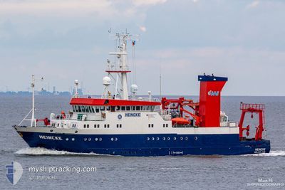
FS HEINCKE
Research/Survey Vessel
Current Trip
RESEARCH
| Time Travelled | 9 h, 3 mins |
|---|---|
| Remaining Time | --- |
| Distance Travelled | 63.60 nm |
| Remaining Distance | --- |
| AVG Speed | 8.6 Knopen |
| MAX Speed | 13.1 Knopen |
| AVG Wind | 15.3 knots |
| MAX Wind | 18 knots |
| MIN Temp | 3.4°C / 38.12°F |
| MAX Temp | 5.8°C / 42.44°F |
| Diepgang | 4.2 M |
| Positie ontvangen | 1 m geleden |
Current Position
| Lengtegraad | 8.38764° |
|---|---|
| Breedtegraat | 54.05278° |
| Status | Restricted manoeuverability |
| Snelheid | 0.3 Knopen |
| Koers | 194° |
| Gebied | North Sea |
| Station | T-AIS |
| Positie ontvangen | 1 m geleden |
Info
Information
The current position of FS HEINCKE is in North Sea with coordinates 54.05278° / 8.38764° as reported on 2025-02-04 15:52 by AIS to our vessel tracker app. The vessel's current speed is 0.3 Knopen
The vessel FS HEINCKE (IMO: 8806113, MMSI: 211208720) is a Research/Survey Vessel that was built in 1990 ( 35 Jaar oud ). It's sailing under the flag of [DE] Germany.
In this page you can find informations about the vessels current position, last detected port calls, and current voyage information. If the vessels is not in coverage by AIS you will find the latest position.
The current position of FS HEINCKE is detected by our AIS receivers and we are not responsible for the reliability of the data. The last position was recorded while the vessel was in Coverage by the Ais receivers of our vessel tracking app.
The current draught of FS HEINCKE as reported by AIS is 4.2 meters
Weather
| Temperature | 5.3°C / 41.54°F |
|---|---|
| Wind Speed | 15 knots |
| Direction | 202° SSW |
| Pressure | 1024.5 hPa |
| Humidity | 84.9 % |
| Cloud Coverage | 13 % |
Featured Company
Last Port Calls
| Port | Arrival | Departure | Time In Port |
|---|---|---|---|
| 2025-02-03 12:03 | 2025-02-04 06:51 | 18 h | |
| 2025-01-30 12:25 | 2025-02-03 07:46 | 3 d | |
| 2025-01-29 16:21 |
Most Visited Ports (Last year)
| Port | Arrivals | |
|---|---|---|
| 43 | ||
| 26 | ||
| 2 |
Last Trips
| Origin | Departure | Destination | Arrival | Distance | |
|---|---|---|---|---|---|
| 2025-02-03 08:46 | 2025-02-03 13:03 | 43.48 nm | |||
| 2025-01-29 17:21 | 2025-01-30 13:25 | 130.02 nm |
Events
| Tijd | Evenement | Details | Positie / Bestemming | Info |
|---|---|---|---|---|
| 2025-02-04 15:50 | Stop beweging | 15.94 nm, North West of CUXHAVEN |
54.05276 / 8.38762
RESEARCH
|
Snelheid: 0.3 kn Koers: 210° |
| 2025-02-04 15:41 | Status Changed | Restricted manoeuverability Default |
54.05348 / 8.38310
RESEARCH
|
Snelheid: 10.6 kn Koers: 85° |
| 2025-02-04 15:21 | Status Changed | Default Restricted manoeuverability |
54.04700 / 8.27972
RESEARCH
|
Snelheid: 11.7 kn Koers: 8.7° |
| 2025-02-04 15:02 | Status Changed | Restricted manoeuverability Default |
54.00590 / 8.30367
RESEARCH
|
Snelheid: 10.9 kn Koers: 289° |
| 2025-02-04 15:01 | Status Changed | Default Restricted manoeuverability |
54.00554 / 8.30537
RESEARCH
|
Snelheid: 10.6 kn Koers: 290.9° |
| 2025-02-04 14:48 | Status Changed | Restricted manoeuverability Default |
53.99236 / 8.36960
RESEARCH
|
Snelheid: 10.3 kn Koers: 280° |
| 2025-02-04 14:33 | Status Changed | Default Restricted manoeuverability |
53.98397 / 8.43861
RESEARCH
|
Snelheid: 10 kn Koers: 281.9° |
| 2025-02-04 13:22 | Start beweging | 2.33 nm, North West of CUXHAVEN |
53.90290 / 8.68253
RESEARCH
|
Snelheid: 3.8 kn Koers: 333° |
| 2025-02-04 13:15 | Stop beweging | 2.23 nm, North West of CUXHAVEN |
53.90154 / 8.68473
RESEARCH
|
Snelheid: 0.3 kn Koers: 319° |
| 2025-02-04 13:00 | Destination Changed | RESEARCH DEHGL |
53.92339 / 8.66491
RESEARCH
|
Snelheid: 12.4 kn Koers: 149.7° |