

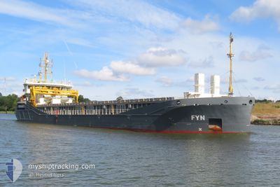
FYN
Cargo

Current Trip
| Time Travelled | 2 days |
|---|---|
| Remaining Time | 5 h, 52 mins |
| Distance Travelled | 411.40 nm |
| Remaining Distance | 219.14 nm |
| AVG Speed | 9.7 Knots |
| MAX Speed | 10.7 Knots |
| AVG Wind | 13.8 knots |
| MAX Wind | 21 knots |
| MIN Temp | 11.3°C / 52.34°F |
| MAX Temp | 14.9°C / 58.82°F |
| Draught | 6.1 m |
| Position Received | 17 h, 14 m ago |
Current Position
| Longitude | 5.91447° |
|---|---|
| Latitude | 55.12773° |
| Status | Under way using engine |
| Speed | 9.6 Knots |
| Course | 206.6° |
| Area | North Sea |
| Station | T-AIS |
| Position Received | 17 h, 14 m ago |
Information
The current position of FYN is in North Sea with coordinates 55.12773° / 5.91447° as reported on 2025-05-17 17:39 by AIS to our vessel tracker app. The vessel's current speed is 9.6 Knots and is heading at the port of ROTTERDAM. The estimated time of arrival as calculated by MyShipTracking vessel tracking app is 2025-05-18 18:45 LT
The vessel FYN (IMO: 9968188, MMSI: 255851000) is a Cargo It's sailing under the flag of [PT] Portugal.
In this page you can find informations about the vessels current position, last detected port calls, and current voyage information. If the vessels is not in coverage by AIS you will find the latest position.
The current position of FYN is detected by our AIS receivers and we are not responsible for the reliability of the data. The last position was recorded while the vessel was in Coverage by the Ais receivers of our vessel tracking app.
The current draught of FYN as reported by AIS is 6.1 meters
Weather
| Temperature | 11.9°C / 53.42°F |
|---|---|
| Wind Speed | 10 knots |
| Direction | 2° N |
| Pressure | 1018.8 hPa |
| Humidity | 85 % |
| Cloud Coverage | 1 % |


Featured Company
Last Port Calls
| Port | Arrival | Departure | Time In Port |
|---|---|---|---|
| 2025-05-14 05:04 | 2025-05-16 10:30 | 2 d | |
| 2025-05-10 17:13 | 2025-05-13 18:35 | 3 d | |
| 2025-05-01 09:03 | 2025-05-01 13:14 | 4 h | |
| 2025-04-22 10:22 | 2025-04-26 16:14 | 4 d | |
| 2025-04-16 14:10 | 2025-04-18 19:14 | 2 d | |
| 2025-03-30 03:52 | 2025-04-01 12:24 | 2 d | |
| 2025-03-27 13:03 | 2025-03-29 00:47 | 1 d | |
| 2025-03-21 09:01 | 2025-03-24 17:44 | 3 d | |
| 2025-03-19 14:54 | 2025-03-20 16:04 | 1 d | |
| 2025-03-08 03:15 | 2025-03-09 13:26 | 1 d |
Most Visited Ports (Last year)
| Port | Arrivals | |
|---|---|---|
| 3 | ||
| 3 | ||
| 2 | ||
| 2 | ||
| 2 | ||
| 2 |
Last Trips
| Origin | Departure | Destination | Arrival | Distance | |
|---|---|---|---|---|---|
| 2025-05-13 18:35 | 2025-05-14 05:04 | 103.67 nm | |||
| 2025-05-01 13:14 | 2025-05-10 17:13 | 1998.33 nm | |||
| 2025-04-26 16:14 | 2025-05-01 09:03 | 1042.78 nm | |||
| 2025-04-18 19:14 | 2025-04-22 10:22 | 643.35 nm | |||
| 2025-04-01 12:24 | 2025-04-16 14:10 | 3324.91 nm | |||
| 2025-03-29 00:47 | 2025-03-30 03:52 | 280.45 nm | |||
| 2025-03-24 17:44 | 2025-03-27 13:03 | 540.55 nm | |||
| 2025-03-20 16:04 | 2025-03-21 09:01 | 178.31 nm | |||
| 2025-03-09 13:26 | 2025-03-19 14:54 | 2140.80 nm | |||
| 2025-02-05 15:57 | 2025-03-08 03:15 | 6411.08 nm |
Events
| Time | Event | Details | Position / Dest | Info |
|---|---|---|---|---|
| 2025-05-17 17:40 | Status Changed | Default Under way using engine |
55.12506 / 5.91211
NLRTM
|
Speed: 9.6 kn Course: 206.6° |
| 2025-05-17 17:39 | OUT of Coverage |
55.12773 / 5.91447
North Sea
NLRTM
|
Speed: 9.6 kn Course: 206.6° |
|
| 2025-05-17 16:54 | Status Changed | Under way using engine Default |
55.23346 / 6.00759
NLRTM
|
Speed: 9.4 kn Course: 205° |
| 2025-05-17 16:12 | Status Changed | Default Under way using engine |
55.33537 / 6.09061
NLRTM
|
Speed: 9.5 kn Course: 205.9° |
| 2025-05-17 15:34 | Detected in Sea | German part of the North Sea |
55.42436 / 6.17047
North Sea
NLRTM
|
Speed: 9.6 kn Course: 207.2° |
| 2025-05-17 02:19 | Change Sea Area | Danish part of the North Sea Danish part of the Skaggerak |
57.19697 / 8.47255
North Sea
NLRTM
|
Speed: 9.9 kn Course: 238.2° |
| 2025-05-16 16:59 | Change Sea Area | Danish part of the Skaggerak Danish part of the Kattegat |
57.79829 / 10.92505
Skaggerak
NLRTM
|
Speed: 9.4 kn Course: 320.3° |
| 2025-05-16 15:19 | Detected in Sea | Danish part of the Kattegat |
57.61553 / 11.24093
Kattegat
NLRTM
|
Speed: 8.6 kn Course: 316.4° |
| 2025-05-16 09:45 | Draught Changed | 6.1 5.9 |
56.96611 / 12.21566
NLRTM
|
Speed: 9.5 kn Course: 328.4° |
| 2025-05-16 09:27 | Status Changed | Under way using engine Default |
56.92627 / 12.26167
NLRTM
|
Speed: 9.5 kn Course: 327° |