
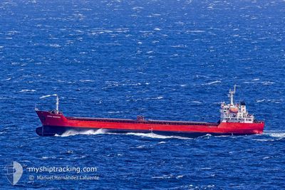
GEMINI MAESTRO
Bulk Carrier
Current Trip
EGDAM
| Time Travelled | 6 days |
|---|---|
| Remaining Time | --- |
| Distance Travelled | 1333.36 nm |
| Remaining Distance | --- |
| AVG Speed | 8.6 Knots |
| MAX Speed | 10.5 Knots |
| AVG Wind | 13.3 knots |
| MAX Wind | 30 knots |
| MIN Temp | 14.3°C / 57.74°F |
| MAX Temp | 18.7°C / 65.66°F |
| Draught | 6.3 m |
| Position Received | 2 d ago |
Current Position
| Longitude | 12.18465° |
|---|---|
| Latitude | 37.52192° |
| Status | Under way using engine |
| Speed | 10 Knots |
| Course | 274° |
| Area | Mediterranean Sea - Eastern Basin |
| Station | T-AIS |
| Position Received | 2 d ago |
Info
Information
The current position of GEMINI MAESTRO is in Mediterranean Sea - Eastern Basin with coordinates 37.52192° / 12.18465° as reported on 2025-12-19 19:34 by AIS to our vessel tracker app. The vessel's current speed is 10 Knots
The vessel GEMINI MAESTRO (IMO: 9350006, MMSI: 636017813) is a Bulk Carrier that was built in 2007 ( 18 years old ). It's sailing under the flag of [LR] Liberia.
In this page you can find informations about the vessels current position, last detected port calls, and current voyage information. If the vessels is not in coverage by AIS you will find the latest position.
The current position of GEMINI MAESTRO is detected by our AIS receivers and we are not responsible for the reliability of the data. The last position was recorded while the vessel was in Coverage by the Ais receivers of our vessel tracking app.
The current draught of GEMINI MAESTRO as reported by AIS is 6.3 meters
Weather
| Temperature | 16.2°C / 61.16°F |
|---|---|
| Wind Speed | 9 knots |
| Direction | 268° W |
| Pressure | 1009.4 hPa |
| Humidity | 62.1 % |
| Cloud Coverage | 12 % |
Featured Company
Last Port Calls
| Port | Arrival | Departure | Time In Port |
|---|---|---|---|
| 2025-12-12 16:49 | 2025-12-15 13:06 | 2 d | |
| 2025-12-05 17:56 | 2025-12-07 22:18 | 2 d | |
| 2025-12-01 12:02 | 2025-12-01 16:19 | 4 h | |
| 2025-10-30 20:14 | 2025-11-03 21:12 | 4 d | |
| 2025-10-24 03:26 | 2025-10-27 07:42 | 3 d | |
| 2025-10-15 21:36 | 2025-10-19 13:04 | 3 d | |
| 2025-10-03 08:08 | 2025-10-07 15:36 | 4 d | |
| 2025-10-01 22:13 |
Last Trips
| Origin | Departure | Destination | Arrival | Distance | |
|---|---|---|---|---|---|
| 2025-12-07 22:18 | 2025-12-12 16:49 | 122.35 nm | |||
| 2025-12-01 16:19 | 2025-12-05 17:56 | 6.28 nm | |||
| 2025-11-03 21:12 | 2025-12-01 12:02 | 2296.38 nm | |||
| 2025-10-27 07:42 | 2025-10-30 20:14 | 806.26 nm | |||
| 2025-10-19 13:04 | 2025-10-24 03:26 | 469.10 nm | |||
| 2025-10-07 15:36 | 2025-10-15 21:36 | 1808.83 nm | |||
| 2025-10-01 22:13 | 2025-10-03 08:08 | 346.99 nm |
Events
| Time | Event | Details | Position / Dest | Info |
|---|---|---|---|---|
| 2025-12-21 17:57 | START Moving | 16 nm, North East of AZEFFUN |
37.07667 / 4.67333
EGDAM
|
Speed: 6 kn Course: 271° |
| 2025-12-21 15:36 | STOP Moving | 14.52 nm, North East of AZEFFUN |
37.06667 / 4.64333
EGDAM
|
Speed: Course: -1° |
| 2025-12-19 19:45 | Status Changed | Default Under way using engine |
37.52334 / 12.14333
EGDAM
|
Speed: 10 kn Course: 274° |
| 2025-12-19 19:34 | OUT of Coverage |
37.52192 / 12.18465
Mediterranean Sea - Eastern Basin
|
Speed: 10 kn Course: 274° |
|
| 2025-12-19 19:30 | Status Changed | Under way using engine Default |
37.52097 / 12.19848
EGDAM
|
Speed: 9 kn Course: 276° |
| 2025-12-19 19:06 | Status Changed | Default Under way using engine |
37.51333 / 12.27833
EGDAM
|
Speed: 9.8 kn Course: 276° |
| 2025-12-19 19:00 | Detected in Sea | Italian part of the Mediterranean Sea - Eastern Basin |
37.51178 / 12.30063
Mediterranean Sea - Eastern Basin
|
Speed: 9.8 kn Course: 276° |
| 2025-12-19 19:00 | Status Changed | Under way using engine Default |
37.51178 / 12.30063
EGDAM
|
Speed: 9.8 kn Course: 278° |
| 2025-12-19 19:00 | IN Coverage |
37.51178 / 12.30063
Mediterranean Sea - Eastern Basin
|
Speed: 9.8 kn Course: 276° |
|
| 2025-12-15 11:06 | PORT DEPARTURE |
|
31.33730 / 30.09050
EGDAM
|
Speed: 4.8 kn Course: 90° |