
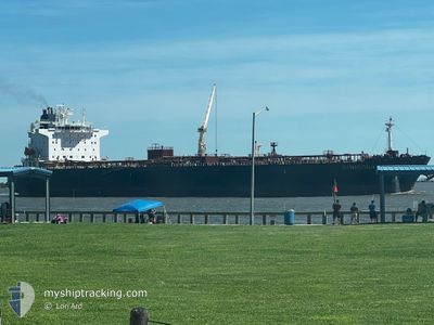
GH MADISON
Crude Oil Tanker
Current Trip
FOR ORDERS
| Time Travelled | 5 days |
|---|---|
| Remaining Time | --- |
| Distance Travelled | 1415.84 nm |
| Remaining Distance | --- |
| AVG Speed | 11.7 Knots |
| MAX Speed | 13.5 Knots |
| AVG Wind | 16.3 knots |
| MAX Wind | 25.1 knots |
| MIN Temp | 21°C / 69.8°F |
| MAX Temp | 26.7°C / 80.06°F |
| Draught | 8 m |
| Position Received | 8 d ago |
Current Position
| Longitude | -96.76506° |
|---|---|
| Latitude | 26.68067° |
| Status | Under way using engine |
| Speed | 12.8 Knots |
| Course | 192.7° |
| Area | Gulf of Mexico |
| Station | T-AIS |
| Position Received | 8 d ago |
Info
Information
The current position of GH MADISON is in Gulf of Mexico with coordinates 26.68067° / -96.76506° as reported on 2025-02-07 05:24 by AIS to our vessel tracker app. The vessel's current speed is 12.8 Knots
The vessel GH MADISON (IMO: 9456915, MMSI: 538004071) is a Crude Oil Tanker that was built in 2010 ( 15 years old ). It's sailing under the flag of [MH] Marshall Is.
In this page you can find informations about the vessels current position, last detected port calls, and current voyage information. If the vessels is not in coverage by AIS you will find the latest position.
The current position of GH MADISON is detected by our AIS receivers and we are not responsible for the reliability of the data. The last position was recorded while the vessel was in Coverage by the Ais receivers of our vessel tracking app.
The current draught of GH MADISON as reported by AIS is 8 meters
Weather
| Temperature | 26.6°C / 79.88°F |
|---|---|
| Wind Speed | 9 knots |
| Direction | 107° ESE |
| Pressure | 1014.2 hPa |
| Humidity | 71 % |
| Cloud Coverage | 65 % |
Featured Company
Last Port Calls
| Port | Arrival | Departure | Time In Port |
|---|---|---|---|
| 2025-02-07 23:51 | 2025-02-10 22:35 | 2 d | |
| 2025-01-23 21:39 | 2025-01-25 20:04 | 1 d | |
| 2024-12-18 00:39 | 2024-12-20 00:55 | 2 d | |
| 2024-12-10 05:05 | 2024-12-13 22:55 | 3 d |
Most Visited Ports (Last year)
| Port | Arrivals | |
|---|---|---|
| 9 | ||
| 4 | ||
| 2 | ||
| 1 | ||
| 1 | ||
| 1 |
Last Trips
| Origin | Departure | Destination | Arrival | Distance | |
|---|---|---|---|---|---|
| 2025-01-25 14:04 | 2025-02-07 17:51 | 1251.84 nm | |||
| 2024-12-19 18:55 | 2025-01-23 15:39 | 1669.79 nm | |||
| 2024-12-13 16:55 | 2024-12-17 18:39 | 702.67 nm | |||
| 2024-11-13 05:58 | 2024-12-09 23:05 | 1364.68 nm |
Events
| Time | Event | Details | Position / Dest | Info |
|---|---|---|---|---|
| 2025-02-10 22:35 | PORT DEPARTURE |
|
25.97654 / -97.32923
FOR ORDERS
|
Speed: 6.2 kn Course: 68° |
| 2025-02-10 22:11 | START Moving |
25.96261 / -97.36877
[US] BROWNSVILLE
|
Speed: 4.2 kn Course: 66° |
|
| 2025-02-08 01:27 | STOP Moving |
25.96021 / -97.37389
[US] BROWNSVILLE
|
Speed: 0.1 kn Course: 69° |
|
| 2025-02-07 23:51 | PORT ARRIVAL |
|
25.97367 / -97.33675
[US] BROWNSVILLE
|
Speed: 6.8 kn Course: 241° |
| 2025-02-07 21:30 | START Moving | 20.25 nm, East of BROWNSVILLE |
26.07819 / -97.01771
FOR ORDERS
|
Speed: 3.7 kn Course: 234° |
| 2025-02-07 08:50 | STOP Moving | 20.29 nm, East of BROWNSVILLE |
26.08255 / -97.01865
FOR ORDERS
|
Speed: 0.3 kn Course: 191° |
| 2025-02-07 05:31 | Status Changed | Default Under way using engine |
26.65577 / -96.77142
FOR ORDERS
|
Speed: 12.8 kn Course: 192.7° |
| 2025-02-07 05:24 | OUT of Coverage |
26.68067 / -96.76506
Gulf of Mexico
|
Speed: 12.8 kn Course: 192.7° |
|
| 2025-02-07 05:17 | Status Changed | Under way using engine Default |
26.70541 / -96.75889
FOR ORDERS
|
Speed: 12.7 kn Course: 193° |
| 2025-02-07 05:07 | IN Coverage |
26.70541 / -96.75889
Gulf of Mexico
|
Speed: 12.7 kn Course: 192.9° |