
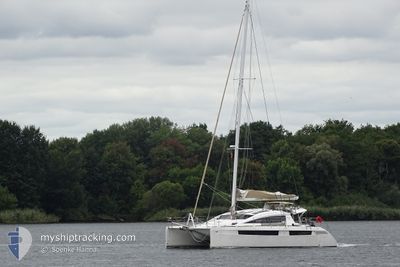
GIRAMONDO
Sailing
Current Trip
Unknown
| Time Travelled | 5 days |
|---|---|
| Remaining Time | --- |
| Distance Travelled | 10.12 nm |
| Remaining Distance | --- |
| AVG Speed | 4.9 Knots |
| MAX Speed | 5.4 Knots |
| AVG Wind | 5.2 knots |
| MAX Wind | 5.6 knots |
| MIN Temp | 12.1°C / 53.78°F |
| MAX Temp | 12.5°C / 54.5°F |
| Draught | 1.7 m |
| Position Received | 4 d ago |
Current Position
| Longitude | 6.09373° |
|---|---|
| Latitude | 43.02339° |
| Status | Default |
| Speed | 5.4 Knots |
| Course | 112° |
| Area | Mediterranean Sea - Western Basin |
| Station | T-AIS |
| Position Received | 4 d ago |
Info
Information
The current position of GIRAMONDO is in Mediterranean Sea - Western Basin with coordinates 43.02339° / 6.09373° as reported on 2025-02-10 11:33 by AIS to our vessel tracker app. The vessel's current speed is 5.4 Knots
The vessel GIRAMONDO (MMSI: 236112491) is a Sailing It's sailing under the flag of [GI] Gibraltar.
In this page you can find informations about the vessels current position, last detected port calls, and current voyage information. If the vessels is not in coverage by AIS you will find the latest position.
The current position of GIRAMONDO is detected by our AIS receivers and we are not responsible for the reliability of the data. The last position was recorded while the vessel was in Coverage by the Ais receivers of our vessel tracking app.
The current draught of GIRAMONDO as reported by AIS is 1.7 meters
Weather
| Temperature | 12.3°C / 54.14°F |
|---|---|
| Wind Speed | 5 knots |
| Direction | 242° WSW |
| Pressure | 1025.5 hPa |
| Humidity | 78.5 % |
| Cloud Coverage | 84 % |
Featured Company
Last Port Calls
| Port | Arrival | Departure | Time In Port |
|---|---|---|---|
| 2025-02-06 14:58 | 2025-02-09 12:11 | 2 d | |
| 2024-12-14 13:06 | 2025-01-17 09:35 |
Most Visited Ports (Last year)
| Port | Arrivals | |
|---|---|---|
| 3 | ||
| 2 | ||
| 2 | ||
| 2 | ||
| 1 | ||
| 1 |
Last Trips
| Origin | Departure | Destination | Arrival | Distance | |
|---|---|---|---|---|---|
| 2025-01-17 09:35 | 2025-02-06 14:58 | 114.46 nm | |||
| 2024-10-01 05:02 | 2024-12-14 13:06 | 15.76 nm |
Events
| Time | Event | Details | Position / Dest | Info |
|---|---|---|---|---|
| 2025-02-10 11:33 | OUT of Coverage |
43.02339 / 6.09373
Mediterranean Sea - Western Basin
|
Speed: 5.4 kn Course: 112° |
|
| 2025-02-10 10:29 | IN Coverage |
43.08838 / 6.01599
Mediterranean Sea - Western Basin
|
Speed: 4.8 kn Course: 210.6° |
|
| 2025-02-09 12:41 | OUT of Coverage |
43.09331 / 6.02119
Mediterranean Sea - Western Basin
|
Speed: 0.5 kn Course: 331.7° |
|
| 2025-02-09 11:11 | PORT DEPARTURE |
|
43.08798 / 5.93047
|
Speed: 5.2 kn Course: 61° |
| 2025-02-09 11:07 | START Moving |
43.08444 / 5.92472
[FR] SAINT MANDRIER
|
Speed: 4.9 kn Course: 12.1° |
|
| 2025-02-09 10:38 | IN Coverage |
43.08007 / 5.92455
Mediterranean Sea - Western Basin
[FR] SAINT MANDRIER
|
Speed: Course: 39.3° |
|
| 2025-02-06 14:05 | OUT of Coverage |
43.08006 / 5.92456
Mediterranean Sea - Western Basin
[FR] SAINT MANDRIER
|
Speed: Course: 246.8° |
|
| 2025-02-06 13:58 | STOP Moving |
43.08006 / 5.92457
[FR] SAINT MANDRIER
|
Speed: Course: 511° |
|
| 2025-02-06 13:58 | PORT ARRIVAL |
|
43.08006 / 5.92457
[FR] SAINT MANDRIER
|
Speed: 1.8 kn Course: 511° |
| 2025-02-06 10:12 | START Moving | 2.52 nm, South East of BANDOL |
43.11024 / 5.80411
|
Speed: 4.7 kn Course: 223.7° |