

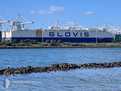
GLOVIS STELLA
Cargo

Current Trip
CNSHA
| Time Travelled | 11 days |
|---|---|
| Remaining Time | --- |
| Distance Travelled | 4640.27 nm |
| Remaining Distance | --- |
| AVG Speed | 16 Knots |
| MAX Speed | 18 Knots |
| AVG Wind | 14.1 knots |
| MAX Wind | 24 knots |
| MIN Temp | 13.8°C / 56.84°F |
| MAX Temp | 30.3°C / 86.54°F |
| Draught | 8.8 m |
| Position Received | 4 d ago |
Current Position
| Longitude | 108.84252° |
|---|---|
| Latitude | -3.31727° |
| Status | Under way using engine |
| Speed | 16.2 Knots |
| Course | 163.6° |
| Area | Java Sea |
| Station | T-AIS |
| Position Received | 4 d ago |
Information
The current position of GLOVIS STELLA is in Java Sea with coordinates -3.31727° / 108.84252° as reported on 2025-05-30 14:20 by AIS to our vessel tracker app. The vessel's current speed is 16.2 Knots
The vessel GLOVIS STELLA (IMO: 9749570, MMSI: 440257000) is a Cargo It's sailing under the flag of [KR] Korea.
In this page you can find informations about the vessels current position, last detected port calls, and current voyage information. If the vessels is not in coverage by AIS you will find the latest position.
The current position of GLOVIS STELLA is detected by our AIS receivers and we are not responsible for the reliability of the data. The last position was recorded while the vessel was in Coverage by the Ais receivers of our vessel tracking app.
The current draught of GLOVIS STELLA as reported by AIS is 8.8 meters
Weather
| Temperature | 23.6°C / 74.48°F |
|---|---|
| Wind Speed | 19 knots |
| Direction | 116° ESE |
| Pressure | 1019.6 hPa |
| Humidity | 67.2 % |
| Cloud Coverage | 100 % |


Featured Company
Last Port Calls
| Port | Arrival | Departure | Time In Port |
|---|---|---|---|
| 2025-05-22 08:03 | 2025-05-23 14:34 | 1 d | |
| 2025-05-21 20:56 | 2025-05-21 22:17 | 1 h | |
| 2025-05-19 06:21 | 2025-05-20 16:27 | 1 d | |
| 2025-05-18 07:01 | 2025-05-18 18:46 | 11 h | |
| 2025-05-14 07:37 | 2025-05-16 17:29 | 2 d | |
| 2025-04-23 00:19 | 2025-04-24 06:37 | 1 d | |
| 2025-04-18 04:01 | 2025-04-22 01:12 | 3 d | |
| 2025-04-13 22:10 | 2025-04-16 20:16 | 2 d |
Most Visited Ports (Last year)
| Port | Arrivals | |
|---|---|---|
| 5 | ||
| 4 | ||
| 2 | ||
| 2 | ||
| 2 | ||
| 2 |
Last Trips
| Origin | Departure | Destination | Arrival | Distance | |
|---|---|---|---|---|---|
| 2025-05-21 22:17 | 2025-05-22 08:03 | 67.92 nm | |||
| 2025-05-20 16:27 | 2025-05-21 20:56 | 419.12 nm | |||
| 2025-05-18 18:46 | 2025-05-19 06:21 | 154.44 nm | |||
| 2025-05-16 17:29 | 2025-05-18 07:01 | 536.95 nm | |||
| 2025-04-24 06:37 | 2025-05-14 07:37 | 6632.50 nm | |||
| 2025-04-22 01:12 | 2025-04-23 00:19 | 325.41 nm | |||
| 2025-04-16 20:16 | 2025-04-18 04:01 | 335.89 nm | |||
| 2025-03-13 04:26 | 2025-04-13 22:10 | 12040.61 nm |
Events
| Time | Event | Details | Position / Dest | Info |
|---|---|---|---|---|
| 2025-05-30 14:33 | Status Changed | Default Under way using engine |
-3.37681 / 108.85953
CNSHA
|
Speed: 16.2 kn Course: 163.6° |
| 2025-05-30 14:20 | OUT of Coverage |
-3.31727 / 108.84252
Java Sea
|
Speed: 16.2 kn Course: 163.6° |
|
| 2025-05-30 12:46 | Change Sea Area | Indonesian part of the Java Sea Indonesian part of the South China Sea |
-2.89832 / 108.82904
Java Sea
|
Speed: 15 kn Course: 181.8° |
| 2025-05-30 12:04 | Change Sea Area | Indonesian part of the South China Sea South Korean part of the Japan Sea |
-2.72676 / 108.91818
South China Sea
|
Speed: 16 kn Course: 204.1° |
| 2025-05-30 12:03 | Status Changed | Under way using engine Default |
-2.72185 / 108.92033
CNSHA
|
Speed: 15.9 kn Course: 206° |
| 2025-05-30 12:03 | IN Coverage |
-2.72676 / 108.91818
South China Sea
|
Speed: 16 kn Course: 204.1° |