
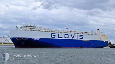
GLOVIS SUPERIOR
Vehicles Carrier
Current Trip
| Time Travelled | 1 day |
|---|---|
| Remaining Time | 1 h, 29 mins |
| Distance Travelled | 269.50 nm |
| Remaining Distance | 13.39 nm |
| AVG Speed | 14.4 Knots |
| MAX Speed | 19.9 Knots |
| AVG Wind | 10.2 knots |
| MAX Wind | 13.9 knots |
| MIN Temp | 21.4°C / 70.52°F |
| MAX Temp | 23.3°C / 73.94°F |
| Draught | 9.4 m |
| Position Received | 1 m ago |
Current Position
| Longitude | 54.91797° |
|---|---|
| Latitude | 25.14307° |
| Status | Under way using engine |
| Speed | 8 Knots |
| Course | 131.5° |
| Area | Persian Gulf |
| Station | T-AIS |
| Position Received | 1 m ago |
Info
Information
The current position of GLOVIS SUPERIOR is in Persian Gulf with coordinates 25.14307° / 54.91797° as reported on 2025-02-14 17:05 by AIS to our vessel tracker app. The vessel's current speed is 8 Knots and is heading at the port of JEBEL ALI. The estimated time of arrival as calculated by MyShipTracking vessel tracking app is 2025-02-14 22:35 LT
The vessel GLOVIS SUPERIOR (IMO: 9674189, MMSI: 441156000) is a Vehicles Carrier that was built in 2013 ( 12 years old ). It's sailing under the flag of [KR] Korea.
In this page you can find informations about the vessels current position, last detected port calls, and current voyage information. If the vessels is not in coverage by AIS you will find the latest position.
The current position of GLOVIS SUPERIOR is detected by our AIS receivers and we are not responsible for the reliability of the data. The last position was recorded while the vessel was in Coverage by the Ais receivers of our vessel tracking app.
The current draught of GLOVIS SUPERIOR as reported by AIS is 9.4 meters
Weather
| Temperature | 22°C / 71.6°F |
|---|---|
| Wind Speed | 10 knots |
| Direction | 305° NW |
| Pressure | 1016.4 hPa |
| Humidity | 79.9 % |
| Cloud Coverage | 76 % |
Featured Company
Last Port Calls
| Port | Arrival | Departure | Time In Port |
|---|---|---|---|
| 2025-02-12 21:20 | 2025-02-13 03:44 | 6 h | |
| 2025-02-08 00:55 | 2025-02-08 15:58 | 15 h | |
| 2025-02-03 20:40 | 2025-02-04 16:58 | 20 h | |
| 2025-01-28 12:40 | 2025-01-29 12:13 | 23 h | |
| 2025-01-10 06:16 | 2025-01-10 16:13 | 9 h | |
| 2025-01-08 21:15 | 2025-01-09 17:28 | 20 h | |
| 2024-12-20 05:23 | 2024-12-21 03:21 | 21 h | |
| 2024-12-04 17:36 |
Most Visited Ports (Last year)
| Port | Arrivals | |
|---|---|---|
| 5 | ||
| 3 | ||
| 3 | ||
| 2 | ||
| 2 | ||
| 2 |
Last Trips
| Origin | Departure | Destination | Arrival | Distance | |
|---|---|---|---|---|---|
| 2025-02-08 15:58 | 2025-02-12 21:20 | 1858.92 nm | |||
| 2025-02-04 16:58 | 2025-02-08 00:55 | 1488.05 nm | |||
| 2025-01-29 12:13 | 2025-02-03 20:40 | 2273.08 nm | |||
| 2025-01-10 16:13 | 2025-01-28 12:40 | 7175.56 nm | |||
| 2025-01-09 17:28 | 2025-01-10 06:16 | 149.13 nm | |||
| 2024-12-21 03:21 | 2025-01-08 21:15 | 1654.88 nm | |||
| 2024-12-04 17:36 | 2024-12-20 05:23 | 5937.02 nm |
Events
| Time | Event | Details | Position / Dest | Info |
|---|---|---|---|---|
| 2025-02-14 16:29 | START Moving | 14.19 nm, North West of JEBEL ALI |
25.17386 / 54.83891
OMSOH>AEJEA
|
Speed: 3.1 kn Course: 67° |
| 2025-02-14 16:08 | Status Changed | Under way using engine At anchor |
25.17184 / 54.83079
OMSOH>AEJEA
|
Speed: 0.1 kn Course: 266° |
| 2025-02-14 15:59 | Status Changed | At anchor Default |
25.17212 / 54.83117
OMSOH>AEJEA
|
Speed: 0.5 kn Course: 304° |
| 2025-02-14 15:55 | Status Changed | Default At anchor |
25.17201 / 54.83131
OMSOH>AEJEA
|
Speed: 0.5 kn Course: 314° |
| 2025-02-14 14:02 | Status Changed | At anchor Default |
25.17104 / 54.83179
OMSOH>AEJEA
|
Speed: 0.1 kn Course: 252° |
| 2025-02-14 13:53 | Status Changed | Default At anchor |
25.17098 / 54.83182
OMSOH>AEJEA
|
Speed: 0.2 kn Course: 261° |
| 2025-02-14 13:02 | Status Changed | At anchor Default |
25.17062 / 54.83177
OMSOH>AEJEA
|
Speed: 0.1 kn Course: 286° |
| 2025-02-14 12:53 | Status Changed | Default At anchor |
25.17059 / 54.83160
OMSOH>AEJEA
|
Speed: 0.1 kn Course: 285° |
| 2025-02-14 11:56 | Status Changed | At anchor Default |
25.17081 / 54.83179
OMSOH>AEJEA
|
Speed: 0.1 kn Course: 312° |
| 2025-02-14 11:32 | Status Changed | Default At anchor |
25.17067 / 54.83163
OMSOH>AEJEA
|
Speed: Course: 305° |