

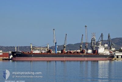
GROTON EAGLE
Bulk Carrier
Current Trip
| Time Travelled | 38 days |
|---|---|
| Remaining Time | 9 days |
| Distance Travelled | 9291.74 nm |
| Remaining Distance | 2418.90 nm |
| AVG Speed | 10.5 Knots |
| MAX Speed | 13 Knots |
| AVG Wind | 13.5 knots |
| MAX Wind | 28.3 knots |
| MIN Temp | 15.6°C / 60.08°F |
| MAX Temp | 27.9°C / 82.22°F |
| Draught | 13.6 m |
| Position Received | 1 d ago |
Current Position
| Longitude | 57.43377° |
|---|---|
| Latitude | -20.13217° |
| Status | Under way using engine |
| Speed | 4 Knots |
| Course | 99° |
| Area | Indian Ocean |
| Station | T-AIS |
| Position Received | 1 d ago |
Information
The current position of GROTON EAGLE is in Indian Ocean with coordinates -20.13217° / 57.43377° as reported on 2025-06-05 12:06 by AIS to our vessel tracker app. The vessel's current speed is 4 Knots and is heading at the port of KAKINADA. The estimated time of arrival as calculated by MyShipTracking vessel tracking app is 2025-06-17 03:15 LT
The vessel GROTON EAGLE (IMO: 9575242, MMSI: 538007505) is a Bulk Carrier that was built in 2013 ( 12 years old ). It's sailing under the flag of [MH] Marshall Is.
In this page you can find informations about the vessels current position, last detected port calls, and current voyage information. If the vessels is not in coverage by AIS you will find the latest position.
The current position of GROTON EAGLE is detected by our AIS receivers and we are not responsible for the reliability of the data. The last position was recorded while the vessel was in Coverage by the Ais receivers of our vessel tracking app.
The current draught of GROTON EAGLE as reported by AIS is 13.6 meters
Weather
| Temperature | 25.6°C / 78.08°F |
|---|---|
| Wind Speed | 22 knots |
| Direction | 124° SE |
| Pressure | 1017.9 hPa |
| Humidity | 64.9 % |
| Cloud Coverage | 8 % |
Featured Company
Most Visited Ports (Last year)
| Port | Arrivals | |
|---|---|---|
| 2 | ||
| 1 | ||
| 1 | ||
| 1 | ||
| 1 | ||
| 1 |
Events
| Time | Event | Details | Position / Dest | Info |
|---|---|---|---|---|
| 2025-06-05 12:46 | START Moving | 2.69 nm, West of PORT LOUIS |
-20.13516 / 57.43516
KAKINADA
|
Speed: 3.2 kn Course: 327° |
| 2025-06-05 12:18 | STOP Moving | 2.57 nm, West of PORT LOUIS |
-20.13238 / 57.43775
KAKINADA
|
Speed: 0.3 kn Course: 182° |
| 2025-06-05 12:14 | Status Changed | Default Under way using engine |
-20.13208 / 57.43739
KAKINADA
|
Speed: 4 kn Course: 99° |
| 2025-06-05 12:06 | OUT of Coverage |
-20.13217 / 57.43377
Indian Ocean
KAKINADA
|
Speed: 4 kn Course: 75.6° |
|
| 2025-06-05 11:58 | Change Sea Area | Mauritian part of the Indian Ocean South African part of the Indian Ocean |
-20.13740 / 57.42443
Indian Ocean
KAKINADA
|
Speed: 6.3 kn Course: 70.8° |
| 2025-06-05 11:58 | Status Changed | Under way using engine Default |
-20.13740 / 57.42443
KAKINADA
|
Speed: 6.5 kn Course: 75° |
| 2025-06-05 11:42 | IN Coverage |
-20.13740 / 57.42443
Indian Ocean
KAKINADA
|
Speed: 6.3 kn Course: 70.8° |
|
| 2025-05-30 03:39 | Status Changed | Default Under way using engine |
-31.49635 / 31.92497
KAKINADA
|
Speed: 11 kn Course: 48.5° |
| 2025-05-30 03:37 | Status Changed | Under way using engine Default |
-31.50044 / 31.91955
KAKINADA
|
Speed: 11.1 kn Course: 49° |
| 2025-05-30 03:37 | OUT of Coverage |
-31.50044 / 31.91955
Indian Ocean
KAKINADA
|
Speed: 11 kn Course: 48.5° |