
HALLEY
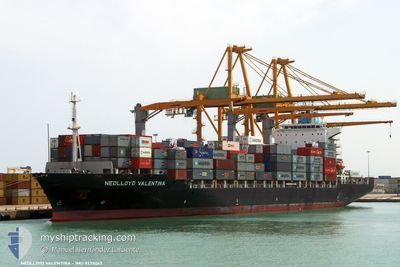
Container Ship
Current Trip
| Trip Time | 1 day |
|---|---|
| Trip Distance | 430.92 nm |
| AVG Speed | 16.5 Knots |
| MAX Speed | 18.8 Knots |
| Draught | 10.4 m |
| AVG Wind | 15.9 knots |
| MAX Wind | 21.5 knots |
| MIN Temp | -3°C / 26.6°F |
| MAX Temp | 4.6°C / 40.28°F |
| Position Received | 5 d ago |
Current Position
| Longitude | 128.80488° |
|---|---|
| Latitude | 34.66338° |
| Status | Under way using engine |
| Speed | 16 Knots |
| Course | 233.2° |
| Area | Japan Sea |
| Station | T-AIS |
| Position Received | 5 d ago |
Info
Information
The current position of HALLEY is in Japan Sea with coordinates 34.66338° / 128.80488° as reported on 2025-02-02 06:01 by AIS to our vessel tracker app. The vessel's current speed is 16 Knots and is currently inside the port of QINGDAO.
The vessel HALLEY (IMO: 9275062, MMSI: 636017971) is a Container Ship that was built in 2004 ( 21 years old ). It's sailing under the flag of [LR] Liberia.
In this page you can find informations about the vessels current position, last detected port calls, and current voyage information. If the vessels is not in coverage by AIS you will find the latest position.
The current position of HALLEY is detected by our AIS receivers and we are not responsible for the reliability of the data. The last position was recorded while the vessel was in Coverage by the Ais receivers of our vessel tracking app.
The current draught of HALLEY as reported by AIS is 10.4 meters
Weather
| Temperature | -4.9°C / 23.18°F |
|---|---|
| Wind Speed | 26 knots |
| Direction | 326° NW |
| Pressure | 1034.7 hPa |
| Humidity | 43.4 % |
| Cloud Coverage | 4 % |
Featured Company
Last Port Calls
| Port | Arrival | Departure | Time In Port |
|---|---|---|---|
| 2025-02-06 18:25 | |||
| 2025-02-05 03:53 | 2025-02-05 16:37 | 12 h | |
| 2025-02-01 21:53 | 2025-02-02 13:22 | 15 h | |
| 2025-01-28 21:37 | 2025-01-29 05:41 | 8 h | |
| 2025-01-26 16:59 | 2025-01-26 22:13 | 5 h | |
| 2025-01-26 10:48 | 2025-01-26 16:54 | 6 h | |
| 2025-01-17 20:13 | 2025-01-18 23:37 | 1 d | |
| 2025-01-09 00:06 | 2025-01-09 09:17 | 9 h | |
| 2025-01-07 11:08 | 2025-01-07 21:04 | 9 h | |
| 2025-01-06 07:04 | 2025-01-07 06:27 | 23 h |
Last Trips
| Origin | Departure | Destination | Arrival | Distance | |
|---|---|---|---|---|---|
| 2025-02-05 16:37 | 2025-02-06 18:25 | 430.92 nm | |||
| 2025-02-02 13:22 | 2025-02-05 03:53 | 797.44 nm | |||
| 2025-01-29 05:41 | 2025-02-01 21:53 | 749.89 nm | |||
| 2025-01-26 22:13 | 2025-01-28 21:37 | 414.39 nm | |||
| 2025-01-26 16:54 | 2025-01-26 16:59 | 0.38 nm | |||
| 2025-01-18 23:37 | 2025-01-26 10:48 | 2341.86 nm | |||
| 2025-01-09 09:17 | 2025-01-17 20:13 | 1618.82 nm | |||
| 2025-01-07 21:04 | 2025-01-09 00:06 | 126.67 nm | |||
| 2025-01-07 06:27 | 2025-01-07 11:08 | 57.45 nm | |||
| 2025-01-03 06:41 | 2025-01-06 07:04 | 1192.08 nm |
Events
| Time | Event | Details | Position / Dest | Info |
|---|---|---|---|---|
| 2025-02-06 11:17 | STOP Moving |
36.01997 / 120.21307
[CN] QINGDAO
|
Speed: 0.2 kn Course: 233° |
|
| 2025-02-06 10:25 | PORT ARRIVAL |
|
36.02203 / 120.35783
[CN] QINGDAO
|
Speed: 10.9 kn Course: 282° |
| 2025-02-05 08:37 | PORT DEPARTURE |
|
38.95563 / 117.88508
CNYTN
|
Speed: 12.3 kn Course: 102° |
| 2025-02-05 08:09 | START Moving |
38.98808 / 117.78582
[CN] TIANJIN
|
Speed: 7.2 kn Course: 156° |
|
| 2025-02-04 19:53 | STOP Moving |
38.99211 / 117.77802
[CN] TIANJIN
|
Speed: 0.1 kn Course: 348° |
|
| 2025-02-04 19:53 | PORT ARRIVAL |
|
38.99211 / 117.77802
[CN] TIANJIN
|
Speed: 1 kn Course: 344° |
| 2025-02-04 02:09 | START Moving | 8.94 nm, North East of DALIAN |
39.02108 / 121.86185
CNYTN
|
Speed: 4 kn Course: 115° |
| 2025-02-03 17:01 | STOP Moving | 8.66 nm, North East of DALIAN |
39.02145 / 121.85471
CNYTN
|
Speed: Course: 320° |
| 2025-02-02 06:07 | Status Changed | Default Under way using engine |
34.64811 / 128.77763
CNYTN
|
Speed: 16 kn Course: 233.2° |
| 2025-02-02 06:01 | OUT of Coverage |
34.66338 / 128.80488
Japan Sea
|
Speed: 16 kn Course: 233.2° |