

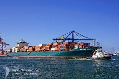
HENG HUI 6
Container Ship
Current Trip
AIN SUKHNA
| Time Travelled | 9 h, 52 mins |
|---|---|
| Remaining Time | --- |
| Distance Travelled | 83.76 nm |
| Remaining Distance | --- |
| AVG Speed | 15.8 Knots |
| MAX Speed | 17 Knots |
| AVG Wind | 9.6 knots |
| MAX Wind | 19.8 knots |
| MIN Temp | 24.5°C / 76.1°F |
| MAX Temp | 26.8°C / 80.24°F |
| Draught | 12.6 m |
| Position Received | 4 d ago |
Current Position
| Longitude | 37.86646° |
|---|---|
| Latitude | 19.66065° |
| Status | Under way using engine |
| Speed | 9.7 Knots |
| Course | 89.9° |
| Area | Red Sea |
| Station | T-AIS |
| Position Received | 4 d ago |
Information
The current position of HENG HUI 6 is in Red Sea with coordinates 19.66065° / 37.86646° as reported on 2025-05-27 01:59 by AIS to our vessel tracker app. The vessel's current speed is 9.7 Knots
The vessel HENG HUI 6 (IMO: 9287895, MMSI: 414653000) is a Container Ship that was built in 2004 ( 21 years old ). It's sailing under the flag of [CN] China.
In this page you can find informations about the vessels current position, last detected port calls, and current voyage information. If the vessels is not in coverage by AIS you will find the latest position.
The current position of HENG HUI 6 is detected by our AIS receivers and we are not responsible for the reliability of the data. The last position was recorded while the vessel was in Coverage by the Ais receivers of our vessel tracking app.
The current draught of HENG HUI 6 as reported by AIS is 12.6 meters
Weather
| Temperature | 25.2°C / 77.36°F |
|---|---|
| Wind Speed | 18 knots |
| Direction | 310° NW |
| Pressure | 1010.6 hPa |
| Humidity | 71.1 % |
| Cloud Coverage | --- |
Featured Company
Last Port Calls
| Port | Arrival | Departure | Time In Port |
|---|---|---|---|
| 2025-05-29 18:07 | 2025-05-31 17:59 | 1 d | |
| 2025-05-24 12:50 | 2025-05-25 10:52 | 22 h | |
| 2025-05-14 14:40 | 2025-05-15 02:20 | 11 h | |
| 2025-05-08 08:42 | 2025-05-08 16:01 | 7 h | |
| 2025-05-01 15:06 | 2025-05-02 02:02 | 10 h | |
| 2025-04-28 21:22 | 2025-04-29 17:45 | 20 h | |
| 2025-04-23 10:31 | 2025-04-24 05:22 | 18 h | |
| 2025-04-02 00:58 | 2025-04-03 02:07 | 1 d |
Last Trips
| Origin | Departure | Destination | Arrival | Distance | |
|---|---|---|---|---|---|
| 2025-05-25 10:52 | 2025-05-29 18:07 | 1569.33 nm | |||
| 2025-05-15 02:20 | 2025-05-24 12:50 | 3829.38 nm | |||
| 2025-05-08 16:01 | 2025-05-14 14:40 | 1503.40 nm | |||
| 2025-05-02 02:02 | 2025-05-08 08:42 | 1028.37 nm | |||
| 2025-04-29 17:45 | 2025-05-01 15:06 | 426.32 nm | |||
| 2025-04-24 05:22 | 2025-04-28 21:22 | 1205.23 nm | |||
| 2025-04-03 02:07 | 2025-04-23 10:31 | 7406.95 nm | |||
| 2025-03-31 10:35 | 2025-04-02 00:58 | 617.85 nm |
Events
| Time | Event | Details | Position / Dest | Info |
|---|---|---|---|---|
| 2025-05-31 15:59 | PORT DEPARTURE |
|
29.64676 / 32.37999
AIN SUKHNA
|
Speed: 7.2 kn Course: 91° |
| 2025-05-31 15:50 | START Moving |
29.64726 / 32.36004
[EG] SOKHNA
|
Speed: 6.4 kn Course: 92° |
|
| 2025-05-29 16:38 | STOP Moving |
29.64785 / 32.34903
[EG] SOKHNA
|
Speed: 0.2 kn Course: 90° |
|
| 2025-05-29 16:07 | PORT ARRIVAL |
|
29.64712 / 32.35849
[EG] SOKHNA
|
Speed: 7.2 kn Course: 271° |
| 2025-05-29 15:22 | START Moving | 3.83 nm, East of SOKHNA |
29.65554 / 32.43385
AIN SUKHNA
|
Speed: 3.1 kn Course: 240° |
| 2025-05-28 21:29 | STOP Moving | 3.99 nm, East of SOKHNA |
29.65923 / 32.43612
AIN SUKHNA
|
Speed: 0.1 kn Course: 86° |
| 2025-05-27 01:59 | OUT of Coverage |
19.66065 / 37.86646
Red Sea
AIN SUKHNA
|
Speed: 9.7 kn Course: 89.9° |
|
| 2025-05-26 23:48 | IN Coverage |
19.66065 / 37.49596
Red Sea
AIN SUKHNA
|
Speed: 9.7 kn Course: 90° |
|
| 2025-05-26 22:21 | OUT of Coverage |
19.38428 / 38.45582
Red Sea
AIN SUKHNA
|
Speed: 9.8 kn Course: 95.4° |
|
| 2025-05-26 21:15 | Status Changed | Under way using engine Default |
19.38430 / 38.26396
AIN SUKHNA
|
Speed: 9.7 kn Course: 90° |